I present without further comment the contents of a letter I sent to Hart District Council yesterday (Friday 20 November 2015). Please do get involved with this consultation and respond to it using our guide on our dedicated page about this consultation here.
Errors, omissions and anomalies in the (Strategic Housing Land Availability Assessment) SHLAA and consultation materials
Dear Messrs Daryl Phillips and Stephen Parker,
It is clear that Hart Council has been very busy, publishing a vast array of new material about the SHLAA and the materials to be used in the forthcoming consultation about Housing Options. I have burned a considerable amount of midnight oil going through those materials in some detail, and I have identified material errors, omissions and anomalies that give me serious cause for concern that I would like to share with you. The Excel workbook containing the amalgamation of the SHLAA Master List, the NHB data and the SHLAA detail is attached for reference. These fall into several broad categories:
- Assessment of brownfield site capacity and delivery
- Deliverable and developable sites not included in the Developing a Local Plan for Hart paper (DLP) nor the New Homes Sites Booklet (NHB)
- Sites missing from NHB but in the SHLAA
- Discrepancies between capacity shown in NHB compared to SHLAA detail
- Sites shown in detailed assessment but not in master list
- Sites assessed as “not currently developable”, but have been granted planning permission
- Range of meanings of “not currently developable”
- Lack of consideration of the economic aspects of housing options
- Assessment of brownfield site capacity and delivery.
There are a number of components to this:
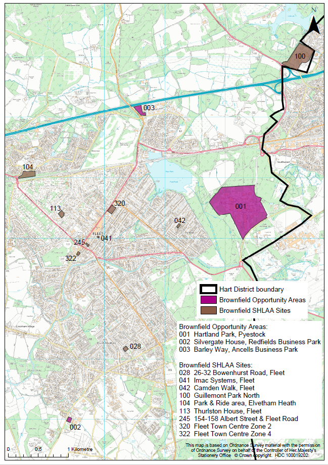
In Hart News in September, and again at cabinet on 1 October, it was said that brownfield capacity had increased to 1,800 units. Now, this has miraculously fallen by 75% to 450 units on some dubious grounds. First, para 41 of the DLP states correctly that years 6-10 need only “developable” sites to be included, beyond that you can be more vague about sites. We are already 4 years into the plan period and, according to the land supply calculation based on the current inflated SHMA, we have 5.7 years of land supply. Yet, you are only selecting sites to be included in your calculations that meet the most onerous criterion of being “deliverable”. As you know I have two FOI requests outstanding with you, the first is inquiring about the disposition of the 750 brownfield units that we were told were achievable back on November 2014, and the second asking for the analysis to support the 1,800 figure. It seems to me you have inappropriately applied criteria that are too onerous in order to artificially reduce the potential brownfield capacity. An example of this would be excluding Bramshill, when everyone knows it will be preferable for this site to undergo some sort of redevelopment to stop the Grade 1 listed building decaying and of course the hideous 1970’s accommodation blocks need replacing too.
You have under-stated the brownfield capacity in the DLP, compared to the assessed capacity in the SHLAA documents. This is shown in the table below:
| Parish/Ref |
Sum of Site Assessment Capacity (Low) |
Sum of Site Assessment Capacity (High) |
Sum of Brownfield Capacity in Table 1 in DLP doc |
| Blackwater and Hawley |
320 |
320 |
300 |
| SHL100 |
320 |
320 |
300 |
| Church Crookham |
6 |
6 |
8 |
| SHL28 |
6 |
6 |
8 |
| Elvetham Heath |
45 |
45 |
45 |
| SHL104 |
45 |
45 |
45 |
| Fleet |
221 |
221 |
83 |
| SHL113 |
12 |
12 |
17 |
| SHL245 |
8 |
8 |
14 |
| SHL320 |
150 |
150 |
20 |
| SHL322 |
37 |
37 |
17 |
| SHL41 |
6 |
6 |
6 |
| SHL42 |
8 |
8 |
9 |
| Grand Total |
592 |
592 |
436 |
This shows that the capacity shown in the DLP (excluding the 20 units from the sites with planning permission) is some 156 units lower than your own assessments in the SHLAA documents with most of the discrepancy arising from sites SHL320 & 322. Correcting this would reduce the net requirement by 156 units.
In Figure 2 of the DLP, you assert that 52% of the development completed or where permission has been granted since 2011 is on brownfield sites. Yet at September Council, a question was asked along similar lines and the response was “these figures exclude brownfield sites that require planning permission, because those are not currently split between greenfield and brownfield developments”. This leads one to conclude either that you have simply made up the figures in the DLP, or you knowingly misled the Council and the public in September. Which is it?
- Deliverable and developable sites not included
[updated with this note]
There’s a large number of deliverable and developable sites that are in the SHLAA but not apparently referred to in the DLP or the NHB. A list if these is shown in the table below (some of which are in the NHB):
| Parish/Ref |
Sum of NHB Capacity |
Sum of Site Assessment Capacity (Low) |
Sum of Site Assessment Capacity (High) |
| Blackwater and Hawley |
|
320 |
320 |
| SHL100 |
|
320 |
320 |
| Church Crookham |
|
6 |
6 |
| SHL28 |
|
6 |
6 |
| Elvetham Heath |
|
45 |
45 |
| SHL104 |
|
45 |
45 |
| Fleet |
25 |
243 |
248 |
| SHL113 |
|
12 |
12 |
| SHL245 |
|
8 |
8 |
| SHL275 |
25 |
12 |
17 |
| SHL320 |
|
150 |
150 |
| SHL322 |
|
37 |
37 |
| SHL41 |
|
6 |
6 |
| SHL42 |
|
8 |
8 |
| SHL69 |
|
10 |
10 |
| Hartley Wintney |
|
6 |
6 |
| SHL95 |
|
6 |
6 |
| Hook |
|
550 |
550 |
| SHL1&2 |
|
550 |
550 |
| South Warnborough |
16 |
16 |
16 |
| SHL172 |
16 |
16 |
16 |
| Grand Total |
41 |
1,186 |
1,191 |
The land supply document shows a total of 3,878 units built, permitted or deliverable up until 1 April 2015, some 722 below the 4,600 figure you assert in the DLP. I accept that 340 units from SHL1 & 2 and 10 from SHL69 are included in the land supply. But the land supply does not include 300 units from Watery Lane. Netting all of this off, then there are around 5,000 units already accounted for by being completed, permitted or deliverable, which would reduce the current net requirement by ~400 units compared to what you assert in the DLP.
- Sites missing from NHB but in the SHLAA
There are 76 units on sites in the SHLAA that are not already on the brownfield list and not strategic sites that do not appear in the NHB. These are shown in the table below:
| Parish/Ref |
Sum of NHB Capacity |
Sum of Site Assessment Capacity (Low) |
Sum of Site Assessment Capacity (High) |
| Fleet |
|
10 |
10 |
| SHL69 |
|
10 |
10 |
| Hartley Wintney |
|
6 |
6 |
| SHL95 |
|
6 |
6 |
| Heckfield |
|
5 |
5 |
| SHL157 |
|
5 |
5 |
| Mattingley |
|
48 |
48 |
| SHL160 |
|
48 |
48 |
| Yateley |
|
7 |
7 |
| SHL18 |
|
7 |
7 |
| Grand Total |
|
76 |
76 |
This raises the question as to why these sites have not been included in the NHB process either as selected or rejected sites.
- Discrepancies between capacity in NHB and SHLAA
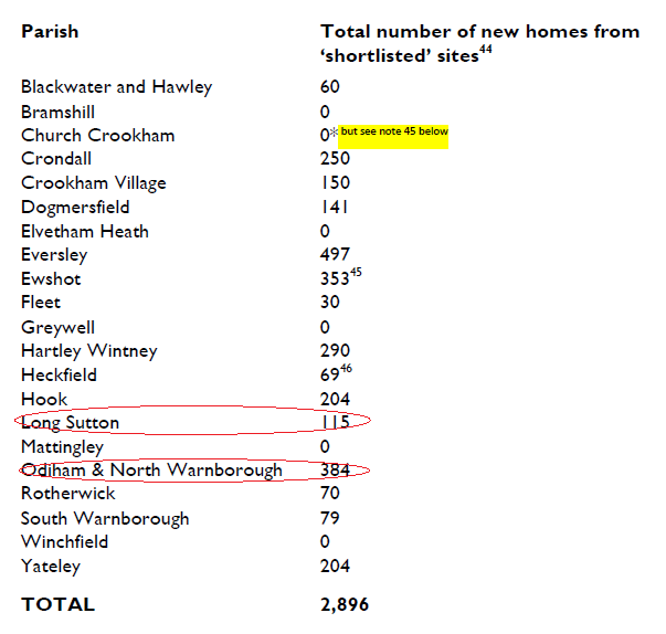
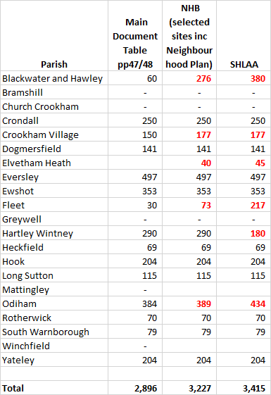
There are material discrepancies between the site capacities shown in the NHB and those in the SHLAA. Sometimes the NHB can be above the SHLAA figures and sometimes below. But overall, adding up all of the sites where the NHB capacity is outside the range of SHLAA lower and upper limits, the NHB shows a lower capacity of some 1,500 units. This demonstrates that the potential capacity of dispersal sites is being materially under-stated. These sites are shown in the table in Appendix 1.
- Sites present in the detail of the SHLAA but not on the master list, and hence not in the NHB, nor mentioned in the DLP.
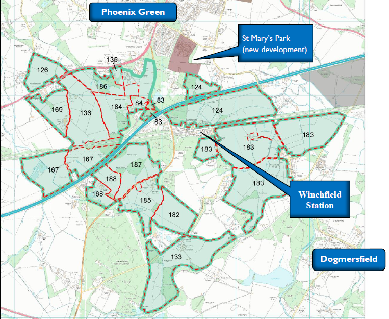
There are three sites, SHL167, 168 and 169 appear in the detailed assessments of sites, but not on the master list.
- Sites shown as “not currently developable” but have in fact been granted planning permission
Sites SHL68 and SHL117 are listed in the detail SHLAA documents as “not currently developable”, but according to the master list of sites have been granted planning permission.
- Range of meanings of “not currently developable”
It is clear from the above that the term “not currently developable” is a somewhat elastic phrase that can include sites that are just an administrative stroke of the pen away from deliverability as well as sites that face very significant challenges. Many sites in the NHB and of course many of the strategic sites face very significant challenges that it is difficult to see how they can be remedied, such as proximity to flood zones, SSSI’s, SINCs, TPOs and the SPA and lack of proximity to existing settlements whereas others are much closer to deliverability.
However, the main materials being circulated for the consultation do not make this distinction clear.
- Lack of discussion about economics
The discussion about infrastructure costs in the DLP, with the only mention of costs being the woefully [inadequate] £30m for a new motorway junction – I would think there is little chance of change out of £100m. But even so this misses out other important infrastructure items like the local road system, new or upgraded railway station, widening of the railway bridges over the local roads, new sewage farm, burying overhead power lines, new schools and new healthcare facilities to name but a few. Hart currently has a £78m infrastructure funding deficit, Hampshire as a whole £1.9bn and the local NHS is predicted to have a large annual funding deficit.
These issues associated with a new town should be spelled out in detail, and I would think many of the same issues will arise with urban extensions.
It is certainly true that these issues will need to be resolved before the Local Plan can be found sound at examination.
So, what are we to conclude from the above? First, the discrepancies outlined above, once corrected will make a very material difference to the calculation of how many more houses we need to build on green field sites (if any) and the capacity of each parish to deliver them. I do not wish to subscribe to conspiracy theories. However, the sum-total of the above, coupled with the obvious single-minded desire on the part of some members to push through a new town at all costs, leads me to conclude that either the people who created these consultation documents were incompetent or they are by their omission or intent about to mislead the public. It is also clear that whatever systems and processes you are using to plan, manage, monitor and control the SHLAA are completely inadequate with such large discrepancies between different views of the same data.
It is clear to me that the forthcoming consultation should be postponed until these discrepancies are ironed out.
I would like you to treat this letter as a formal complaint and respond according to LGO guidelines. I might also add that I will copy this letter to the chairman of the Standards Committee to ask him to set up an investigation and to our Local MP. You might expect this letter and your response to be presented as evidence in any examination of the Local Plan.
Yours sincerely,
cc: Peter Kern, Chairman of Hart DC Standards Committee
Ranil Jayawardena, MP
Appendix 1:
| Parish/Ref |
Sum of NHB Capacity |
Sum of Site Assessment Capacity (Low) |
Sum of Site Assessment Capacity (High) |
| Blackwater and Hawley |
15 |
12 |
12 |
| SHL21 |
15 |
12 |
12 |
| Bramshill |
300 |
250 |
250 |
| SHL106 |
300 |
250 |
250 |
| Crondall |
112 |
130 |
130 |
| SHL159 |
65 |
100 |
100 |
| SHL72 |
16 |
18 |
18 |
| SHL76 |
31 |
12 |
12 |
| Crookham Village |
70 |
100 |
100 |
| SHL53 |
70 |
100 |
100 |
| Dogmersfield |
40 |
5 |
10 |
| SHL39 |
40 |
5 |
10 |
| Eversley |
91 |
123 |
123 |
| SHL127 |
50 |
70 |
70 |
| SHL140 |
41 |
53 |
53 |
| Ewshot |
120 |
187 |
187 |
| SHL174 |
63 |
105 |
105 |
| SHL355 |
48 |
75 |
75 |
| SHL80 |
9 |
7 |
7 |
| Fleet |
706 |
881 |
886 |
| SHL102 |
43 |
45 |
45 |
| SHL275 |
25 |
12 |
17 |
| SHL333 |
500 |
750 |
750 |
| SHL50 |
46 |
60 |
60 |
| SHL51 |
92 |
14 |
14 |
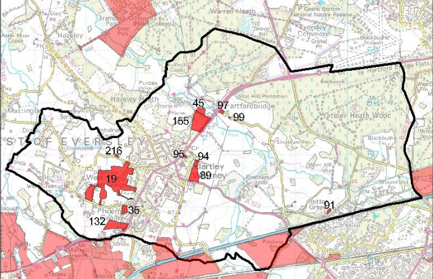
| Hartley Wintney |
208 |
287 |
301 |
| SHL155 |
117 |
194 |
194 |
| SHL216 |
8 |
6 |
6 |
| SHL35 |
34 |
3 |
17 |
| SHL45 |
25 |
51 |
51 |
| SHL91 |
10 |
11 |
11 |
| SHL97 |
12 |
10 |
10 |
| SHL99 |
2 |
12 |
12 |
| Heckfield |
169 |
45 |
65 |
| SHL109 |
44 |
5 |
5 |
| SHL257 |
62 |
20 |
30 |
| SHL259 |
63 |
20 |
30 |
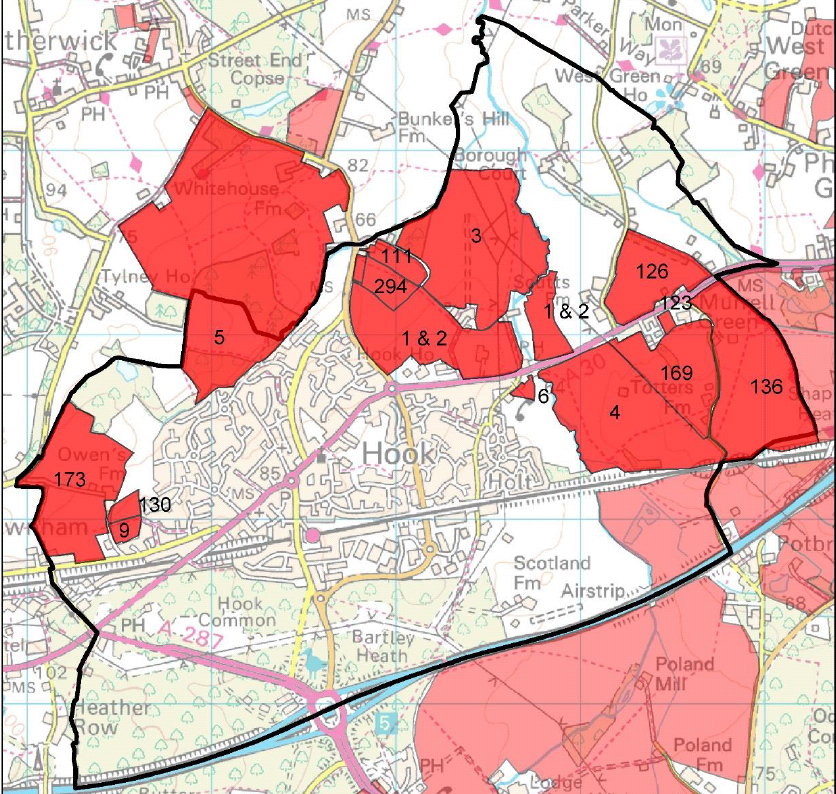
| Hook |
2,090 |
3,849 |
3,849 |
| SHL123 |
13 |
20 |
20 |
| SHL3 |
543 |
1,000 |
1,000 |
| SHL4 |
458 |
1,800 |
1,800 |
| SHL5 |
1,065 |
1,000 |
1,000 |
| SHL6 |
11 |
29 |
29 |
| Long Sutton |
63 |
65 |
65 |
| SHL296 |
6 |
5 |
5 |
| SHL335 |
34 |
35 |
35 |
| SHL336 |
23 |
25 |
25 |
| Mattingley |
130 |
40 |
60 |
| SHL239 |
55 |
20 |
30 |
| SHL240 |
75 |
20 |
30 |
| Odiham |
3,308 |
2,894 |
2,904 |
| SHL108 |
387 |
160 |
160 |
| SHL110 |
2,160 |
1,900 |
1,900 |
| SHL138 |
204 |
261 |
261 |
| SHL228 |
48 |
75 |
75 |
| SHL29 |
10 |
6 |
6 |
| SHL328 |
25 |
30 |
30 |
| SHL329 |
44 |
30 |
30 |
| SHL57 |
47 |
75 |
75 |
| SHL59 |
115 |
175 |
175 |
| SHL60 |
11 |
12 |
12 |
| SHL65 |
36 |
50 |
50 |
| SHL67 |
53 |
80 |
80 |
| SHL78 |
168 |
40 |
50 |
| Rotherwick |
130 |
200 |
200 |
| SHL86 |
130 |
200 |
200 |
| South Warnborough |
36 |
20 |
25 |
| SHL70 |
7 |
5 |
5 |
| SHL75 |
29 |
15 |
20 |
| Winchfield |
119 |
32 |
42 |
| SHL114 |
11 |
12 |
12 |
| SHL262 |
108 |
20 |
30 |
| Yateley |
9 |
60 |
60 |
| SHL13 |
0 |
8 |
8 |
| SHL149 |
0 |
10 |
10 |
| SHL17 |
0 |
30 |
30 |
| SHL303 |
9 |
12 |
12 |
| Grand Total |
7,716 |
9,180 |
9,269 |
See more at our consultation page:
link