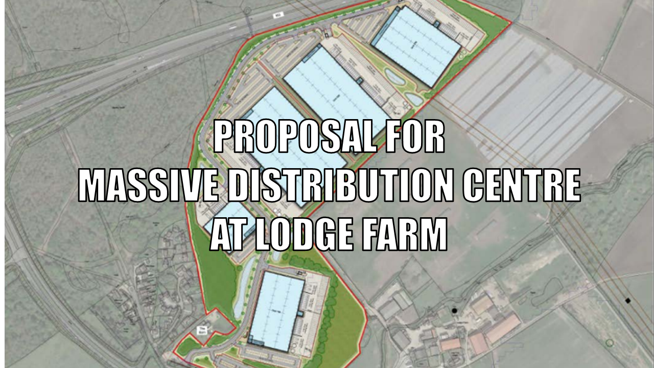
Proposal for Massive Distribution Centre at Lodge Farm
There is a new proposal for a massive distribution centre at Lodge Farm, North Warnborough. The backers have submitted a “scoping opinion” for an Environmental Impact Assessment and a separate pre-app to Hart Council. The company promoting the scheme is Obsidian Strategic.
The proposal is enormous in scale. Their cover letter calls for 105,000 square metres (or over 1.1m sq ft) of B2/B8 (storage and distribution) floor space over 5 separate warehouses. They also plan to provide space for 200 EV charging points. The overall site is over 32 hectares or 79 acres. The cover letter says the buildings will be 18-20m tall. However, the “Theoretical Visibility Plan” says 15-35m above existing ground level.
[Update 13 Jan 2024]: A dedicated group has been set up to oppose this development. You can visit their website to see their detailed objections here. [/Update]
Proposal Details
The scoping opinion application (Number: 22/01347/EIA ) can be found here.
The pre-app (Number: 22/01355/PREAPP) can be found here.
The scoping opinion was submitted first and at the time of writing had attracted 333 public comments, mostly opposed. Only 3 comments were in favour. The pre-app appears to have slipped under the radar, attracting only 3 public comments, all opposed.
We think that those who have objected to the scoping opinion should also submit their comments on the pre-app. It is difficult to object to a request for an opinion. Better to object to the actual application. However, Hart seem to only allow comments on the scoping opinion and not on the pre-app. This seems very odd to us, but we have sent in an objection direct to planningadmin@hart.gov.uk. Both applications seem to have been delegated to officers to make a decision without the involvement of councillors, another worrying feature of this proposal.
Below we set out our main reasons for objecting to the proposed distribution centre at Lodge Farm.
- Fatally flawed Flood Risk assessment glosses over groundwater flooding.
- Incomplete Ecology Assessment misses out Basingstoke Canal impact.
- Defective Transport Assessment.
- No Analysis of Noise and Pollution
- Impact on Key Views from the Canal.
- Optimistic Economic Assessment overlooks Pyestock/Hartland Park distribution centre was cancelled.
- Impact on Food Production.
Each point is covered in more detail below:
Flood Risk at Proposed Distribution Centre at Lodge Farm
As part of the application, they have produced a Flood Risk Assessment. The document covers fluvial, surface water, reservoir, sewer and groundwater flooding.
The site is adjacent to the River Whitewater and part of the site to the South East is deemed at risk of flooding from the river. They have carefully avoided siting any of the warehouses on that part of the site. Roughly the same part of the site is assessed as being susceptible to surface water flooding. They propose to address this issue using a Sustainable Drainage System or SuDS.
However, their assessment of groundwater flooding is superficial and they do not provide a map. Helpfully, Hart has an online map that shows areas subject to groundwater flooding. We have superimposed the site boundary on to that map and it shows that most of the site is subject to groundwater flooding. See the image below.
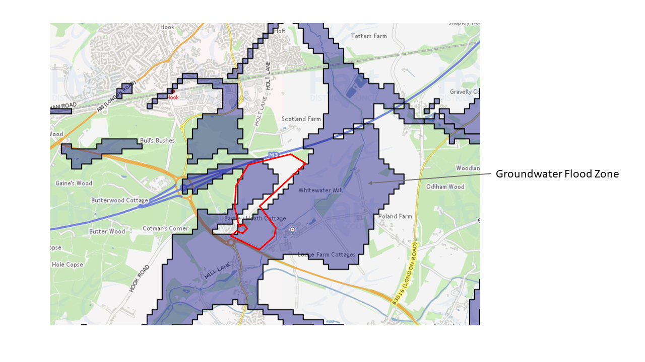
Distribution Centre at Lodge Farm – Groundwater Flood Risk
We can certainly add anecdotal evidence to that map. A few years ago we got stuck axle deep in muddy water while attempting to cycle through the adjacent Bartley Heath woods. We recall the fields that the site covers were also flooded at that time.
Incomplete Ecology Assessment
The promoter have also produced an ecology assessment. However, this is incomplete as it fails to address the proximity of the site to the Basingstoke Canal SSSI and conservation area. About a third of the site is within the 500m buffer zone for the canal and all of it within the 1,500m buffer zone. As can be seen in the image below, the site is adjacent to a large number of SINCs and other SSSIs.
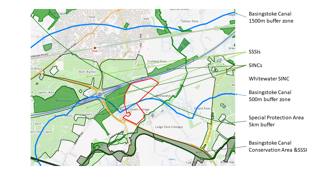
Distribution Centre at Lodge Farm – Ecological Constraint of Basingstoke Canal
The report also highlights important species that have been found nearby including dormice, otters, water voles, hedgehogs, harvest mice and rare breeds of bats. Indeed some of the trees on site are assessed as being suitable to support roosting bats. They propose keeping those trees and implementing a “sensitive” lighting scheme. However, we remain to be convinced that the noise and pollution from thousands of daily HGV movements will be conducive to supporting bat or any other habitat.
Defective Transport Assessment
Obsidian Strategic have also produced a transport assessment. Unfortunately it is defective in two key respects:
- It omits the additional traffic movements from the 1,500-2,400 employees at the site.
- It doesn’t cover the impact on roads and junctions in the wider area.
Employee Traffic Movements Omitted
The assessment covers the additional traffic movements from the vehicles using the new centre. It quotes a range of additional movements dependent upon the eventual end use. The range is somewhere between 4,509 and 12,273 additional movements per day. The highest peak morning would be 581 2-way movements. the evening peak could be as high as 810 2-way movements. The report also says that a “high proportion of the vehicles to/from the site will be HGVs”.
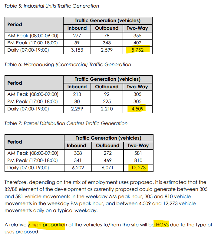
Distribution Centre at Lodge Farm HGV movements
The report also covers the additional movements generated by the 200 EV charging stations. They estimate the 200 charging stations could lead to 2,000 additional 2-way movements per day. This gives a total maximum number of 14,273 additional movements per day. We estimate that could be 700 total additional movements in the morning rush hour and nearly 1,000 in the evening busy period.
The economic assessment suggests that the proposal could deliver 1,500-2,400 jobs at the site. However the transport assessment doesn’t seem to take account of the additional movements from the employees. Of course, not all of the employees will work on the same day. But it is reasonable to expect the additional employee movements will be of the order of 1-2,000 per day.
They also talk of potentially providing service facilities to support the EV charging stations. It is possible that non-EV vehicles may stop at the services too, further increasing traffic.
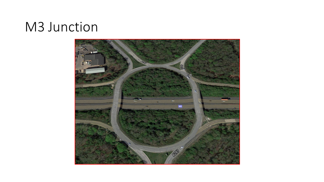
Overall, this is a massive increase in traffic, mostly of heavy vehicles. We hesitate to think what impact it will have on J5 of the M3 and surrounding roads, especially at already busy peak times.
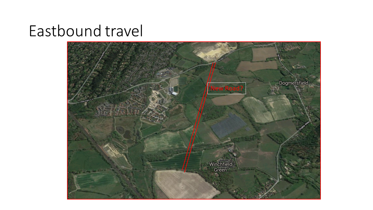
Wider Impact Ignored
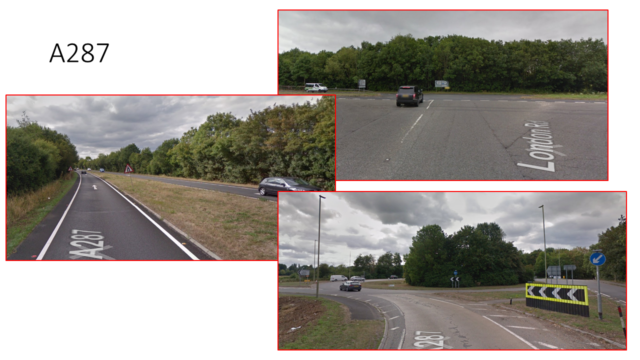
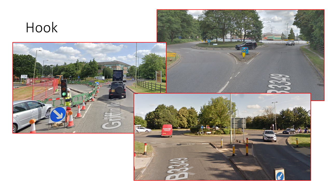
The backers have not run a full Traffic Impact Assessment. They assume that the biggest impacts of the proposed development will be on the A287/B3349/Holt Lane roundabout and the Station Road/B3349 roundabout in Hook.
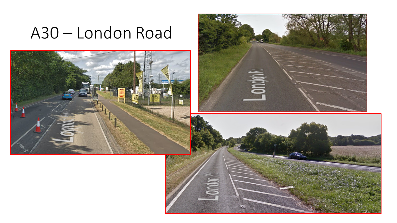
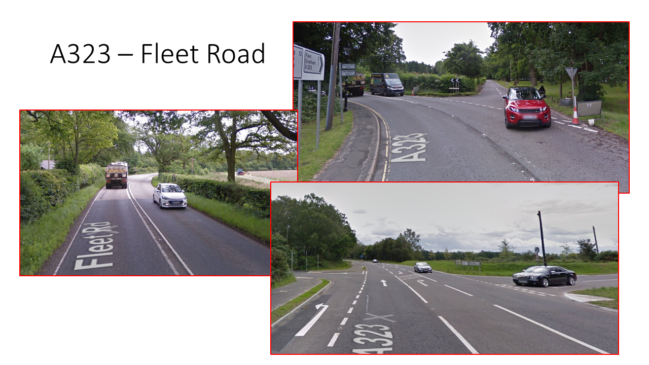
However, they have not really considered the wider potential impacts. They haven’t looked at the additional traffic likely to be generated on the B3349 from the A33 and M4. It is inconceivable that such a large warehouse would not attract traffic from the M4. Nor have they looked at the potential impacts further along the A287, notably the junction with the B3016 to Winchfield and the single carriageway part of the A287 towards Farnham and through Upper Hale.
Surely, this can’t be allowed to go ahead with such a superficial analysis of the traffic impact.
No Analysis of Noise and Pollution
In addition to the big increase in traffic movements, such a massive development is bound to have an impact on noise and pollution levels for the surrounding area. As far as we can tell, Obsidian have not provided any analysis of noise or pollution. We would have particular concern for the residents of Holt Lane, Derby Fields and Mill Lane
Surely, they can’t be allowed to get away with this?
Impact on Key Views
Hart’s Conservation Appraisal of Basingstoke Canal contains a number of key views. One of them is view number 6 looking northwards across the river Whitewater flood plain.
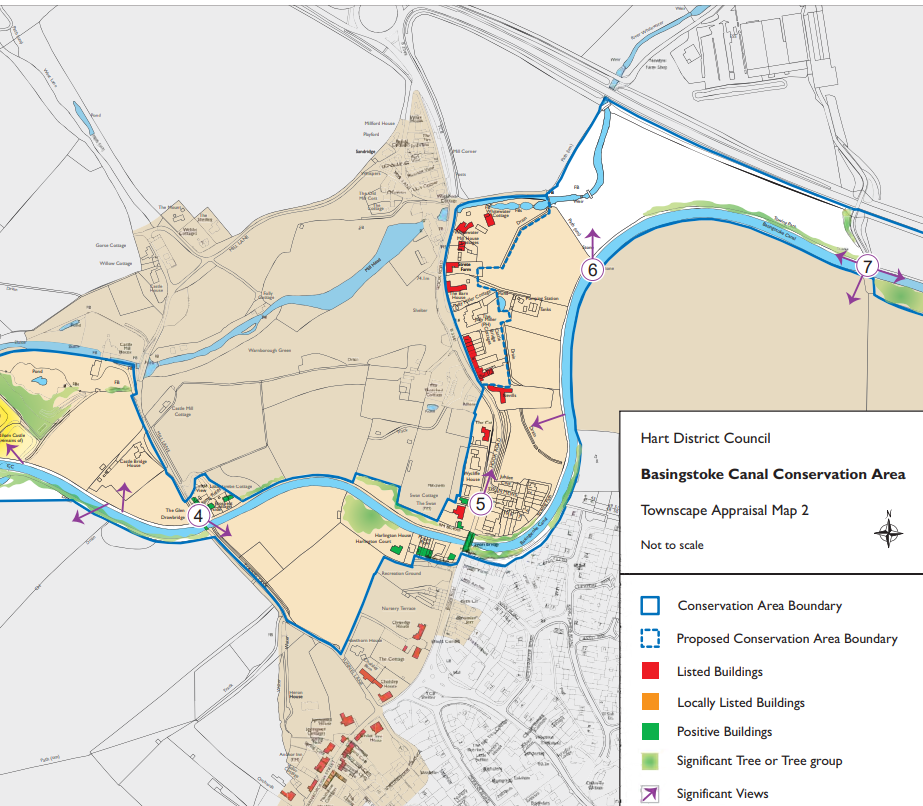
Basingstoke Canal Key View Number 6
We can’t imagine how 5 warehouses, each 20m tall will do anything to enhance this view.
Optimistic Economic Assessment for Proposed Distribution Centre at Lodge Farm
They have produced an economic assessment for the proposed development. They do make some good points about additional jobs, extra business rates and an increase in gross value added for the area.
However, they make extensive use of the 2016 Hart, Rushmoor and Surrey Heath Employment Land Review in their assessment. They make the claim that “only two out of the 24 [employment] sites have ‘distribution’ identified as their core use”. This may well be true.
What they don’t mention is that Pyestock/Hartland Park was removed from the review. Outline planning permission had been granted in 2005 for a 125,500 sq m distribution centre. The permission was extended in 2012. Even though the nearby road system has been improved to cope with the extra traffic, no takers could be found for the distribution centre. Later the site was sold and is now being redeveloped for housing.
It is difficult to believe their claims for a shortage of distribution sites, when a site of similar size could not find an investor at a time vacancy rates were even lower than today.
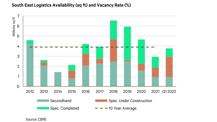
South East Logistics Availability from CBRE report
Note that the vacancy rate data shown above is taken from the CBRE report included in their own application. We conclude that the economic benefits they promise should be taken with a rather large pinch of salt.
Impact on Food Production
It is widely acknowledged that the world is about to endure a food crisis. The Prime Minister has outlined plans to boost UK food production with his “Grow for Britain” strategy. The site of the proposals is currently used for agriculture and food production.
It seems to us, that we should do all we can to protect the nation’s food security and keep growing food on productive fields, rather than concrete over them.
Conclusion on Proposed Distribution Centre at Lodge Farm
We believe that we should oppose this development because of the flood risk, the risk to local ecology, the additional traffic, noise and pollution, impact on the views from Basingstoke Canal and the apparently illusory economic benefits.