Flood risk means Winchfield failed testing
The documents that reveal why Winchfield failed testing have been revealed by persistent efforts from Winchfield Action Group. A Freedom of Information request has revealed the results of a new testing document. The full document can be downloaded on the link below.
In summary, the main issues were impact on:
- Historic Environment
- Bio-diversity
- Landscape
- Water Quality
- Flood risk
However, in our opinion, the impact of flood risk was massively downplayed in the report. More detail is given in the analysis below. Moreover, some of the alleged positives in the report are also complete nonsense.
For instance, they claim that building a “renewable and low-carbon energy generation and transfer” plant will diversify energy supply. What they mean is expanded upon in the Sustainability Assessment – they mean building a wood-burning power station utilising locally sourced timber (p74). Such a plant would be extremely undesirable since burning wood produces more CO2 than burning coal, and none of the proposed master plans include such space for such a plant.
They also claim that building 3,000 new houses, with associated traffic will somehow “reduce the
emissions of greenhouse gases and manage the impacts of climate change”. Again, complete and utter nonsense. They completely ignore research that shows higher density development in urban areas is much more sustainable than green field development.
This leaves the Local Plan in something of a pickle. Their preferred green field site of Murrell Green has been severely impaired by the presence of a Major Accident Hazard pipeline and their obvious second choice is not viable.
This puts at risk the other green field sites in the district, namely Pale Lane (Elvetham Chase) and Netherhouse Copse (Grove Farm). At the same time, Hart Council is seeking to protect our brownfield sites from redevelopment. These problems arise because they are proposing a ridiculous housing target of over 10,000 dwellings.
This is our chance to shape the draft Local Plan that is currently our for consultation. Our suggested comments can be found on the link below. Please do download and review them. Please do make amendments into your own words and submit it to planningpolicy@hart.gov.uk before the deadline of 5pm on 9th June 2017. All of the Council’s consultation documents can be found here.
Detail of how Winchfield failed testing
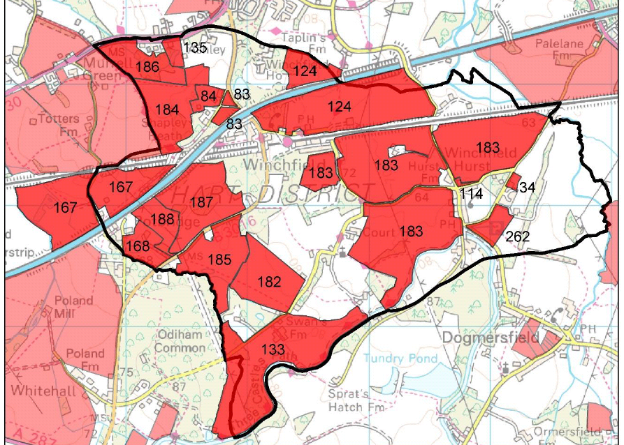
Winchfield SHLAA Sites in Hart District Hampshire
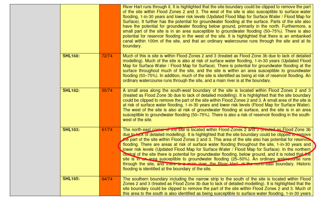
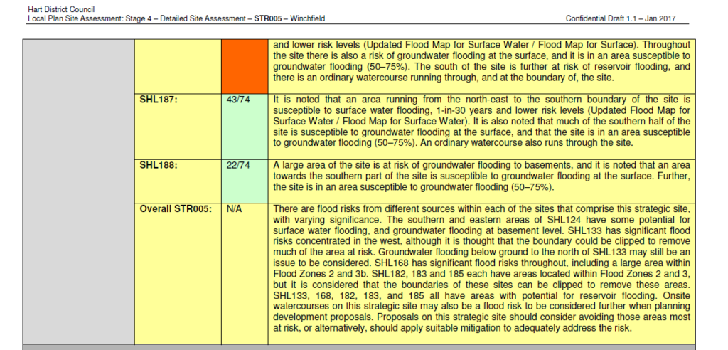
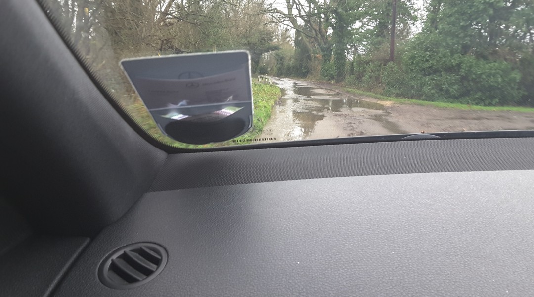
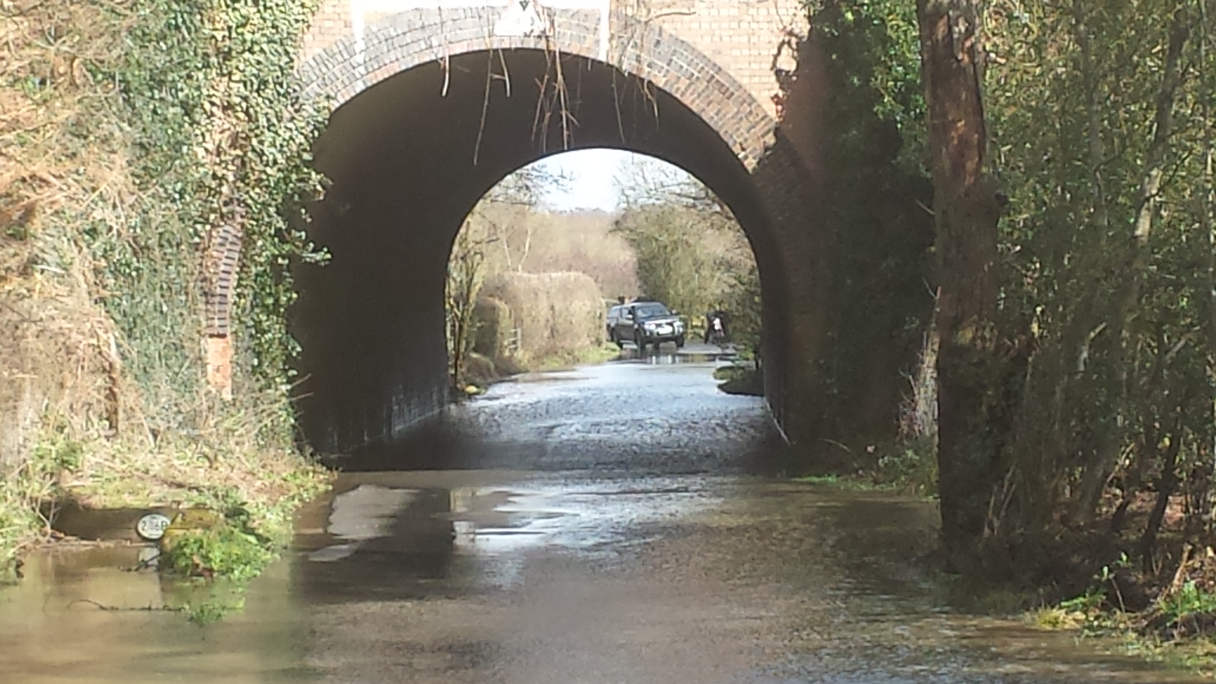
First, they say there was some evidence of wet ground at the far east of SHL183, but “no other obvious evidence of current or past flooding”.
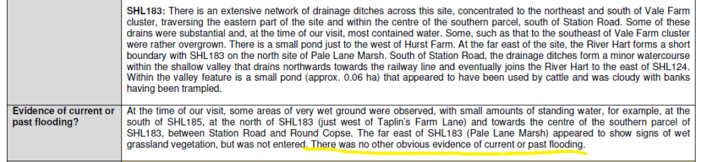
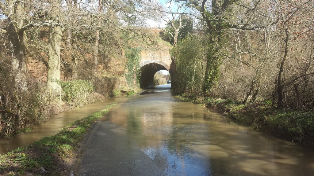
This is of course complete nonsense. The detailed assessment also says there’s only a one in 30 year chance of surface water flooding. The area of Taplins Farm Lane near the railway bridge flooded three times in 2016 alone. The image at the top of this post documents just one of those events. The posts documenting the flood events can be found here (4 Jan) , here (7 Jan), here (9 March on Station Road) and here (28 March due to #StormKatie).
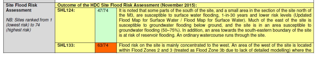
They seem to gloss over the flood risk being over 55 on a 74 point scale for five of the eight SHLAA sites they consider.


1-in-30 year flood risk protection level is a desire, not any kind of guarantee. The fact is many new and older systems do not or will not offer this kind of protection. When we purchased our house in Fleet town in 2013, Thames Water told us our house was not at risk of flooding. After purchase, they then told us a survey of the surface water sewer system in the road adjacent to our property, that they had undertaken in 2008, identified it as only offering a 1-in-2 year level of protection. Effectively, there is a possibility that the surface water system could become overwhelmed by the sort of storm we could expect to see every 2 years, and this could potentially cause flooding to our house. Summer storms are becoming more aggressive and dropping more water in shorter periods of time, and winters are also getting wetter.
You can add ‘financially unviable ‘ to this from a planning officer recently.
I have no idea. My guess is they will try.
Is this the end of the proposal or can they (CCH) still try to push it through?
Haven’t read it all yet but “works include the replacement of the roundabout in the centre of Hartley Wintney with a signalised junction.” doesn’t sound good for impact on HW.