Impact of Housing Density on Land Required for Hart Local Plan
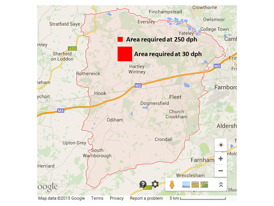
This diagram shows the impact of the area of land required to meet the housing need of 7,534 houses in the Hart Local Plan. Hart District Council use a rule of thumb of approximately 30 dwellings per hectare (dph) for new housing density. However, the study by Gareth Price showed that in urban areas it is quite possible to create vibrant communities with housing densities of 250 dph.
Using Hart’s metric of 30dph would mean we would have to find around 251 hectares (621 acres) of land to meet the housing need. Whereas if we were to build at a higher density of 250 dph on brownfield sites we would only need to find around 30 hectares of land (around 75 acres). These approximate areas are shown in the red squares on the map above.
Interestingly, Hartland Park (aka Pyestock), near Fleet is a brownfield site of 119 acres which is larger than we need to meet our total housing requirement.
We have already posted lots of other brownfield sites such as Sun Park near the M3, Ancell’s Farm and the derelict buildings at the end of Fleet Road in Fleet and Bartley Wood in Hook, Hampshire.
This shows that with vision, creativity, energy and political will, we can meet our housing needs for decades to come by properly utilising brownfield land and have no need to concrete over our beautiful green fields by building a new town.
If you would like to join the campaign to ask Hart District Council to think again, please sign our petition:
Pingback: We Heart Hart Petition to campaign against concreting over the green fields of Hart District breaks 2,000 barrier
Pingback: We Heart Hart petition breaks the 1,500 barrier | We Heart Hart
Pingback: Brownfield Capacity in Fleet and Hook in Hart District, Hampshire Keeps on Rising
Pingback: We Heart Hart petition is now twice as big as Hart District Council consultation | We Heart Hart
Pingback: Council concedes that we could build at higher density on brownfield land | We Heart Hart
Pingback: Hart District Council gets its facts wrong on the Local Plan | We Heart Hart