Murrell Green is Back – Ideas on how to object

We Heart Hart has been quiet for a while, because there has not been much to do. But Murrell Green has reared its ugly head again, so it is time to return.

What is the Murrell Green Development?

Developers have submitted a planning application to deliver up to 2,160 dwellings at Murrell Green mostly on the land between the A30 and the railway line between Hartley Wintney and Hook. This is 26/01201/OUT on the Hart planning portal. See Figure 1 for the Master Plan.
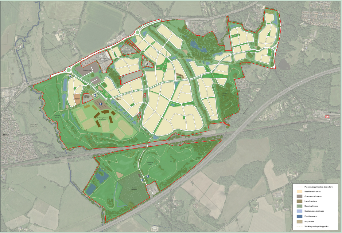
Murrell Green Master Plan 26/01201/OUT

Figure 1 – Murrell Green Master Plan

This latest proposal covers a much larger area than the earlier proposal put forward in 2017. This proposal covers 184 hectares (455 acres) or the equivalent of 258 football pitches – a huge area. The application form proposes is for a total of 2,160 dwellings broken down into 1,188 market units, 562 units for social rent, 302 affordable ownership dwellings and 108 self-build. This is roughly the scale of the current Hartley Wintney village which is about 2,300-2,400 households of the 2,600 households in the parish.

The proposal also includes employment land for commercial and business uses, space for a local centre and a larger primary centre to accommodate shops and community uses and potentially healthcare. The proposal also includes provision for a nursery/pre-school, 3-form entry primary school and an 8-form entry secondary school.

Some of the existing green space is also to be designated as a Suitable Alternative Natural Greenspace (SANG).

Why is Hart Vulnerable?

Hart does have a local plan in place running to 2032. However, much of the development in the plan was front-end loaded and the Labour Government increased Hart’s Local housing “need” to 771 dwellings per annum from the Local Plan figure of 423 dpa. The combination of the front-end loading of the Local Plan, the extra housing “need” and the Council’s lackadaisical approach to reviewing the Local Plan means Hart no longer meets its 5-year land supply target.

Moreover, back in 2017 the Council appeared to be edging towards favouring the earlier Murrell Green development.

Grounds for Objection

Despite Hart being vulnerable, there are still several grounds for objection to the proposal. Readers may wish to use these ideas for inspiration for their own objections that have to be made to Hart Council by 13 August 2026. In summary the grounds for objection are:

  • Landscape, Character and Coalescence
  • Environmental
  • Transport and Traffic
  • Infrastructure and Local Services
  • Economic Viability

Landscape, character, coalescence

The rural nature of the fields between Hook and Hartley Wintney are almost all developed under the proposal that effectively leads to coalescence of Hartley Wintney and Hook. The huge size and scale of the development is out of character to the local area.

The proposal lies entirely outside any defined settlement boundary and is therefore in the open countryside. Policy NBE1 (Development in the Countryside) of the Hart Local Plan states that development in the countryside will only be supported in a limited number of defined circumstances. A major new settlement of 2,160 dwellings does not fall within any of those exceptions.

Policy NBE2 (Landscape) requires development to protect and where possible enhance the landscape character of the District. The proposal would fundamentally alter the rural character of the land between Hook and Hartley Wintney and would result in the physical and visual coalescence of the two settlements.

Key View 3 from the B3016 in the Winchfield Neighbourhood Plan is violated. The spirit of Distinctive View E in the Hartley Wintney Neighbourhood Plan is also violated which calls for the preservation of the rural approach to the village and calls for coalescence to be prevented.

I therefore object on the grounds that the proposal is contrary to Policies NBE1 and NBE2 of the Hart Local Plan and the relevant policies of the Winchfield and Hartley Wintney Neighbourhood Plans.

Environmental

About 115 of the total 184 hectares is classified as Best and Most Versatile land (Grade 2 or 3a). This land would be lost to development in contravention of NPPF paragraphs 187 and 188. The Environmental Statement non-Technical Summary (p32) within the Murrell Green planning application states the loss of so much land to development will be a permanent major adverse effect.

The proposal identifies 66 Sites of Importance to Nature Conservation (SINCs) within 2km of the site, with seven of them within the site boundary. There are also six Sites of Special Scientific Interest (SSSIs) within 2km and the site is within 2km of the Thames Basin Heath Special Protection Area (SPA). Adding 2,160 extra dwellings in the area will no doubt put all these sites under stress.

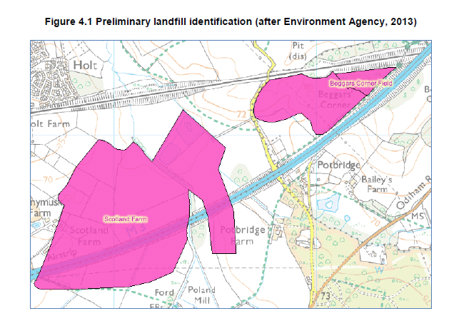
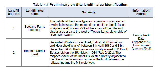
The mitigation is to propose 58 hectares of Suitable Alternative Natural Greenspace (SANG). However, much of the SANG is placed on former landfill (see section 4), see Figures 2 and 3.
Murrell Green SHL 167 former landfill site Beggars Corner. 26/01201/OUT

Figure 2 – SHL 167 former landfill site Beggars Corner
Murrell Green HL 167 Landfill details Beggars Corner. 26/01201/OUT

Figure 3 – SHL 167 Landfill details Beggars Corner

It is not known what is in some of the landfill and at this stage, the developer has not carried out detailed ground investigations. This presents a risk to future users of the SANG.

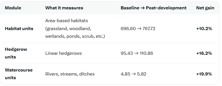
The claims on Biodiversity Net Gain (BNG) are frankly laughable. The proposal claims that gains will be made in all three areas: habitat, hedgerow and watercourse units (see Figure 4).
Murrell Green Biodiversity Net Gain Claims. 26/01201/OUT

Figure 4 – Biodiversity Net Gain Claims

The proposal starts with a baseline of 696.6 habitat units in its baseline assessment. It its stage 1 assessment (section 2.5.3) it admits 534.07 of those units (essentially the fields) will be lost. After allowing for improvements to the SANG, the loss falls to 196.15 units, although it has to be said that most of the area remains as grassland as before and the proposed orchards are not visible on the map. Then the whole-site proposal miraculously increases the habitat units to 767.72, an increase of 10.2% without giving an itemised list of how they achieved this. By pure coincidence, they have to achieve more than 10% net gain across all three modules to meet planning rules. This looks like a huge fudge that does not stand up to scrutiny.

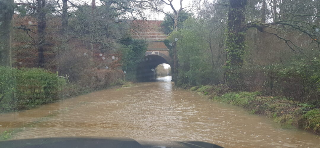
In addition, it appears that the only access to the southern SANG, south of the railway line is via the very narrow Totters Lane over the railway bridge. It is not at all clear the road and bridge can handle the extra traffic.

Policy NBE3 (Thames Basin Heaths Special Protection Area) and Policy NBE4 (Biodiversity) of the Hart Local Plan require development to protect and enhance biodiversity and to ensure no adverse effect on the integrity of the SPA. While a SANG is proposed, significant parts of it are located on former landfill of uncertain composition, and the Biodiversity Net Gain calculations appear to rely on optimistic and poorly evidenced assumptions to reach the statutory 10% target.

I therefore object on environmental grounds, including conflict with Policies NBE3 and NBE4 of the Hart Local Plan and the NPPF.

Transport and Traffic

The Murrell Green proposal includes the provision for two new roundabouts and a new T-junction on the A30 and a new roundabout on the B3016. Of course, the addition of 2,160 extra houses, probably over 4,000 cars will increase traffic on both roads leading to more congestion in Hartley Wintney and Hook. No mention is made of the need to improve the junctions of the B3016 with the A30 and A287, or the railway bridge on Totters Lane. Both are currently difficult T-junctions and will no doubt require improvement or converting to roundabouts to remain safe. The developer has not put a cost on the required improvements. The developer only commits to “proportionate contributions”.

The original 3-way roundabout at the A30/A327 junction cost £2.5m in 2015. With inflation that would probably cost £3.5m in today’s money. The proposed T-junction and three roundabouts plus the two extra probably required could easily amount to a cost of £20m.

No quantitative assessment has been made of the impact of this development on Winchfield or Hook railway stations. There is no assessment of the current or future capacity of mainline trains up to London, peak hour passenger demand, platform capacity or car park capacity. It is proposed there might be electric bike hire or a 30-minute bus service to connect to Winchfield station. No financial commitment has been made for any physical works that may be required. We might expect car park and station improvements to cost £8m.

I therefore object to the Murrell Green planning application on the grounds the transport and traffic proposals are inadequate and unfunded.

Infrastructure and Services

The developer has made provision for some non-domestic buildings on site but has not made explicit provision for a new doctor’s surgery. There is only a vague commitment to providing “proportionate financial contributions” for primary care. This is insufficient as the Whitewater Health serving the public from sites in Hook and Hartley Wintney is already overstretched. The cost of a proper surgery could easily run to £3m.

The Murrell Green planning application identifies gaps in capacity for both water provision and disposal of foul sewage. And proposes off-site reinforcement for water and a new foul water pumping station. The responsibility for funding much of this work will fall on the water companies. However, the cost of the on-site pumping station would fall on the developer and we might expect the cost to be around £5m.

As previously documented, there is a high-pressure gas main running through the site. This time the developer is planning to divert the gas main but is only budgeting £2.1m +VAT for the works. This is the same amount as they suggested in 2017, so already looks like a low-ball estimate. Data from the US shows the cost of pipelines around $12.1m per mile. The proposed diversion is about a mile long, so this suggests a cost in the region of £9m, probably higher in the UK.

The Master Plan shows land provision for an “all-through” school consisting of a nursery, up to 3-form entry primary school and an up to 8-form entry secondary school with up to 1,200 places. In the Heads of Terms, the developer only commits to providing “proportionate financial contributions” with no actual figure mentioned. However, North Whitely School (900) places cost £52m. Scaling this up to 1,200 places gives £69m. Adding extra for the 630-place primary school and nursery could easily take the total to £110m. Relying solely on “proportionate contributions” creates a significant risk that the school will be under-funded or delayed.

I therefore object to this proposal on the grounds that the local infrastructure cannot cope with the additional 2,160 dwellings and the mitigation is inadequate and underfunded.

Economic Viability

The developer is listed as Lightwood Land Limited in the application. According to Companies House, this is a micro-company with just £256K in net assets in the latest accounts up to November 2024.

A project of this scale could easily have a Gross Development Value of over £1bn, well out of reach of such a small company. If we assume GDV of £1.1bn and a gross margin of 18%, the gross profit for this scheme would be in the order of £200m.

Now let us consider the cost of the various infrastructure promised and required to make this development work. Adding up the items above gives a total of £155m, see Figure 5.

Murrell Green Estimated Infrastructure Costs (£m). 26/01201/OUT

Figure 5 – Estimated Infrastructure Costs (£m)

In other words most of the expected gross profit will be consumed by the cost of infrastructure. We can therefore expect the developer to propose “proportionate financial contributions” well below the full cost, meaning much of the cost will fall on the taxpayer or the infrastructure will not get built at all. I therefore object to this proposal on the grounds that it is not economically viable.
Shapley Heath Baseline Studies Fall Short of Cabinet Claims

In their defence of the Shapley Heath project debacle, Hart Cabinet have made a great deal of noise about the Baseline Studies produced by the developers as part of the project. The purpose of this post is to analyse the conclusions of those reports and come to a conclusion about their value.

The first point to note is that those reports have now been removed from Hart’s website. However, we did download them when they were available. Together they take up hundreds of MB of disk space. We have made them available here, on our Google drive for those who may wish to view them.

Summary of Results of the Shapley Heath Baseline Studies

Geo-Enviro Study

Low risk from past use, but calls for more detailed work. Glosses over landfill at Scotland Farm and Beggars Corner.

Transport

Proposes an impractical technocratic nirvana of bicycles, cargo-bikes and e-scooters with convoluted car journeys; Council should only consider “increases in highway capacity as a last resort”. Great way to wriggle out of infrastructure spending.

Landscape

Hundreds of pages of bumph, many simply repeating earlier studies in a massive appendix,  resulting in no conclusions except for a call for further work to “consider landscape value, sensitivity and capacity”.  In effect, totally useless.

Agricultural Land Classification

No specific report produced. One chart in the Landscape report. Was supposed to be extended into a detailed study, but apparently not produced.

Archaeological and Heritage

Concedes there would be harm to heritage assets, but claims “informed masterplanning” would avoid or reduce harm. More detailed work required.

Flooding and Drainage

Study concludes that there is a risk of fluvial (river), surface, reservoir and groundwater flooding across parts of the Area of Search. Recommends further work, particularly groundwater monitoring. Some pieces of evidence contradictory. Recommends areas prone to flood as “dry routes” out of the site.

Water Cycle/Management

No report produced.

Utilities

No report produced. It seems they’re ignoring the high pressure gas main and the high-voltage power lines.

Air Quality

Study admits the M3 is the biggest air quality constraint and that nearby SSSIs could be at risk. Apparently, air quality issues during the 16-year build phase are only temporary, so we don’t need to worry about them. Thankfully, they appear to have dropped the idea of building a tree-burning power plant.

Noise

Flawed study didn’t take account of increased traffic levels arising from the development. Admitted to needing an 80m buffer zone either side of the M3 and 20m from the A30 London Road. Concludes that “there are no planning or technical reasons with regard to noise to refuse the promotion of this site as a residential development”.

Contamination

No specific report produced

Ecology & Biodiversity Net Gain

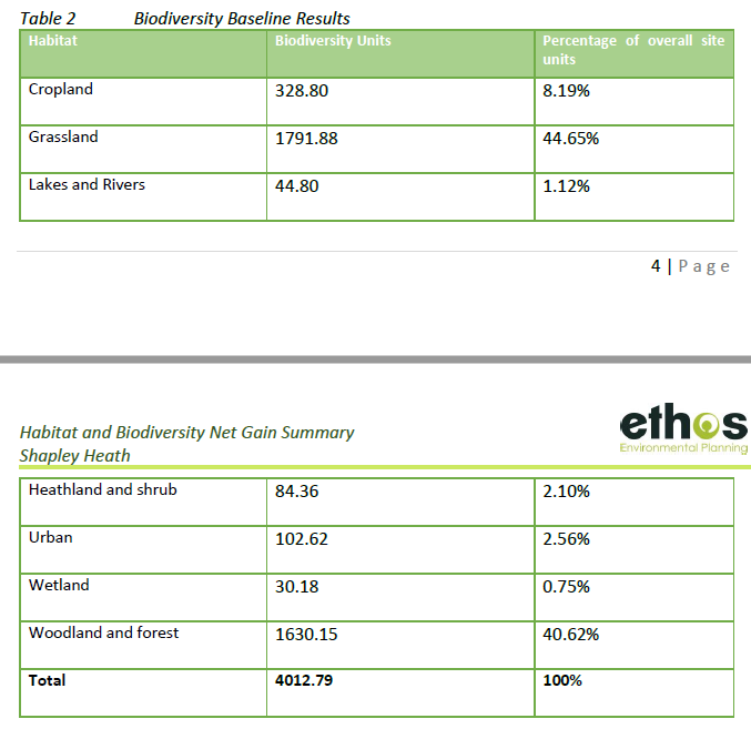
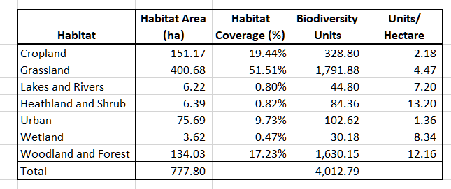
Fairly useless report that documents the different habitat groups in the Area of Search and attributes biodiversity points to each one. Concludes with a statement of the bleeding obvious that to achieve a biodiversity net gain, there needs to be an increase in biodiversity. However, replacing any of the cropland or grassland with urban areas will automatically reduce biodiversity.

Ancient Woodland, Ancient and Veteran Trees

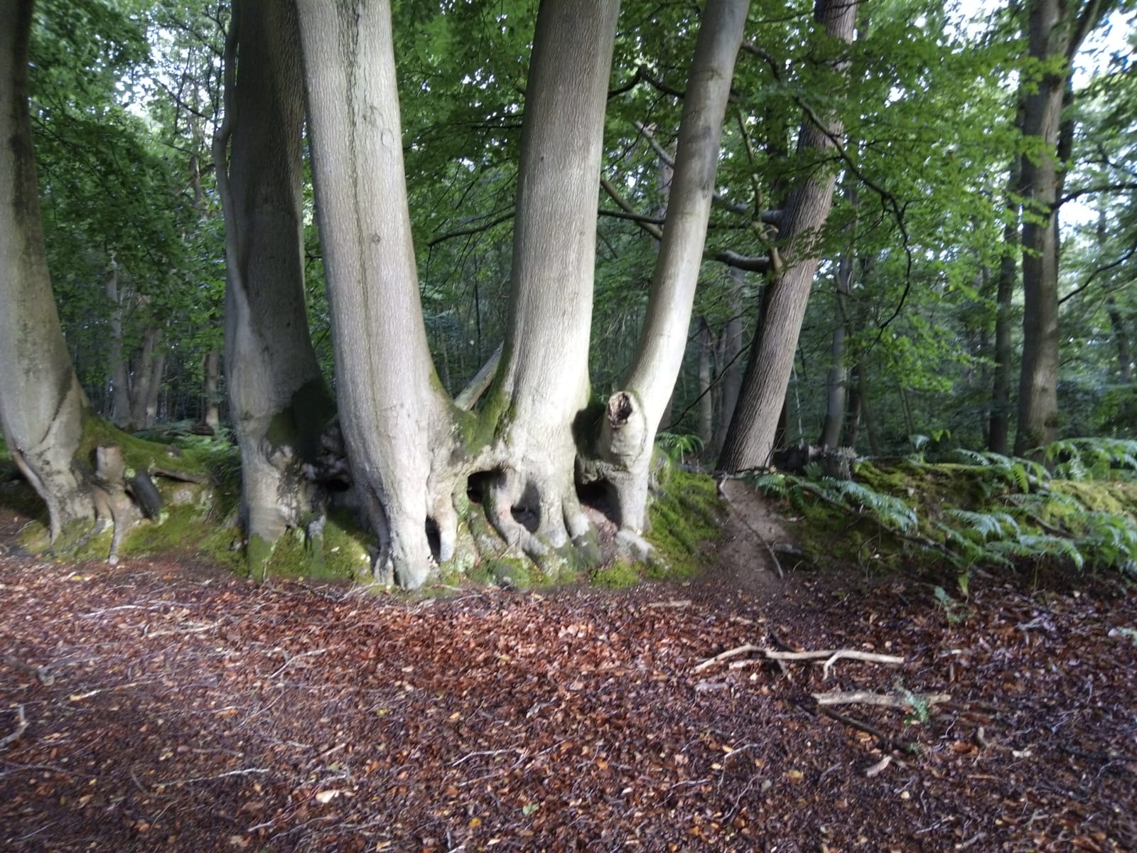
Useful report detailing all of the areas of ancient woodland and a schedule of 37 veteran trees. The report points out that development that might damage these areas be refused. It recommends buffer zones around the veteran trees of around 5m from the edge of the canopy and 15m from the ancient woodland.

Overall Status of Shapley Heath Baseline Studies

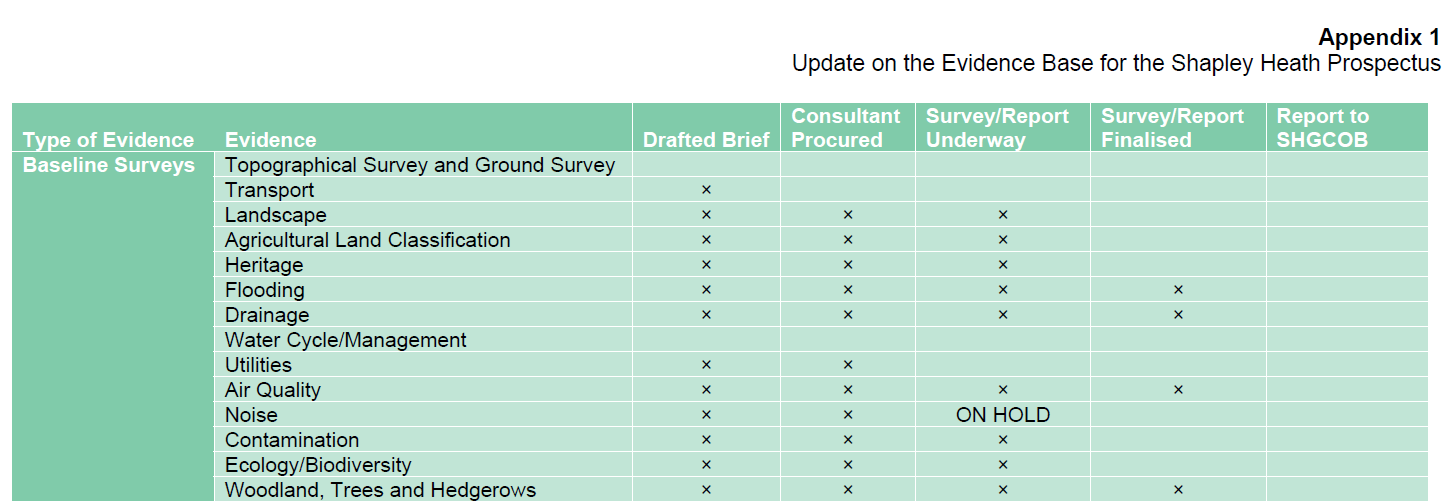
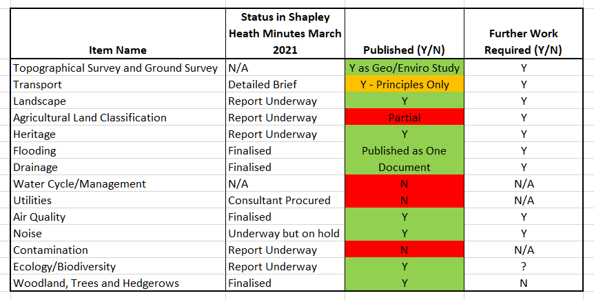
The Opportunity Board that took place in March 2021 promised no less than 14 Baseline Studies and showed the status of each at that time.

Status of Shapley Heath Baseline Studies as of March 2021

Status of Shapley Heath Baseline Studies as of March 2021

Despite claims by Cabinet that 10 studies have been produced, only 9 were published. However, one of them covered both Flood Risk and Drainage, so maybe we can say 10 of the promised subject areas were covered. It remains to be seen what happened to the other four.

Status of Shapley Heath Baseline Studies Falls Short of Expectations

Status of Shapley Heath Baseline Studies Falls Short of Expectations

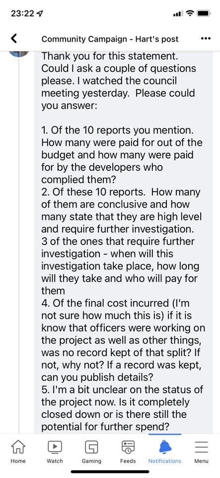
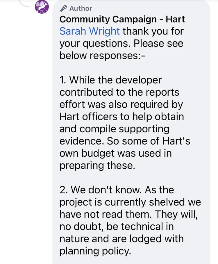
Interestingly, Community Campaign Hart have gone on record saying the have not read the documents. So, obviously they are total experts on the content of the reports and are well placed to judge their value 😉.

Questions about Shapley Heath Baseline Studies to CCH

Questions about Shapley Heath Baseline Studies to CCH

Answers about Shapley Heath Baseline Studies from CCH

Answers about Shapley Heath Baseline Studies from CCH.

Now let’s go through the details of each report.

Topographical and Ground Survey aka Geo-Enviro Desk Study

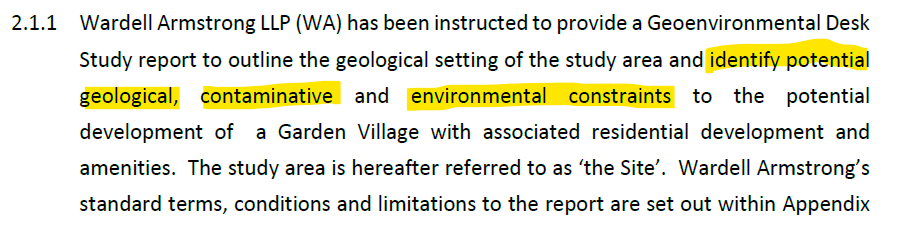
This was published as the Geo-Enviro desk study. The document was produced by Wardell Armstrong and is dated January 2021, despite the March status report showing no work had started. Note this is a desk based study; no actual field work has been carried out.

Geo-Enviro Study Objectives Wardell-Armstrong

Geo-Enviro Study Objectives.

They conclude that “site is considered to present an overall low risk from past use” and “the site is suitable for the proposed end use of residential and or commercial development with associated infrastructure”.

Geo-Enviro Study Low Risk from Past Use Wardell-Armstrong

Geo-Enviro Study Low Risk from Past Use

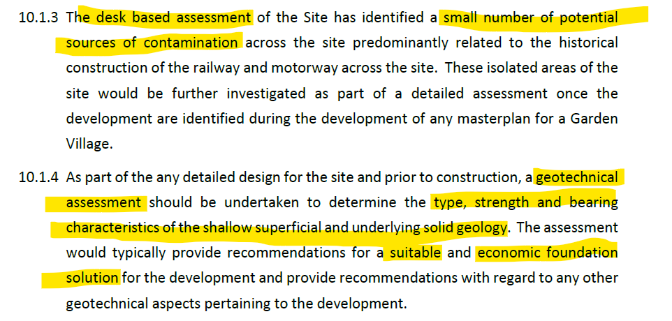
However, they go on to caveat their conclusions by stating that more detailed geotechnical work is required about the appropriate foundation solution for parts of the site.

Geo-Enviro Study Potential contamination Geotechnical Assessment Wardell-Armstrong

Geo-Enviro Study Potential contamination Geotechnical Assessment

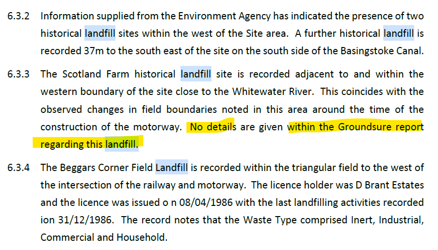
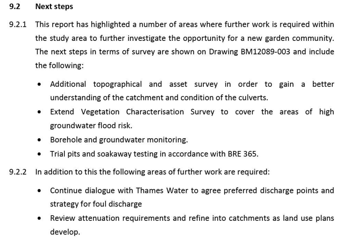
In the body of the paper they do note that Beggars Corner and Scotland Farm are former landfill sites, but gloss over the implications of this.

Geo-Enviro Study Potential Historic Landfill Beggars Corner Scotland Farm Wardell-Armstrong

Geo-Enviro Study Potential Historic Landfill Beggars Corner Scotland Farm

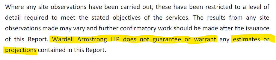
They also go on to note in their terms and conditions that they offer no guarantee  or warranty on their findings.

Geo-Enviro Study Potential No Guarantee or Warranty Wardell-Armstrong

Geo-Enviro Study Potential No Guarantee or Warranty

Shapley Heath Baseline Studies – Transport

Summary

The Transport Studies consist on seven “Topic Papers” delivered via email from the Steer Group. They are a triumph of technocratic idealism over common sense.

In their nirvana, everyone will ride bicycles or e-scooters so there’s no need to make a significant investment in roads.  The Council should abandon the philosophy of “Predict and Provide” and in favour of “Decide and Provide”, or rather don’t provide. They elaborate on this saying “user hierarchy putting pedestrians and cyclists first and motor traffic last, and design features including limited and well-placed car parking”.

This means that the Council should:

  • Simply “decide” the “preferred future” and provide for that future instead. SO, they can decide not to provide proper road infrastructure.
  • Actively seek to add “convoluted car journeys”.
  • Not try to predict the future traffic flows arising from 5-10,000 additional houses.
  • Only be “considering increases in highway capacity as a last resort”.
  • Include only limited parking facilities.
  • Assume everyone is going to cycle or take their lives in their hands on an e-scooter, instead of driving to do their big shop at the supermarket.
  • Not bother working out the costs of transport improvements.

In other words, they have decided that they will aim for an impractical technocratic nirvana so there’s no need to cost out a practical solution.

More Walking and Cycling Routes Plus Cargo Cycles

The aims of providing more walking and cycling routes are laudable. The roads around the proposed site notably lack pavements in  most places and there are almost no dedicated cycle paths.  However, there are some completely ridiculous ideas such as “freight to be transported by cargo cycles”. I don’t think any new supermarket would be happy to be restocked by a fleet of “cargo cycles”.

Shapley Heath Transport Study e-cargo bikes

Shapley Heath Transport Study e-cargo bikes

Convoluted Car Journeys

They also propose to “create more convoluted journeys for private vehicles thereby reducing propensity for short distance car trips”. In other words design the environment so it is difficult for cars to get in, through and out of the new development. This is a recipe for more congestion and poor quality of life. It is fundamental to economic efficiency and vibrant social life that it is easy for people to go where they want, when they want. The thing about private cars is that they promote freedom of movement and convenience. They seem to want to “Decide” that new residents should live the lives of Trappist Monks, never leaving the new town and not having visitors.

Shapley Heath Transport Study e-scooters and convoluted car journeys

Shapley Heath Transport Study e-scooters and convoluted car journeys

Better Public Transport

They also call for more busses. However, if the No. 7 bus service that already goes through Hartley Wintney is any guide, there is precious little demand for this mode of transport. By observation, these busses often have no passengers at all, and never more than a handful. It is difficult to see how this will change even with 5-10,000 extra houses.

The papers also call for more train journeys. However, they acknowledge that pre-pandemic the line was operating at maximum capacity. They outline a series of improvements that are planned for the Wessex line. However, it isn’t clear whether any of them will improve capacity or enhance services from Winchfield.

Ignoring EVs Eliminate Tail Pipe Emissions

Part of their rationale for strongly discouraging car use is to cut tail-pipe emissions. They fail to understand that by 2030 all new cars sold will be EVs, with no tailpipe emissions. Even now, hybrids are taking an ever increasing share of the market, so CO2 emissions are already falling in urban areas. It can be seen that their  rationale for reducing car usage  completely falls away.

No Costing

None of the Topic Papers addresses the costs of even providing footpaths and cycle paths. Of course they don’t address the cost of road improvements because they should only be “considering increases in highway capacity as a last resort”. In other words, they have decided that they will aim for an impractical technocratic nirvana so there’s no need to cost out a practical solution.

Landscape Character Assessment

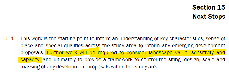
The Environmental Dimension Partnership (EDP) have produced hundreds of pages of bumph resulting in no conclusions. Much of the report is a massive appendix of earlier work carried out for the Council. They conclude by calling for further work to “consider landscape value, sensitivity and capacity”.  In effect, totally useless. The work is nowhere near as good as the work carried out by Michelle Bolger on behalf of Winchfield Parish Council.

Shapley Heath Landscape Study Further work required

Shapley Heath Landscape Study Further work required

Archaeological and Heritage Study

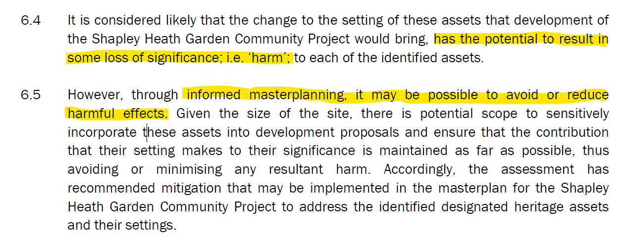
This is an 87-page report produced again by EDP. The report concedes that heritage assets would suffer “harm” as a result of such a significant development. However, they contend that with “informed masterplanning, it may be possible to avoid or reduce harmful effects”. Note the “may”.

Shapley Heath Archaeological and Heritage Study

Shapley Heath Archaeological and Heritage Study – Harm to heritage assets

Of course, they say more work is required, including actually visiting the site! Got to keep those consultancy fees rolling in.

Shapley Heath Baseline Studies – Flooding and Drainage

The Flooding and Drainage studies were produced as one document by Wardell-Armstrong who also produced the ge0-enviro desk study. This is an 68-page document plus three appendices. One plus point is that the various flood events documented on this website are incorporated into the evidence base.


The main document shows that there is a risk of fluvial (river), reservoir, surface water and groundwater flooding across large parts of the site. It recommends further work to better quantify the risks and work out the mitigation.

Shapley Heath Flood Risk Study Additional Work Programme

Shapley Heath Flood Risk Study Additional Work Programme

In particular, a 12-month borehole study is recommended.

Shapley Heath Flood Risk Study 12 month borehole study required

Shapley Heath Flood Risk Study 12 month borehole study required

Given the project has been cancelled and no budget is currently allocated, it isn’t clear when or if this work will take place.

It is worth noting that significant parts of the evidence base are self-contradictory.

Surface Water Contradictions

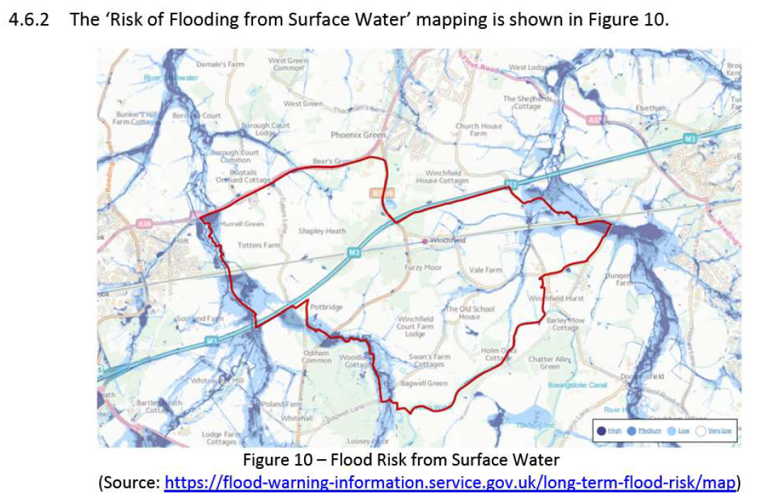
The first point to note is that they provide a very low quality image of the parts of the Area of Search that are subject to surface water risk.

Shapley Heath Flood Risk Study Figure 10 Surface Water

Shapley Heath Flood Risk Study Figure 10 Surface Water

At first glance, it looks like pretty much the whole site is clear of surface water flood risk.

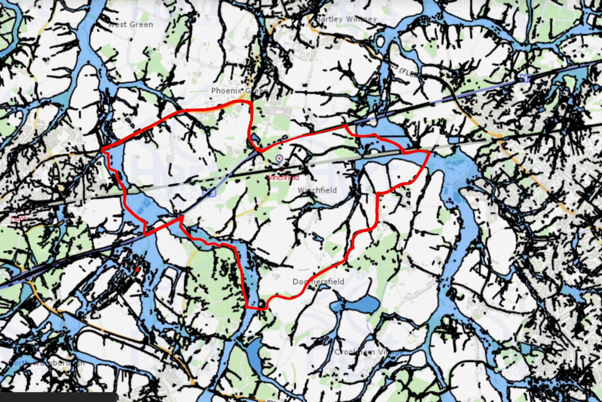
However, if you superimpose the Area of Search on Hart’s own map of surface water flood risk, a very different picture emerges.

Shapley Heath Surface Water Flood Risk from Hart Council Maps

Shapley Heath Surface Water Flood Risk from Hart Council Maps

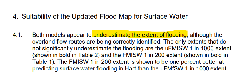
Large swathes of the Area of Search is subject to surface water flood risk. An addendum to Hart’s own Strategic Flood Risk Assessment states that their various models of surface water flood risk underestimate the extent of flooding.

Models Underestimate Surface Water Flood Risk

Models Underestimate Surface Water Flood Risk

Clearly, more work is required on this subject.

Groundwater Contradictions

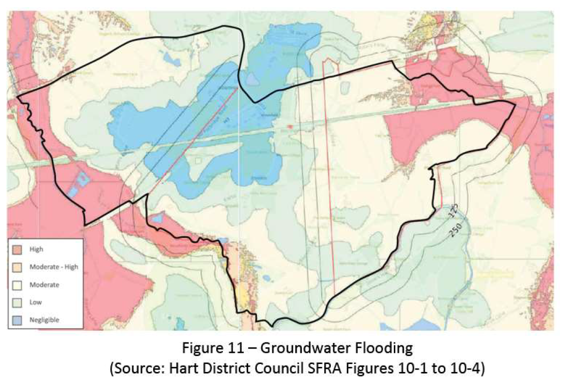
They use two different charts to illustrate the risk of groundwater flooding. The first shows high risk to the North East of the site and negligible risk across the central belt.

Shapley Heath Flood Risk Study Figure 11 Groundwater Flood Risk

Shapley Heath Flood Risk Study Figure 11 Groundwater Flood Risk

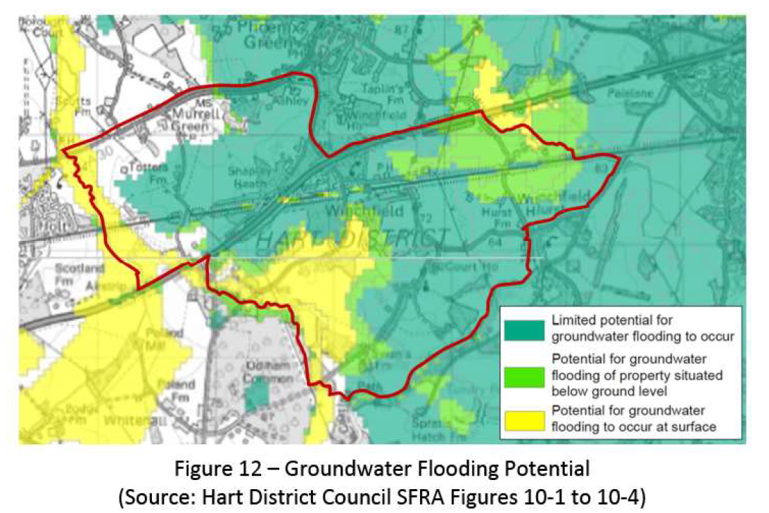
The second map shows high risk to the south, medium risk in the north east and low (note not negligible) across most of the rest of the site.

Shapley Heath Flood Risk Study Figure 12 Groundwater Flood Risk

Shapley Heath Flood Risk Study Figure 12 Groundwater Flood Risk

No wonder they called for the 12 month borehole study to work out what the real risks are.

Exit Route contradictions

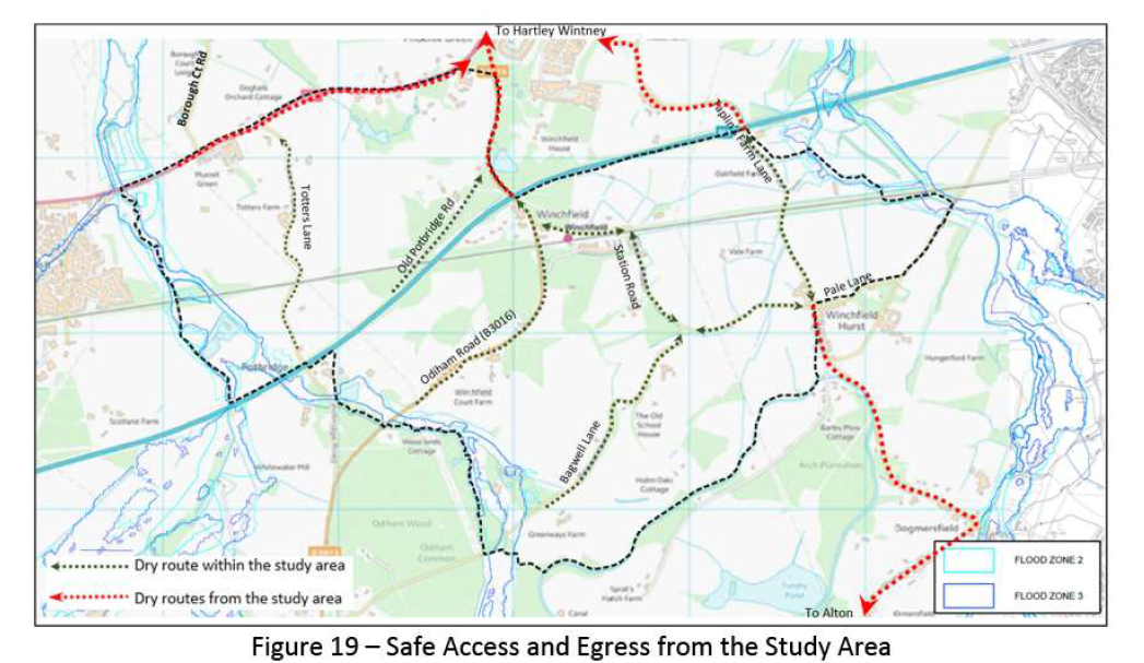
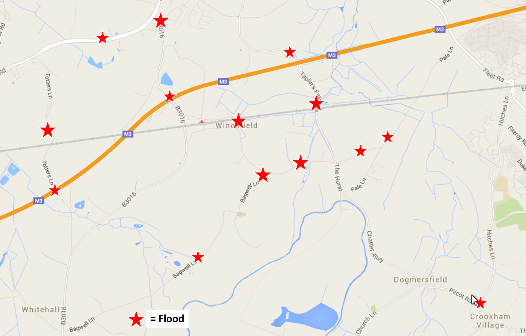
As part of their mitigation strategy, they identify a number of “dry routes” out of the site. These include Taplins Farm Lane, Station Road, Bagwell Lane and Totters Lane. The very roads that we have documented flood frequently and often to such an extent that they are impassable. They even reproduced the graphic below in their own document.

Shapley Heath Flood Risk Study Allegedly Dry Routes

Shapley Heath Flood Risk Study Allegedly Dry Routes

Winchfield, Hook, Crookham Village Floods 3 January 2016

Winchfield, Hook, Crookham Village Floods 3 January 2016

Clearly, they need to think again.

Shapley Heath Baseline Studies – Air Quality

Wardell-Armstrong have produced another 15-page report. However, the report is next to useless because there are no monitoring stations within the boundary of the Area of Search.

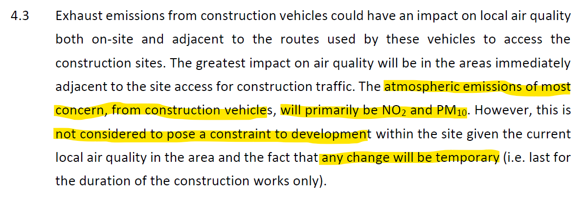
They do have a section on potential air quality impacts. They dismiss concerns about any impacts during construction as only “temporary.

Shapley Heath Air Quality Study Temporary Impacts during 16 year construction phase

Shapley Heath Air Quality Study Temporary Impacts during 16 year construction phase

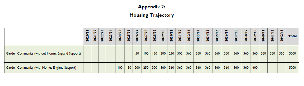
However, the bid documentation suggested a building trajectory of 16 years. This hardly fits most people’s definition of temporary.

Shapley Heath Housing Trajectory Sept 2020

Shapley Heath Housing Trajectory Sept 2020

They then move on to the “operation” phase, by which they mean the impact on air quality having built 5-10,000 extra houses.

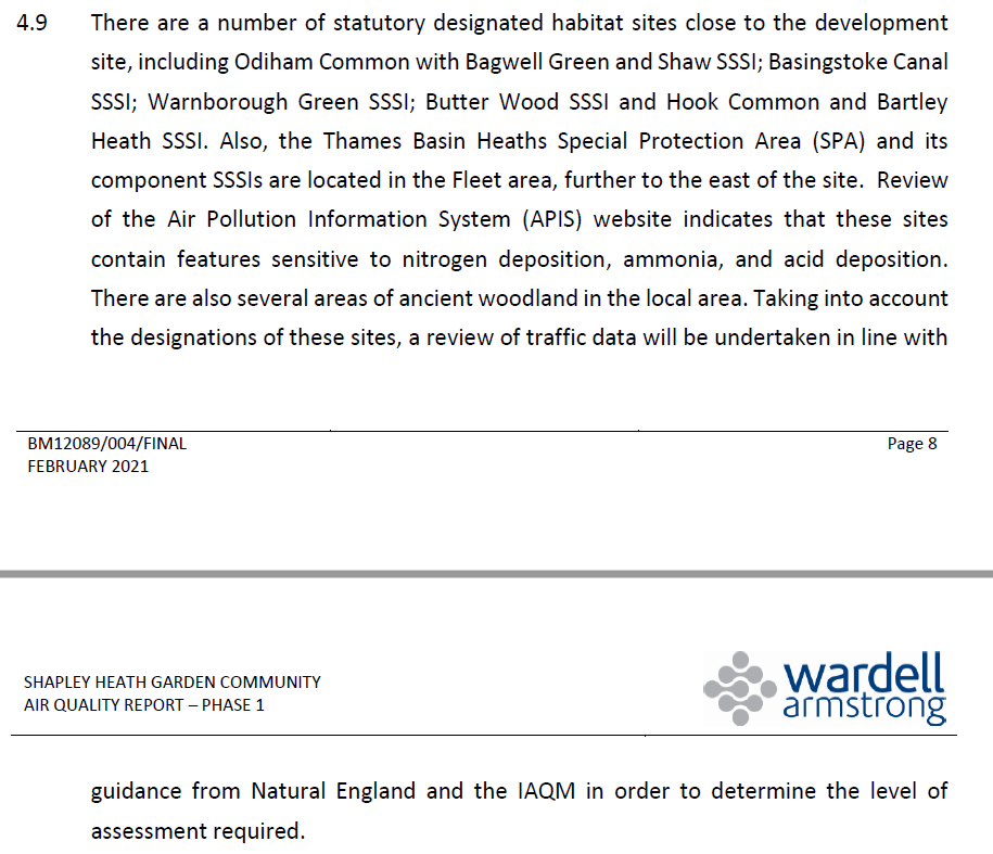
They concede that there could be potential damage to nearby SSSI’s, although they do not mention the many SINCs within the Area of Search.

Shapley Heath Air Quality Study Potential Damage to SSSIs during operation

Shapley Heath Air Quality Study Potential Damage to SSSIs during operation

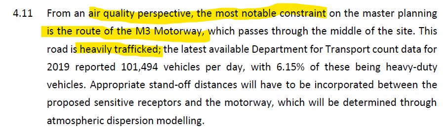
They also admit that the M3 is “the most notable constraint” regarding air quality.

Shapley Heath Air Quality - M3 Is A Significant Constraint

Shapley Heath Air Quality – M3 Is A Significant Constraint

Thankfully, they have given up on the idea of a tree-burning biomass power plant or CHP as they euphemistically call it. In a previous Sustainability Appraisal they used the potential of such a plant to rank Shapley Heath above other options. Heaven knows why, burning wood to produce power generates more CO2 and noxious particulate emissions than burning coal.

Shapley Heath Air Quality - Given up on idea of a Power Plant

Shapley Heath Air Quality – Given up on idea of a Power Plant

Of course they need to do further more detailed work.

Shapley Heath Baseline Studies – Noise

Our friends at Wardell Armstrong have been busy again, this time on a 39-page Noise Assessment report. However, we believe this assessment to contain a very significant flaws:

  1. Study Timing.
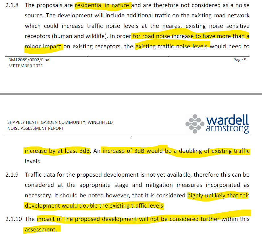
  2. No account was taken of the extra traffic generated by the development.
  3. They assumed the development would be residential only.

Study Timing

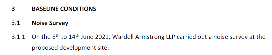
First, the study was carried out in mid-June 2021. They assumed traffic levels were back to normal levels. However, some Covid restrictions were still in place up to mid-July 2021.

Shapley Heath Noise Study - Study period 9-14 June 2021

Shapley Heath Noise Study – Study period 9-14 June 2021

In addition, the study period was 9-14th June 2021. The 12th of June was a Saturday and the 13th was a Sunday. Weekends generally have lower traffic levels, so some of the readings they took will understate the mid-week noise levels.

Extra Traffic Ignored

The extra traffic that will be generated by the development was not considered in their work. They justify this by saying traffic volumes would have to double to generate a 3dB increase in noise levels.

Shapley Heath Noise Study - Will Not Consider Impact of Proposed Development

Shapley Heath Noise Study – Will Not Consider Impact of Proposed Development

For a road like the M3, that is justifiable. For the A30 London Road, that assumption is at least debatable as it is likely to be one of the major access points should the development go ahead. Therefore, traffic volumes will likely rise significantly. However, for the more minor roads such as the B3016, Station Road, Bagwell Lane and Taplins Farm Lane, this assumption is demonstrably false. There’s currently only a couple of hundred dwellings in Winchfield. Increasing that by 5-10,000 would likely increase traffic on these minor roads by at least an order of magnitude, far more than double. Yet, they have chosen to ignore this obvious fact, despite designing the place to have “convoluted” car journeys adding to congestion and noise.

Assumed Residential Only

Moreover, they also assume that the development would be residential only. However, Hart’s own Project Overview document made it clear that the development would be mixed use, with various employment sites, supermarkets/retail and schools. These types of development will add further to the noise problem.

Shapley Heath Project Overview - Mixed Use Community with Employment and Retail premises

Shapley Heath Project Overview – Mixed Use Community with Employment and Retail premises

Noise Mitigation Strategy

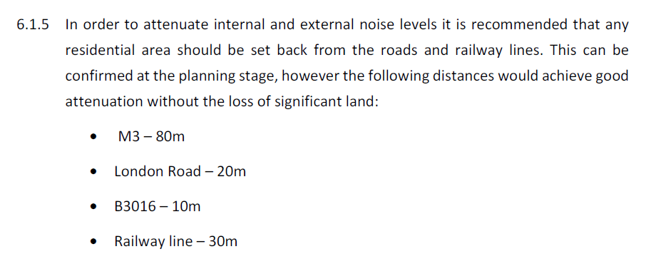
To mitigate the impact they recommend buffer zones around various roads and the railway. These include 80m from the M3, 20m from the A30 and 30m from the railway. We suspect the 10m buffer recommended around the B3016 will prove to be inadequate because traffic levels will rise very significantly.

Shapley Heath Noise Study - Road and Rail Buffer Zones

Shapley Heath Noise Study – Road and Rail Buffer Zones

However, as highlighted above, they have assumed zero extra traffic impact on Station Road, Bagwell Lane and Taplins Farm Lane. Therefore additional buffer zones maybe required. Such a buffer zone would reduce the land available for building, particularly on the parcel of land bounded by the B3016, the M3, Taplins Farm Lane and the railway.

They also recommend various other mitigation strategies such as 2m high fences, special glass in some windows near the major noise sources and “acoustic ventilation” so there’s no need to open windows.

The report concludes that if appropriate mitigation measures are put in place, “there are no planning or technical
reasons with regard to noise to refuse the promotion of this site as a residential development”. Of course, more detailed acoustic design will be required, to generate even more fees.

Shapley Heath Baseline Studies – Ecology and Biodiversity Net Gain

This is a 15-page report plus a 12-page appendix consisting mostly of maps. It was produced by a Ethos Environmental Planning. Overall it’s a chocolate teapot of a report because it concludes that in order to increase biodiversity, the number of biodiversity points need to increase, but it doesn’t say how.

Methodology

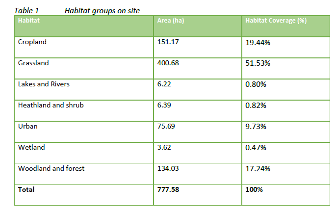
It starts by classifying different parts of the Area of Search into Habitat Groups

Shapley Heath Ecology and Biodiversity Habitat Groups

Shapley Heath Ecology and Biodiversity Habitat Groups

It then goes on to award “Biodiversity Units” to each group.

Shapley Heath Ecology and Biodiversity Units

Shapley Heath Ecology and Biodiversity Units

Biodiversity units are calculated using the Biodiversity Metric 2.0. The metric subjects the area of the habitats to a selection of multipliers which determine an areas biodiversity value. The multipliers are the condition of the habitat, its distinctiveness, its connectivity and its strategic significance. However, the report doesn’t explain how they assigned values to the various multipliers. They do caveat their results by making clear that the Biodiversity Metric 2.0 they used is a beta-test trial and the results maybe subject to change.

They go on to say that to enhance or maintain biodiversity, they need to retain high value areas and poorer areas “be targeted for removal”.

Shapley Heath Ecology and Biodiversity target areas for removal

Shapley Heath Ecology and Biodiversity target areas for removal

So, if you already live in the Area of Search, they’re going to target your house for removal.

Conclusions

They conclude with a statement of the obvious. To increase biodiversity points, you have to increase biodiversity points.  However, they offer no advice on how to do that. By combining their tables we have been able to demonstrate that replacing any of the grassland or cropland with urban development, biodiversity will be reduced. This is because the average biodiversity units per hectare are lowest for urban areas.

Shapley Heath Ecology and Biodiversity Points per Hectare

Shapley Heath Ecology and Biodiversity Points per Hectare

This is contrary to the expectations set in the Project Overview:

Shapley Heath Project Overview BioDiversity Net Gain

Shapley Heath Project Overview BioDiversity Net Gain

The Shapley Heath survey last year even suggested that “green spaces within garden communities are also opportunities to enhance biodiversity and the natural environment”. It isn’t clear how they came to that conclusion on the basis of their own survey.

Ancient Woodland, Ancient and Veteran Trees

This is a 39-page report with an 8-page appendix again produced by EDP. Overall, this is a useful report detailing all of the areas of ancient woodland and a schedule of 37 veteran trees. The report points out that the NPPF says that development which might damage these areas be refused, unless there are exceptional circumstances. It recommends buffer zones around the veteran trees of around 5m from the edge of the canopy and 15m from the ancient woodland. Note the results of the survey expire two years after it was conducted. This means that the survey will be useless after December 2022.


Virtue Signalling Council Refuses Help for Hard Pressed Families

At Council last week, we asked a number of questions to challenge the budget for next year. One of those questions asked what specific deliverables would be produced from the £250K they have set aside to “tackle climate change”. The answer revealed that they didn’t have the faintest clue what they were going to spend it on or what they were going to deliver with the money. The supplementary question asked if they wouldn’t be better to keep the money in reserves to balance future budgets or offer a rebate on council tax to help families struggling with the cost of living rather than signalling their virtue with other people’s money.

The full exchange can be viewed here: https://youtu.be/sa2I5KxdmsM?t=3809

This accusation caused offence to the Leader of the Council. We’re sorry if the truth hurts. Remember, climate change is supposed to be their “top priority”, but they have no plan. During the debate about the budget many of the Councillors got up to virtue signal express their outrage at such a suggestion. As they expelled lots of hot air containing 40,000ppm CO2, not one of them came up with a single idea to reduce emissions or improve the environment. The Conservatives proposed a motion to remove that item from the budget and instead offer a council tax rebate to the poorest households in the district. This amendment was rejected.

Among the critics of the amendment was Saint Councillor Peter Wildsmith, who asked for the £250K annual budget to be extended indefinitely to tackle the problem. Again, he didn’t come up with a single idea on how to use the money effectively. Now he has taken to social media to describe as a “disgrace” anyone who has the temerity to disagree with him.

The budget was eventually passed with a small amendment to offer a welcome £10,000 grant to Fleet Food Bank.

6 Ideas to Improve Hart’s Environment

We are very concerned about waste at Hart Council. Over £700K has been splurged on the doomed Shapley Heath project since FY19/20 and nothing of substance has been produced. They squandered ~£140K on planters and signs for the disastrous Fleet pedestrianisation project. Now it appears they want to create a permanent £250K/yr climate slush fund to parade their virtue and produce nothing but CO2-laden hot air.

We think if we criticise the Council we should offer some alternative ideas.

  1. The Council has substantial capital reserves. They should invest some of this to insulate better the social housing in the district. This would reduce emissions and reduce residents’ soaring energy bills.
  2. They have been talking about the “green grid” for a long time now and delivered nothing. They should accelerate this project to encourage and enable more walking and cycling.
  3. The Council offices are far bigger than they need. They should move to smaller, better insulated premises and reduce their own energy consumption.
  4. Apply for one or more of these grants to support planting trees in the District.
  5. End support for their disastrous plan to build 5-10,000 unnecessary houses at Shapley Heath. Construction alone would emit 1m tonnes of CO2 and destroy valuable habitat and carbon sinks.
  6. Extend the range of items that can be recycled in the blue bins.

Readers should also note that earlier iterations of Shapley Heath pushed the idea of a locally-sourced biomass energy plant. This is essentially chopping down the wonderful trees in the district to produce electricity. Burning wood produces more CO2 per unit of electricity generated than burning coal. At Drax, it also produces more particulate emissions than burning coal.

The Council declared a Climate Emergency last year. Since then the committee has met several times and produced nothing but hot air. None of the ideas above would require a single penny of the £250K they have allocated to be spent, but would help Hart residents directly and improve the environment. It’s time for the Council to stop the hot air and start acting.


Shapley Heath Endangers Red List Birds

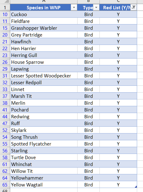
This article builds on our earlier post setting out the green case against Shapley Heath. We have been inspired by new research that shows the red list species that are found in Winchfield.  New analysis shows that 26 of the 67 bird species on the RSPB Red List have been spotted in Winchfield parish.

Clearly building 5-10,000 houses in the Shapley Heath area will endanger these important species. Hart Council’s survey about Shapley Heath focuses on biodiversity as a key issue. It is mentioned in questions 19, 20 and 21. However, they fail to mention the damage that a new community will do to the existing ecosystems and the threatened species found there.

This seems odd given that Hart has its own Biodiversity Action Plan. But it seems they haven’t kept up to date with their promised monitoring reports. The Council even has a page dedicated to biodiversity that promises to

[Set] targets for biodiversity achievement in planning, site management and monitoring and education and awareness

Having read the rest of this article, you might like to respond to the Shapley Heath survey. This is your chance to make known your concerns about the proposals. We have produced a handy guide with suggestions as to how you might choose to answer the freeform questions. The guide can be found on the download below. The full survey can be found here. The survey closes on 5 July.

Shapley Heath Survey with Suggested Responses

Winchfield Notable and Protected Bird Species

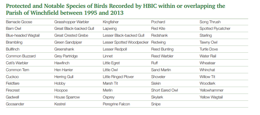
The current Winchfield Neighbourhood Plan (WNP) shows on p47 the notable and protected species identified by the Hampshire Biodiversity Information Centre (HBIC).

Winchfield Notable and Protected Bird Species

Winchfield Notable and Protected Bird Species

This shows a total of 64 different species.

RSPB Red List

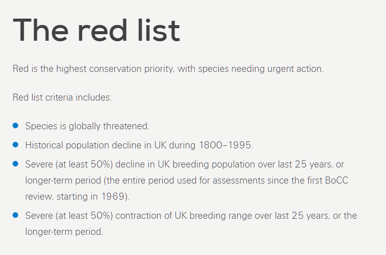
The RSPB helpfully produce a red list of UK birds. This contains 67 separate species.  To place a bird species on the Red List, the RSPB apply a set of strict criteria:

Shapley Heath Endangers Red List Birds

RSPB Red List Criteria

The criteria include population decline and contraction in breeding range. Clearly, building all over the Area of Search will contract the available space and may well kill-off the local population of these birds. The red list contains 67 different species.

Shapley Heath Endangers Red List Birds

By cross-referencing these lists, you can see the red list birds that make their home in Winchfield.

Shapley Heath Endangers Red List Birds

Red List Bird Species in Winchfield Neighbourhood Plan

This list contains 26 different species. So, nearly 39% of the species on the red list have been found in Winchfield parish. It would be an act of pure malice to destroy the habitat of these important birds.

Mammals Need Protecting Too

The WNP (p44) also says that Winchfield is home to five species of bats. All species of bats are protected in the UK.

Pipistrelle Bat found in Winchfield

Pipistrelle Bat found in Winchfield

Winchfield is also home to brown hares.

Brown Hare Found in Winchfield

Brown Hare Found in Winchfield

Hares are protected in the UK under the Wildlife and Countryside Act, 1981. They are also a Priority Species under the UK Post-2010 Biodiversity Framework. Surely a council committed to biodiversity wold not put these important creatures at risk.


The Green Case Against Shapley Heath: Regeneration is the Solution

The Green Case Against Shapley Heath: Regeneration is the Solution

The Green Case Against Shapley Heath: Regeneration is the Solution

The purpose of this post is to illustrate the green case against Shapley Heath.  We will:

  • Examine Hart’s environmental and climate change commitments.
  • Show how Shapley Heath will deliver excess housing and up to 1m tonnes of excess CO2 emissions just from building it.
  • Demonstrate how concreting over 505 acres to deliver 5,300 houses will destroy habitat and damage biodiversity.
  • Look at how the talk of “renewable energy” might put our forests at risk and produce more CO2 and particulates then burning coal.
  • Show how urban regeneration would produce lower CO2 per capita and keep our vital green spaces.

If Hart Council want to save the planet, they should cancel Shapley Heath and focus on urban regeneration.

Having read the article, you might like to respond to the Shapley Heath survey and make known your concerns about the environment. We have produced a handy guide with suggestions as to how you might choose to answer the freeform questions. The guide can be found on the download below. The full survey can be found here.

Shapley Heath Survey with Suggested Responses

Hart Council’s environmental and climate change commitments

In April 2021, Hart Council joined many other public bodies in declaring a Climate Emergency. They unanimously agreed (our emphasis):

“Following the successful adoption of Hart’s Climate Change Action Plan, this Council now wishes to declare a climate emergency, which commits us to putting the reduction of CO2 in the atmosphere at the front and centre of all policies and formal decision making, particularly Planning.

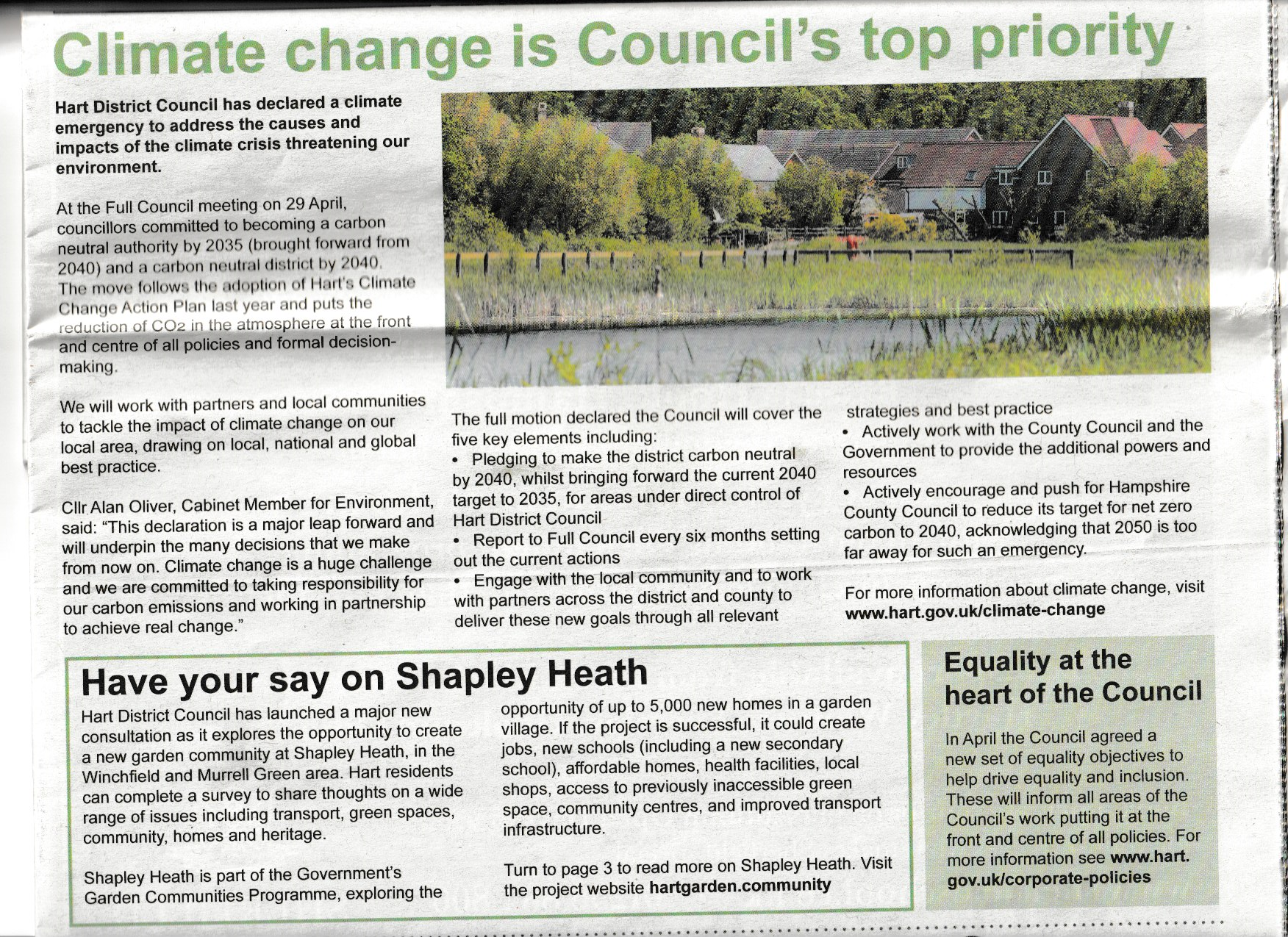
They even proclaimed that climate change is their top priority on the front page of the latest edition of Hart News.

The Green Case Against Shapley Heath

Hart News Climate Change Top Priority June 2021

However, on the same page they talk about the new Shapley Heath survey, cunningly avoiding any discussion about the environmental impact.

Excess House Building Leads to Excess CO2 Emissions

The Local Plan was agreed at a build rate of 423 dwellings per annum (dpa). However, the latest Government target is 286dpa. The 286 represents Hart’s share of the Government’s overall 300,000 dpa target. According to ONS figures, this national target is far in excess of what is required to meet demographic changes.

Hart refuse to conduct an early review of the Local Plan to take advantage of this reduction. Moreover, their original bid for Shapley Heath funding committed to deliver the new town in addition to the Local Plan requirements.

Shapley Heath in addition to Local Plan

Shapley Heath in addition to Local Plan

So, Hart are proposing to continue building at a rate far higher than the Government target, which in itself is far more than required and to deliver Shapley Heath on top. We can pretty safely say that any houses delivered by Shapley Heath will be far in excess of requirements. So any CO2 emissions arising from construction will also be entirely unnecessary.

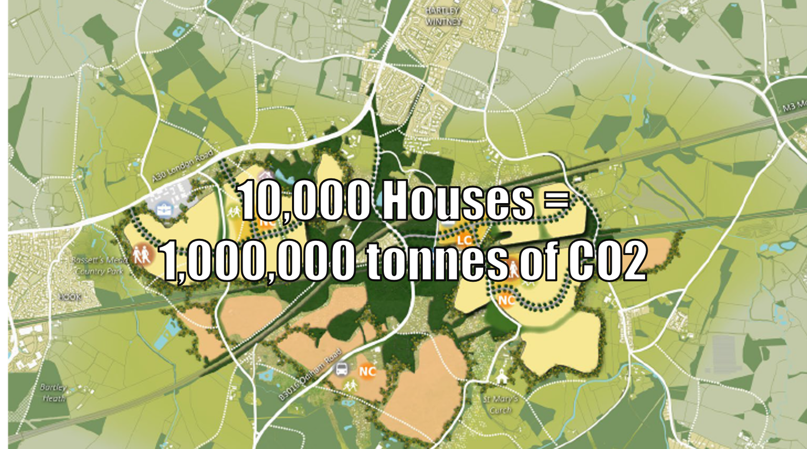
We calculated that a new town of 10,000 houses would emit around 1m tonnes of CO2. A new town of 5,000 would be half that amount.

Shapley Heath Climate Change Impact

The Green Case Against Shapley Heath: Up to 1m tonnes of CO2

We find it difficult to understand how building more houses than we need and emitting more CO2 than we need to is consistent with putting the reduction of CO2 in the atmosphere at the front and centre of all policies.

Green Case Against Shapley Heath: Biodiversity Impact

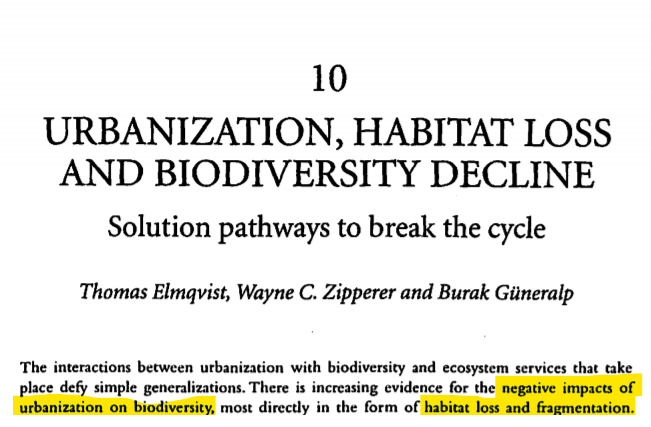
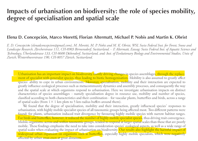
There’s plenty of academic evidence that urbanisation causes irreparable damage to biodiversity and habitat loss.

For example here,

The Green Case Against Shapley Heath: Urbanisation Habitat Loss and Biodiversity Decline

The Green Case Against Shapley Heath: Urbanisation Habitat Loss and Biodiversity Decline

and here:

The Green Case Against Shapley Heath: Impacts of Urbanisation on Biodiversity

The Green Case Against Shapley Heath: Impacts of Urbanisation on Biodiversity

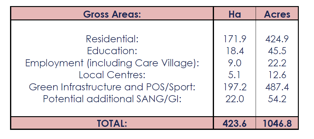
The issues include replacement of species, habitat loss and biodiversity decline. The Shapley Heath survey emphasises the importance of green spaces, wildlife habitat and woodland. Yet, they somehow fail to mention that the Viability Study accompanying their bid for Government funding proposed concreting over 505 acres of the 1,047 acres of land under consideration.

Shapley Heath Development Acreage

Shapley Heath Development Acreage

The damage to the local eco-systems will be incalculable. And all for a development that isn’t required and is in addition to the Local Plan requirement.
The Renewable Energy Trap

The new Shapley Heath survey does ask for opinion about renewable energy. Initially, this sounds quite green and cuddly. Until you look at what they meant by renewable energy in prior studies into the Winchfield new town. The Sustainability Appraisal (p74) said:

It is fair to assume that a scheme of this scale (c.3,000 homes) [Ed: How times have changed, now 5-10,000] could enable combined heat and power generation (potentially even fuelled by biomass, which might even be locally sourced).

What they mean by biomass is explained in the North Hampshire Renewable Energy Opportunities Plan.

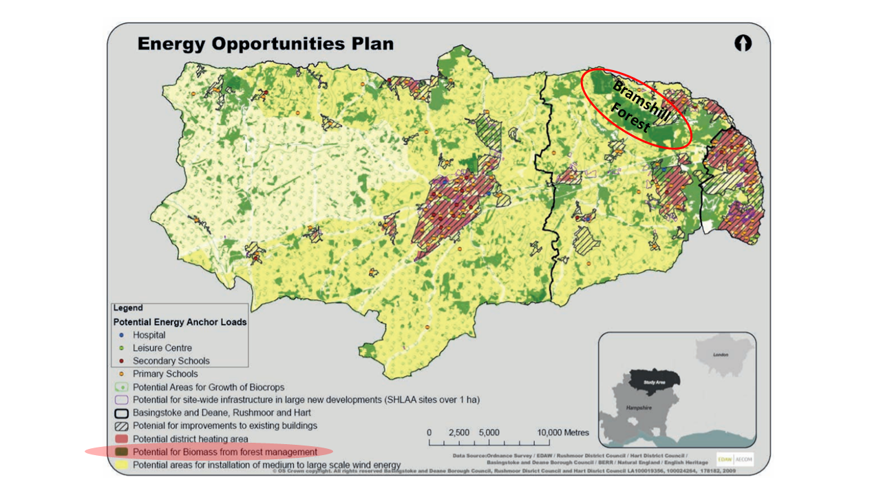
North Hampshire Biomass from Forest Management

North Hampshire Biomass from Forest Management

What they mean is chopping down trees in Bramshill Forest to fuel a wood-burning power plant. Burning wood produces more CO2 per unit of electricity produced than coal. And if Drax is anything to go by, more than twice the amount of noxious particulates.

In summary, they are considering building a wood-fired power station, using locally sourced timber that will produce more CO2 and more particulates than burning coal. This will destroy our local forest in addition to concreting over 505 acres of land, all in the name of environmentalism.

Green Case Against Shapley Heath: Regeneration is the Solution

There is a simple alternative to Shapley Heath. It’s Urban Regeneration. The benefits of this approach would be:

  • Control the build rate to match the actual requirement
  • Reduce delivery risk by having a range of projects instead of relying on just one big development
  • Protect our green fields and ancient woodland to maintain habitats and biodiversity
  • Keep vital green infrastructure to enhance our quality of life, wellbeing and mental health
  • Maintain our agricultural capacity to produce food
  • Produce less CO2 per capita

There’s plenty of evidence that shows that gentle densification produces communities that are more sustainable from a CO2 emissions point of view.

CO2 emission per capita vs Population density

CO2 emissions per capita vs Population density

The reason for this is that more people can walk to work, walk to the station and walk to leisure facilities. They need fewer cars and do fewer journeys. And slightly denser building means that occupants need less heating.

So, if we want to save the planet, urban regeneration is the answer. Cancel Shapley Heath.


#StormDennis dissolves daft Shapley Heath idea

"<yoastmark

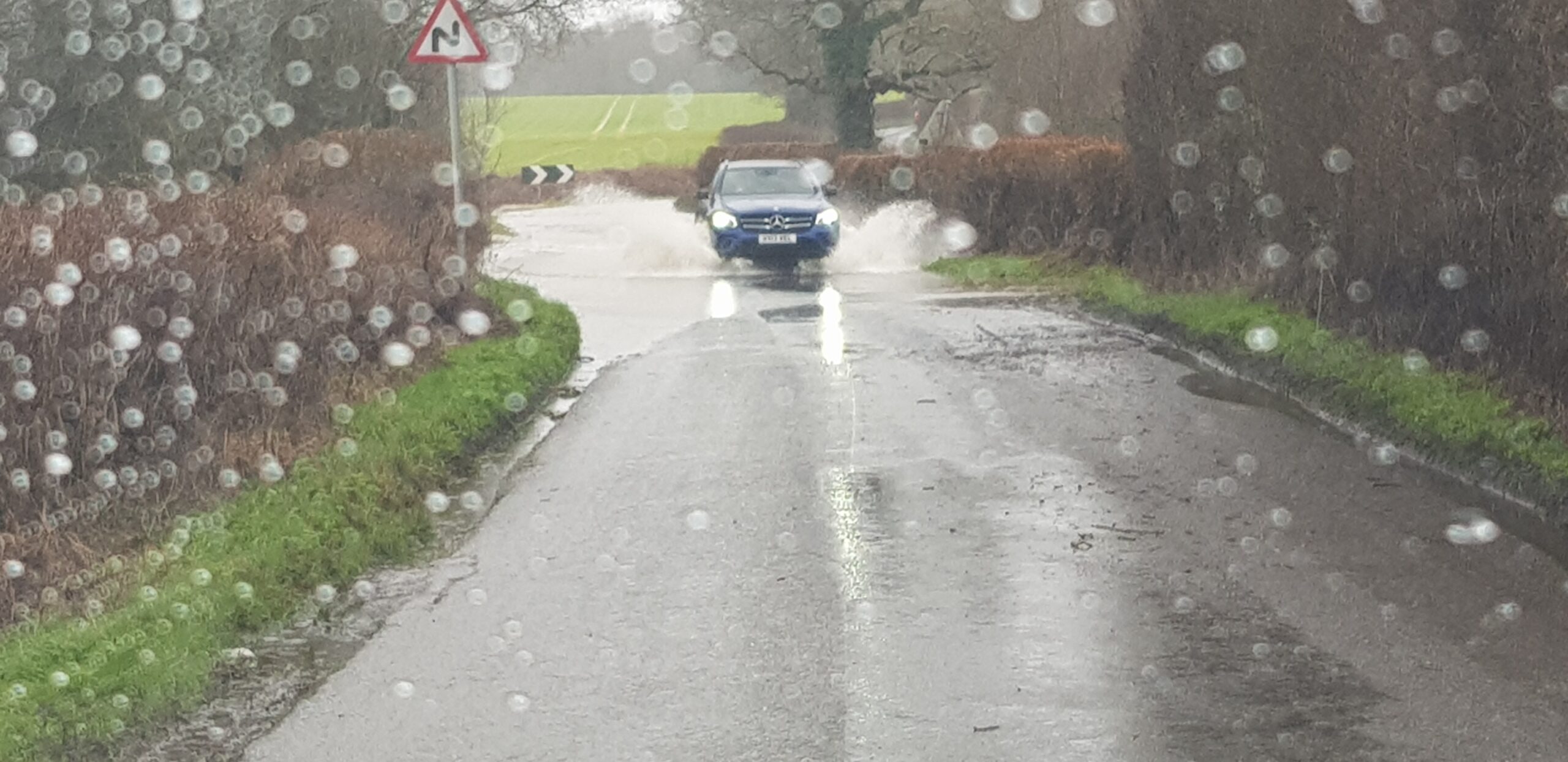
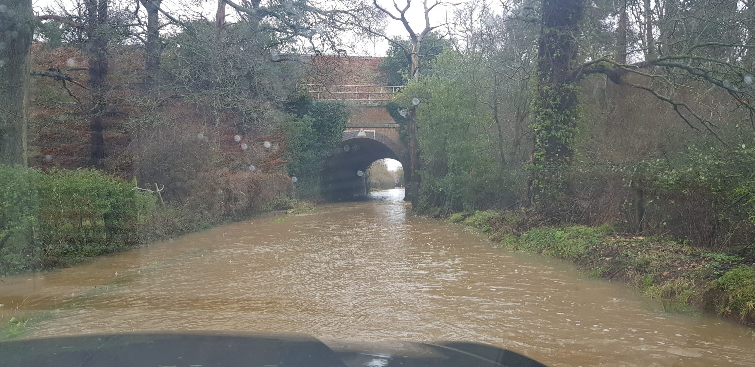
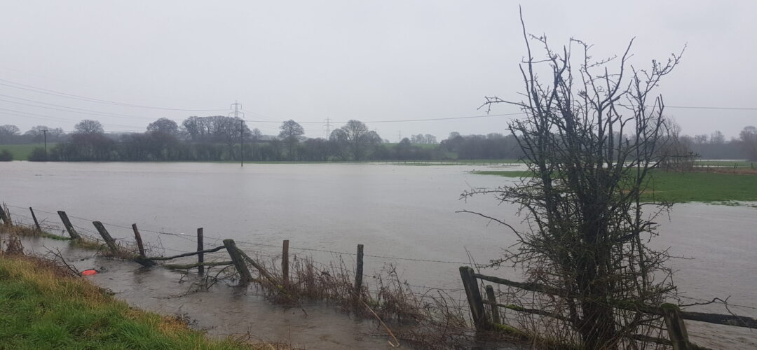
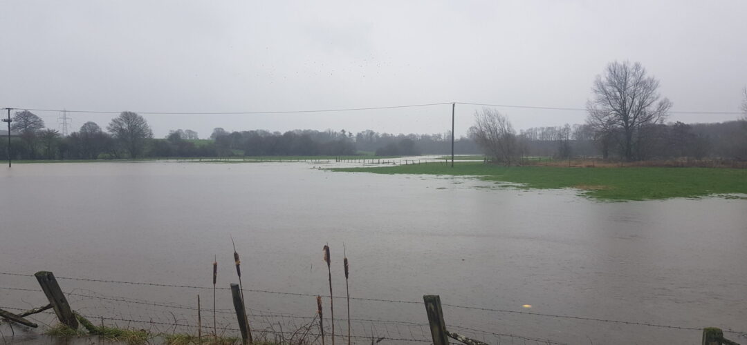
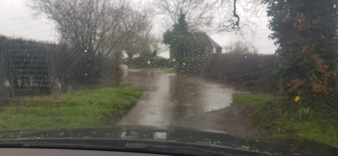
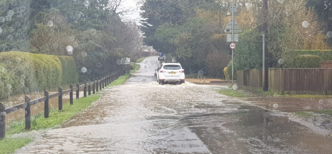
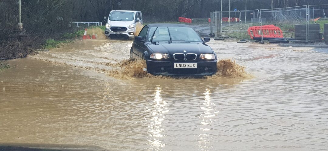
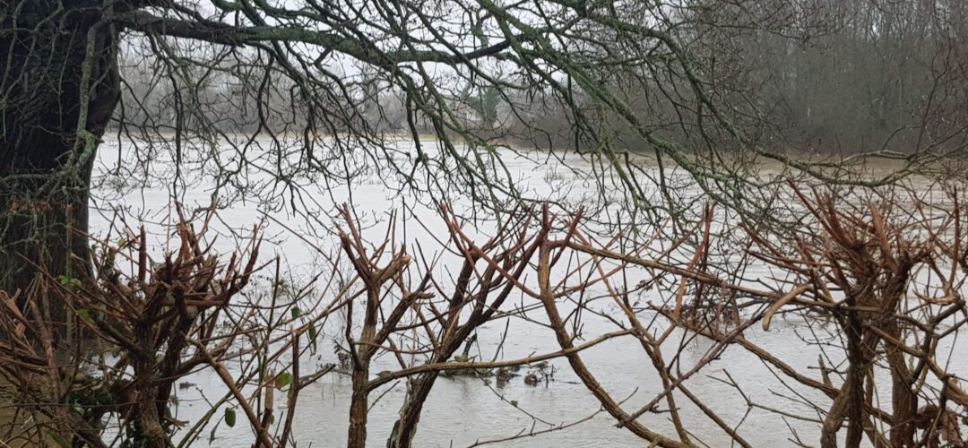
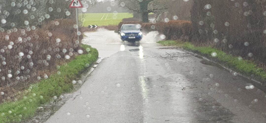
#StormDennis has taken its toll on Hart District. As far as we can tell, the worst hit area is around the mooted Shapley Heath/ Winchfield new town.  Here we have evidence of yet another of these supposed 1 in 30 year events. We drove around there this morning and found:

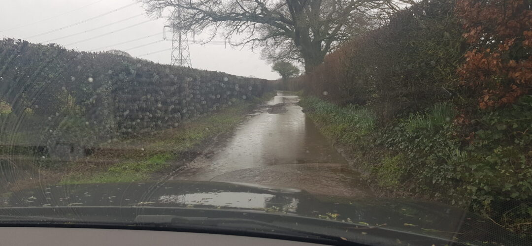
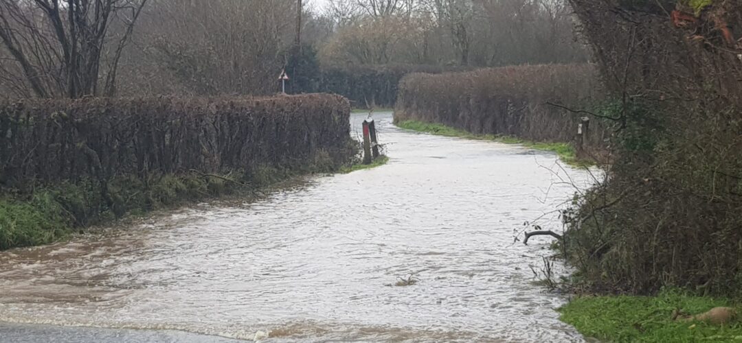
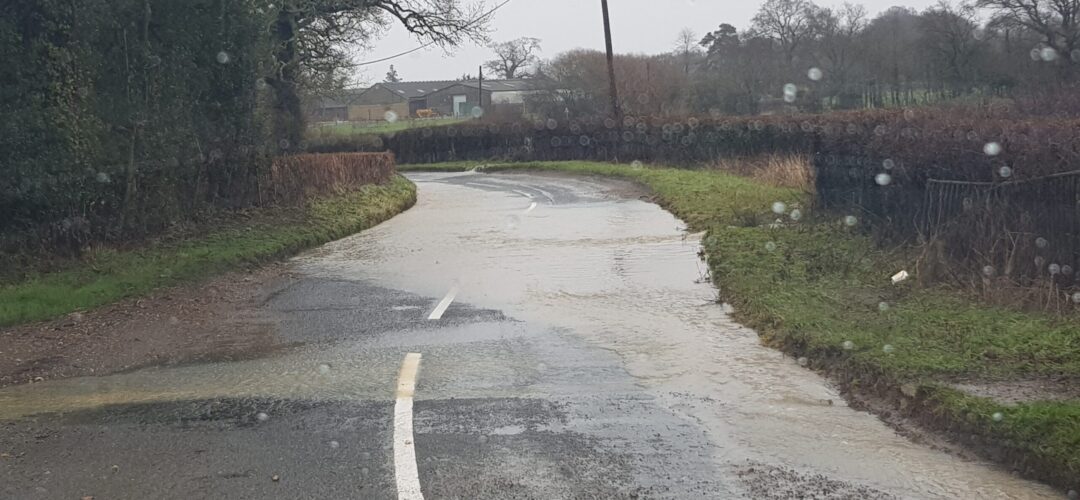
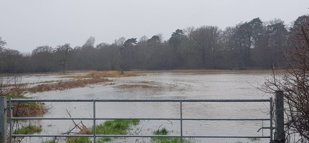
  • The river Whitewater had flooded by the A30 opposite the Crooked Billet. This is the area that is supposed to be Suitable Alternative Natural Greenspace (SANG). The sort of area earmarked for country rambles and dog-walking. Definitely not water-skiing.

  • Totters Lane flooded at the top for quite a distance
  • Bagwell Lane in Winchfield flooded
  • Station Road flooded
  • Pilcot Road in Dogmersfield flooded
  • Hitches Lane in Crookham Village flooded near the new roundabout for the Grove Farm development. Who knows how the new residents are supposed to get out of their new houses.
  • Taplins Farm Lane flooded again. We didn’t even attempt to drive through in a 4×4.
Taplins Farm Lane Flood. #StormDennis.

Taplins Farm Lane Flood

  • #StormDennis also flooded Pale Lane and the fields either side. The west side is also supposed to be SANG for the proposed Shapley Heath development.

This latest flood comes in addition to the other floods we have recorded in the area. We have recorded flood events on 15 January 2020 (#StormBrendan), 20 December 2019,  4 February 2019,  in April 2018 and three times in 2016 alone. Evidence documenting the 2016 flood events can be found here (4 Jan) , here (7 Jan), here (9 March on Station Road) and here (28 March due to #StormKatie).

The Whitewater Valley Society have also reported that North Warnborough has been badly hit.

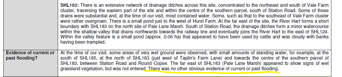
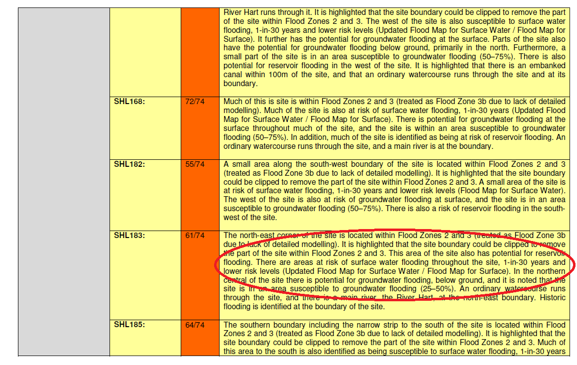
The actual weather has once again refused to comply with the flood assessment carried out for Hart Council as part of its evidence base for the Local Plan. The sustainability assessment claimed:

There was some evidence of wet ground at the far east of SHL183, but “no other obvious evidence of current or past flooding”.

Winchfield Strategic Assessment - Flood Risk 1

The detailed assessment also said there’s only a one in 30 year chance of surface water flooding.

Winchfield Strategic Assessment - Flood Risk 3

As far as we can tell, the road through the proposed development area and all roads out of the area were affected by the floods. Both SANG areas were also flooded.  When will Hart District Council see sense and abandon this daft project?

Shapley Heath Climate Change Impact

Shapley Heath Climate Change Impact

Shapley Heath Climate Change Impact

In the light of the focus on the environment in the General Election campaign, we thought it would be a good idea to look at the Shapley Heath Climate Change impact.

Shapley Heath Climate Change Impact: Summary

  • 1,000,000 tonnes of CO2 emitted from construction
  • 312,000 tonnes of CO2 per annum from the occupants
  • Loss of pasture carbon sink
  • Damage to SSSIs, Ancient Woodland and heritage

Yet, Hart has agreed the “serious impact of climate change globally” and recognises “the need for urgent action”.  Councillor Graham Cockarill is standing in the General Election as a Liberal Democrat candidate. They say “the UK should be leading the world on tackling the environment crisis”.

Why are they pursuing an unnecessary new town that goes against their own climate change policies?

Shapley Heath Climate Change Impact: CO2 emissions

According to this article in the Guardian, construction of an average 2-bed cottage emits around 80 tonnes of CO2.  The average size of Shapley Heath dwellings is likely to be larger, so let’s assume 100 tonnes of CO2 per dwelling.  The vision and bid documents both suggested the eventual size of Shapley Heath will be 10,000 houses. So, building 10,000 houses will emit around 1,000,000 tonnes of CO2. There will of course be additional emissions from building new roads, supermarkets and office blocks.

These 10,000 houses will house around 24,000 people, and each of them will emit on average ~13 tonnes of CO2 per annum each. So, there will be 312,000 tonnes of CO2 emitted by the occupants of the houses.

Moreover, the existing pasture acts as a carbon sink, so this benefit will be lost too.

Remember, the Hart Local Plan, the Inspector’s report and even the bid document said that Shapley Heath isn’t required to meet our housing targets, so all of these emissions are entirely avoidable.

Shapley Heath Climate Change Impact: Damage to Nature

The area of search contains or borders many important natural sites. These include:

  • Odiham Common SSSI
  • Basingstoke Canal SSSI
  • Numerous ancient woodland sites that are also Sites of Importance for Nature Conservation
Shapley Heath Climate Change Impact - Damage to nature

Shapley Heath Climate Change Impact – Damage to nature

Hart District Council and Lib Dem Climate Change Policies

Back in September, Hart Cabinet decided the following in respect of climate change (our emphasis):

  1. Recognises the serious impact of climate change globally and agrees that there is a need for urgent action; and

  2. Agrees that a cross party Climate Change Member Working Group be established and that the Terms of Reference for that Group as set out in Appendix 1 be agreed in principle; and

  3. That a Climate Change Strategy and Action Plan led by the Member Working  Group be prepared by January 2020 based on Hart District Council becoming a net zero carbon emitter by 2040 at the latest.

Councillor Graham Cockarill is standing in the General Election as a Liberal Democrat candidate. They say:
The UK should be leading the world on tackling the environment crisis. Our planet is on the brink of being irreparably damaged and we are responsible for that damage.
Why are they pursuing an unnecessary new town that goes against their own climate change policies?

CPRE Hampshire host event on protecting Hart countryside

CPRE Hampshire event on protecting the countryside in Hart and Rushmoor

CPRE Hampshire event on protecting the countryside

CPRE Hampshire are hosting an event about protecting the countryside in Hart and Rushmoor.

The event is free and everybody is welcome, so please do attend if you can. However, you need to book in advance so they can organise catering.

The event is taking place at the Church on the Heath, Elvetham Heath, Fleet GU51 1HA at 7pm on 24th October 2018.

You can book by following the link to www.cprehampshire.org.uk or phoning them on 01962 841897.

The full leaflet can be downloaded here.

Please oppose the consultation about the Rye Common new village development

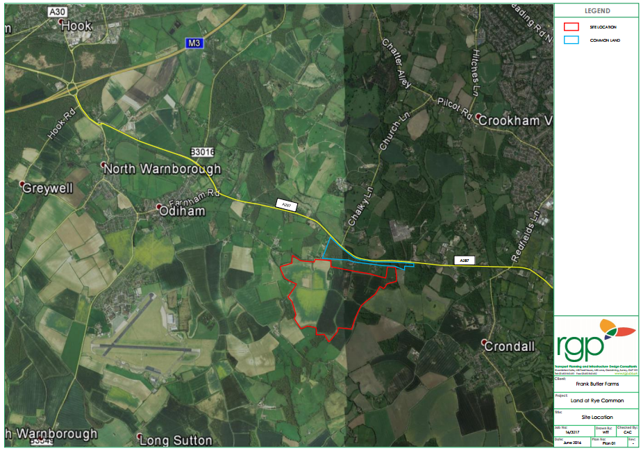
Rye Common new village proposal, Odiham, Hart District, Hampshire

Rye Common new village proposal near Odiham and Crondall in Hart District Hampshire

Bell Cornwell have launched a consultation on proposals to build a 1,600-1,900 new houses on around 140 hectares to form the so-called Rye Common New Village to the south of the A287 between Odiham and Crondall. We urge all We Heart Hart supporters to oppose the proposals by responding to the consultation that can be found here, on the grounds that it is not needed as there are plenty of brownfield sites available and Hart’s declared strategy is to prioritise brownfield development ahead of green field development.

More details about the plans can be found in Bell Cornwell’s consultation microsite,  leaflet and vision document.

We suggest you utilise some of the following arguments in your answer to the first question:

This development is not required as there are plenty of brownfield sites available, as can be seen here:

https://wehearthart.co.uk/2015/11/there-is-a-brownfield-solution-to-harts-housing-needs/

There are at most 2,350 more homes to be granted permission in the plan period (and according to a recent press release from Hart DC this may be further reduced by 1,500), and close to 4,000 dwellings that could be built on brownfield sites.

Hart’s declared strategy is to prioritise brownfield development before green field development as can be seen on page 2 of the recent Refined Housing Options paper.

Thank you for your help.


Greens set out their position on Winchfield, Pyestock and housing policy

Green Party Logo

The local Green Party have been in touch, setting out their position on the key planning issues impacting the Hart Local Plan and some ideas on broader housing policy.  In short, all of the candidates oppose Winchfield New Town and support redeveloping the brownfield site at Pyestock (aka Hartland Park). This is an important issue for the Hart Local Elections 2016.

We have updated our summary page, and table of candidates accordingly.  The detail of their response is reproduced below.

In brief I can confirm that the local [Green] party, and all its candidates in these elections are opposed to the Winchfield new town, but support the latest proposal for redevelopment of housing in Pyestock.
1. Winchfield – No. It is not required to meet Hart’s own housing targets and  by concreting over such swathes of green space, would be the destruction of Hart as we know it for generations to come. In addition, Winchfield simply does not have the infrastructure to support a New Town – it would put strain on GPs, schools, roads and quality of life – not just in Winchfield but also in Hook, Fleet, Hartley Wintney, etc.
2. Pyestock for housing – Yes. By developing brownfield sites such as Pyestock, Hart’s housing targets can be met through dispersal of home building, and lessen the burden on roads and facilities in a concentrated area. Additionally, such developments are eligible for central Government grants towards infrastructure and do not leave HDC at the mercy of council tax hikes and s106-shy developers.
Our more detailed response will include demands for any new housing to be zero- or negative-carbon and high density, and any new roads to incorporate cycle lanes. But more importantly, we don’t see this as being just about whether or not to build the Winchfield development and need to address the broader policy – how the housing need projections are worked out and allocated. If this area continues to be put under pressure to build new houses, taking in allocations from outside the area, other beautiful rural areas will be hit.
We need to emphasise the importance of rural, countryside for everyone, not just those of us lucky enough to live in villages/ rural areas. There are genuine benefits for non residents too – loads of research on mental health benefits, conservation, getting children engaged with nature, air quality etc.
And we  need to be offering alternatives, and to acknowledge the problems lots of people have in getting onto the property ladder. Is continuing to build in the over-developed South East really the answer? Should we be pushing for a more equal distribution of investment, for example, promoting business growth and sustainable development in northern England?
Consequently we are developing a vision starting with what the area should look like in 2030, and then how to get there.
We Heart Hart welcomes the stance of the Green Party on the local development issues in Hart and broadly accept many of their ideas on wider housing policy.