In their defence of the Shapley Heath project debacle, Hart Cabinet have made a great deal of noise about the Baseline Studies produced by the developers as part of the project. The purpose of this post is to analyse the conclusions of those reports and come to a conclusion about their value.
The first point to note is that those reports have now been removed from Hart’s website. However, we did download them when they were available. Together they take up hundreds of MB of disk space. We have made them available here, on our Google drive for those who may wish to view them.
Summary of Results of the Shapley Heath Baseline Studies
Geo-Enviro Study
Low risk from past use, but calls for more detailed work. Glosses over landfill at Scotland Farm and Beggars Corner.
Transport
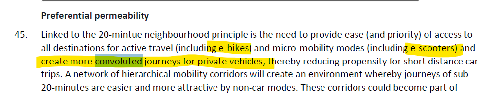
Proposes an impractical technocratic nirvana of bicycles, cargo-bikes and e-scooters with convoluted car journeys; Council should only consider “increases in highway capacity as a last resort”. Great way to wriggle out of infrastructure spending.
Landscape
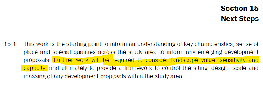
Hundreds of pages of bumph, many simply repeating earlier studies in a massive appendix, resulting in no conclusions except for a call for further work to “consider landscape value, sensitivity and capacity”. In effect, totally useless.
Agricultural Land Classification
No specific report produced. One chart in the Landscape report. Was supposed to be extended into a detailed study, but apparently not produced.
Archaeological and Heritage
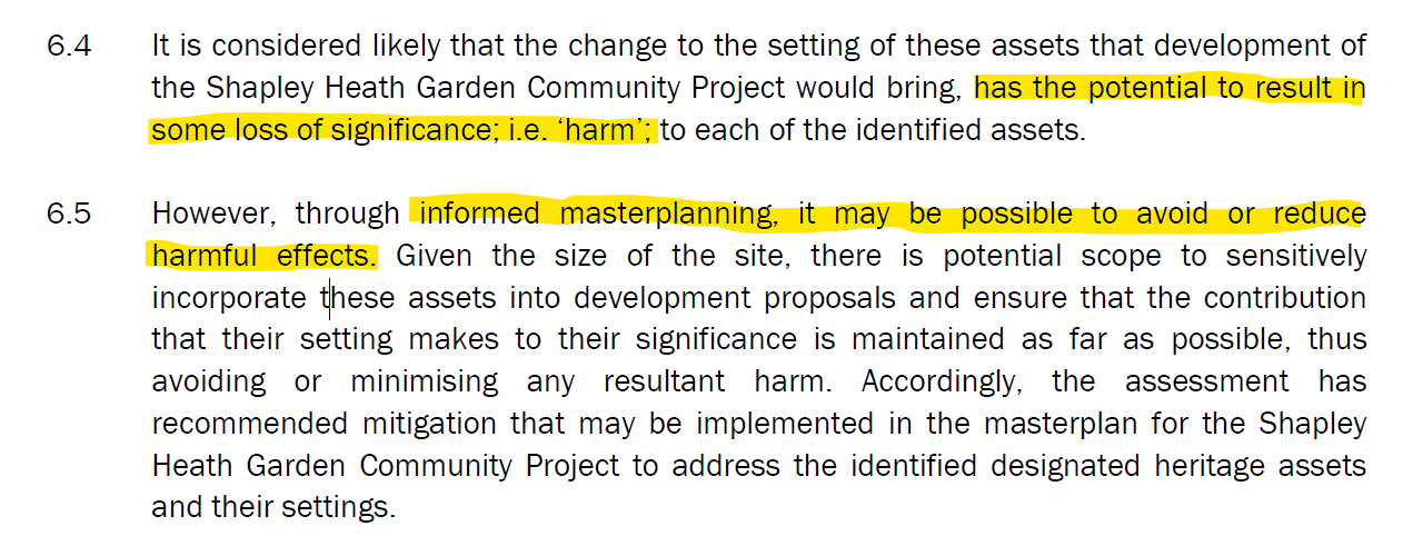
Concedes there would be harm to heritage assets, but claims “informed masterplanning” would avoid or reduce harm. More detailed work required.
Flooding and Drainage
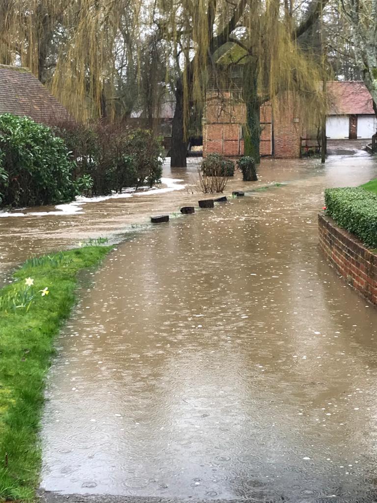
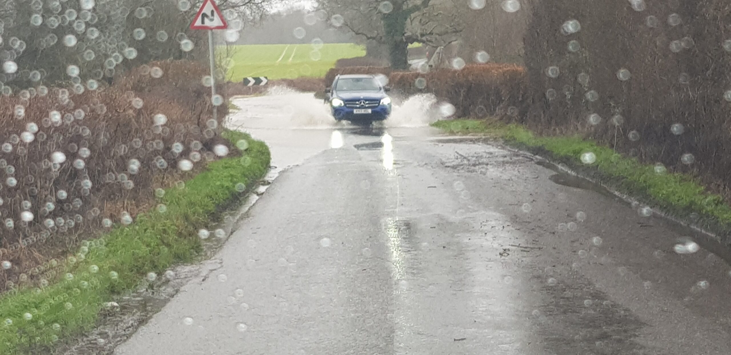
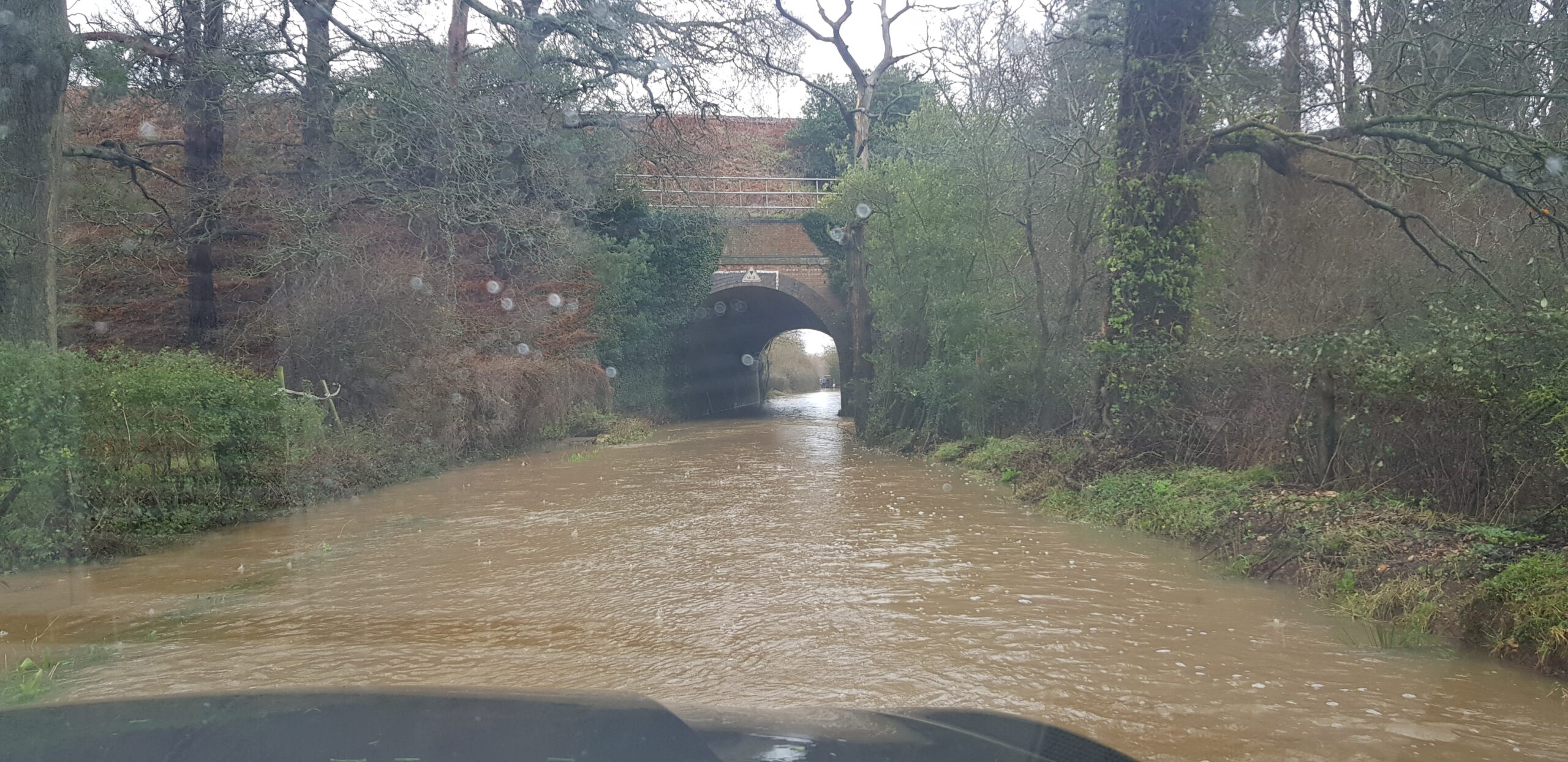
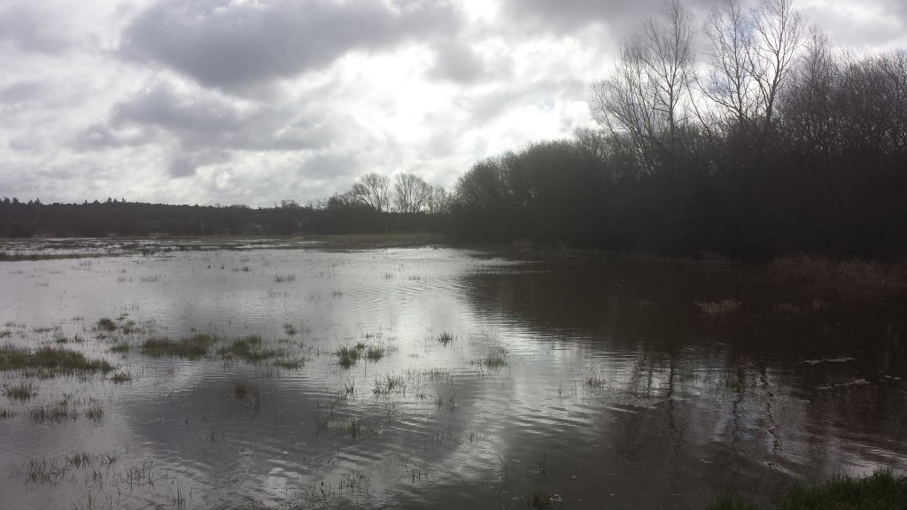
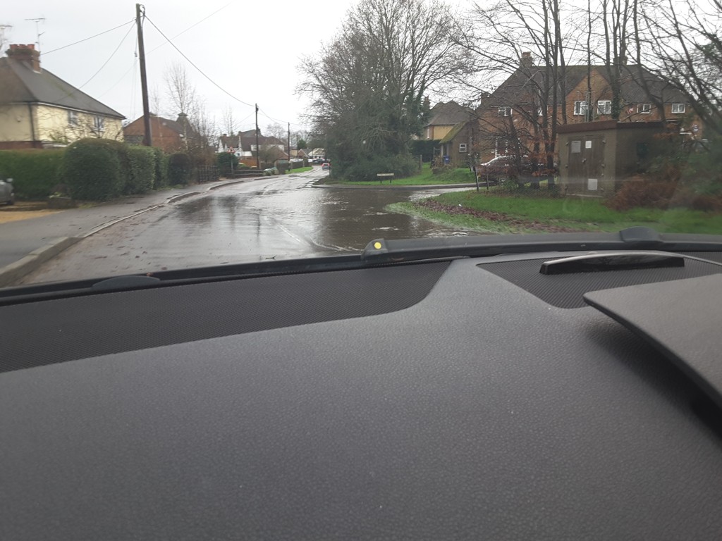
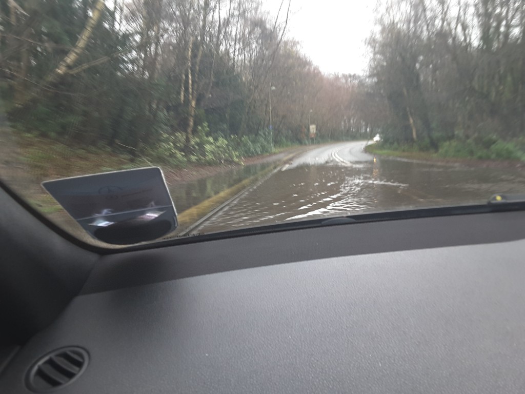
Study concludes that there is a risk of fluvial (river), surface, reservoir and groundwater flooding across parts of the Area of Search. Recommends further work, particularly groundwater monitoring. Some pieces of evidence contradictory. Recommends areas prone to flood as “dry routes” out of the site.
Water Cycle/Management
No report produced.
Utilities
No report produced. It seems they’re ignoring the high pressure gas main and the high-voltage power lines.
Air Quality
Study admits the M3 is the biggest air quality constraint and that nearby SSSIs could be at risk. Apparently, air quality issues during the 16-year build phase are only temporary, so we don’t need to worry about them. Thankfully, they appear to have dropped the idea of building a tree-burning power plant.
Noise
Flawed study didn’t take account of increased traffic levels arising from the development. Admitted to needing an 80m buffer zone either side of the M3 and 20m from the A30 London Road. Concludes that “there are no planning or technical reasons with regard to noise to refuse the promotion of this site as a residential development”.
Contamination
No specific report produced
Ecology & Biodiversity Net Gain
Fairly useless report that documents the different habitat groups in the Area of Search and attributes biodiversity points to each one. Concludes with a statement of the bleeding obvious that to achieve a biodiversity net gain, there needs to be an increase in biodiversity. However, replacing any of the cropland or grassland with urban areas will automatically reduce biodiversity.
Ancient Woodland, Ancient and Veteran Trees
Useful report detailing all of the areas of ancient woodland and a schedule of 37 veteran trees. The report points out that development that might damage these areas be refused. It recommends buffer zones around the veteran trees of around 5m from the edge of the canopy and 15m from the ancient woodland.
Overall Status of Shapley Heath Baseline Studies
The Opportunity Board that took place in March 2021 promised no less than 14 Baseline Studies and showed the status of each at that time.
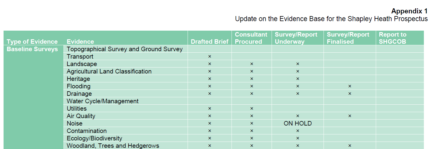
Status of Shapley Heath Baseline Studies as of March 2021
Despite claims by Cabinet that 10 studies have been produced, only 9 were published. However, one of them covered both Flood Risk and Drainage, so maybe we can say 10 of the promised subject areas were covered. It remains to be seen what happened to the other four.
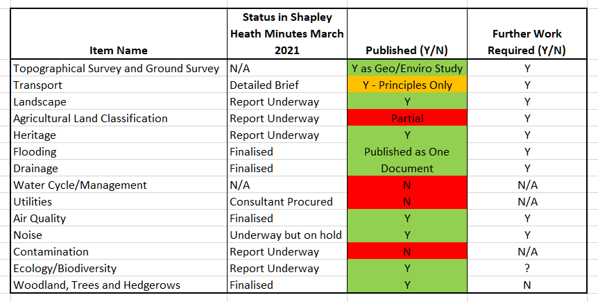
Status of Shapley Heath Baseline Studies Falls Short of Expectations
Interestingly, Community Campaign Hart have gone on record saying the have not read the documents. So, obviously they are total experts on the content of the reports and are well placed to judge their value 😉.
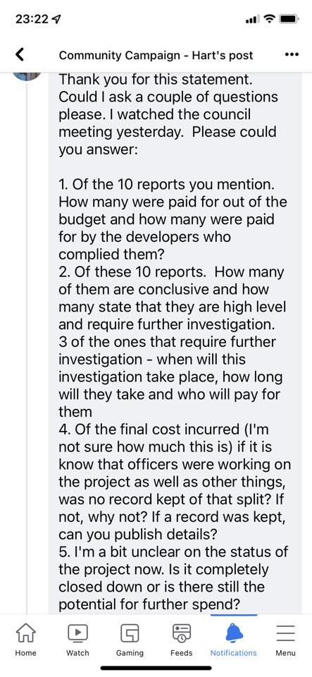
Questions about Shapley Heath Baseline Studies to CCH
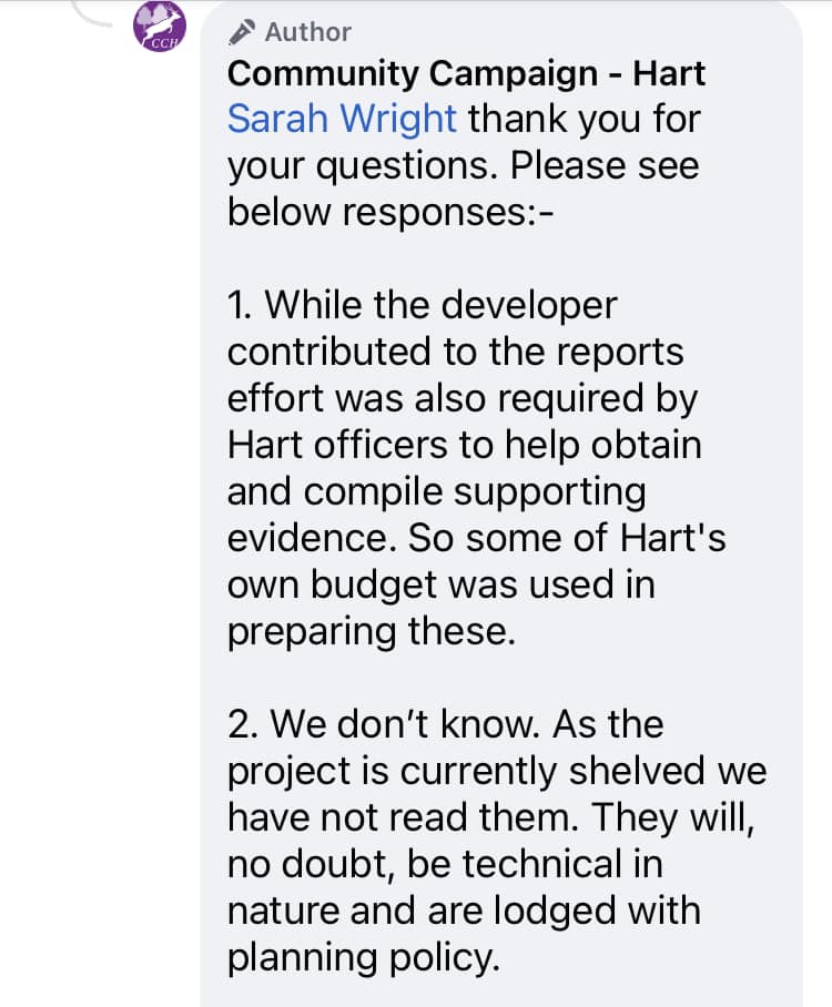
Answers about Shapley Heath Baseline Studies from CCH.
Now let’s go through the details of each report.
Topographical and Ground Survey aka Geo-Enviro Desk Study
This was published as the Geo-Enviro desk study. The document was produced by Wardell Armstrong and is dated January 2021, despite the March status report showing no work had started. Note this is a desk based study; no actual field work has been carried out.
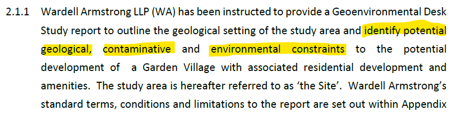
Geo-Enviro Study Objectives.
They conclude that “site is considered to present an overall low risk from past use” and “the site is suitable for the proposed end use of residential and or commercial development with associated infrastructure”.
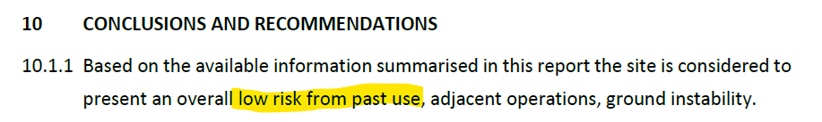
Geo-Enviro Study Low Risk from Past Use
However, they go on to caveat their conclusions by stating that more detailed geotechnical work is required about the appropriate foundation solution for parts of the site.
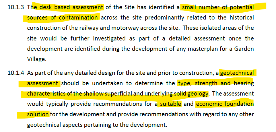
Geo-Enviro Study Potential contamination Geotechnical Assessment
In the body of the paper they do note that Beggars Corner and Scotland Farm are former landfill sites, but gloss over the implications of this.
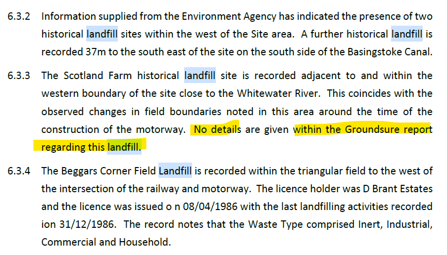
Geo-Enviro Study Potential Historic Landfill Beggars Corner Scotland Farm
They also go on to note in their terms and conditions that they offer no guarantee or warranty on their findings.
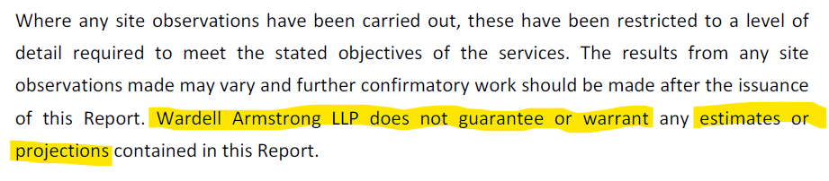
Geo-Enviro Study Potential No Guarantee or Warranty
Shapley Heath Baseline Studies – Transport
Summary
The Transport Studies consist on seven “Topic Papers” delivered via email from the Steer Group. They are a triumph of technocratic idealism over common sense.
In their nirvana, everyone will ride bicycles or e-scooters so there’s no need to make a significant investment in roads. The Council should abandon the philosophy of “Predict and Provide” and in favour of “Decide and Provide”, or rather don’t provide. They elaborate on this saying “user hierarchy putting pedestrians and cyclists first and motor traffic last, and design features including limited and well-placed car parking”.
This means that the Council should:
- Simply “decide” the “preferred future” and provide for that future instead. SO, they can decide not to provide proper road infrastructure.
- Actively seek to add “convoluted car journeys”.
- Not try to predict the future traffic flows arising from 5-10,000 additional houses.
- Only be “considering increases in highway capacity as a last resort”.
- Include only limited parking facilities.
- Assume everyone is going to cycle or take their lives in their hands on an e-scooter, instead of driving to do their big shop at the supermarket.
- Not bother working out the costs of transport improvements.
In other words, they have decided that they will aim for an impractical technocratic nirvana so there’s no need to cost out a practical solution.
More Walking and Cycling Routes Plus Cargo Cycles
The aims of providing more walking and cycling routes are laudable. The roads around the proposed site notably lack pavements in most places and there are almost no dedicated cycle paths. However, there are some completely ridiculous ideas such as “freight to be transported by cargo cycles”. I don’t think any new supermarket would be happy to be restocked by a fleet of “cargo cycles”.
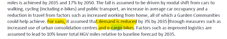
Shapley Heath Transport Study e-cargo bikes
Convoluted Car Journeys
They also propose to “create more convoluted journeys for private vehicles thereby reducing propensity for short distance car trips”. In other words design the environment so it is difficult for cars to get in, through and out of the new development. This is a recipe for more congestion and poor quality of life. It is fundamental to economic efficiency and vibrant social life that it is easy for people to go where they want, when they want. The thing about private cars is that they promote freedom of movement and convenience. They seem to want to “Decide” that new residents should live the lives of Trappist Monks, never leaving the new town and not having visitors.
Shapley Heath Transport Study e-scooters and convoluted car journeys
Better Public Transport
They also call for more busses. However, if the No. 7 bus service that already goes through Hartley Wintney is any guide, there is precious little demand for this mode of transport. By observation, these busses often have no passengers at all, and never more than a handful. It is difficult to see how this will change even with 5-10,000 extra houses.
The papers also call for more train journeys. However, they acknowledge that pre-pandemic the line was operating at maximum capacity. They outline a series of improvements that are planned for the Wessex line. However, it isn’t clear whether any of them will improve capacity or enhance services from Winchfield.
Ignoring EVs Eliminate Tail Pipe Emissions
Part of their rationale for strongly discouraging car use is to cut tail-pipe emissions. They fail to understand that by 2030 all new cars sold will be EVs, with no tailpipe emissions. Even now, hybrids are taking an ever increasing share of the market, so CO2 emissions are already falling in urban areas. It can be seen that their rationale for reducing car usage completely falls away.
No Costing
None of the Topic Papers addresses the costs of even providing footpaths and cycle paths. Of course they don’t address the cost of road improvements because they should only be “considering increases in highway capacity as a last resort”. In other words, they have decided that they will aim for an impractical technocratic nirvana so there’s no need to cost out a practical solution.
Landscape Character Assessment
The Environmental Dimension Partnership (EDP) have produced hundreds of pages of bumph resulting in no conclusions. Much of the report is a massive appendix of earlier work carried out for the Council. They conclude by calling for further work to “consider landscape value, sensitivity and capacity”. In effect, totally useless. The work is nowhere near as good as the work carried out by Michelle Bolger on behalf of Winchfield Parish Council.
Shapley Heath Landscape Study Further work required
Archaeological and Heritage Study
This is an 87-page report produced again by EDP. The report concedes that heritage assets would suffer “harm” as a result of such a significant development. However, they contend that with “informed masterplanning, it may be possible to avoid or reduce harmful effects”. Note the “may”.
Shapley Heath Archaeological and Heritage Study – Harm to heritage assets
Of course, they say more work is required, including actually visiting the site! Got to keep those consultancy fees rolling in.
Shapley Heath Baseline Studies – Flooding and Drainage
The Flooding and Drainage studies were produced as one document by Wardell-Armstrong who also produced the ge0-enviro desk study. This is an 68-page document plus three appendices. One plus point is that the various flood events documented on this website are incorporated into the evidence base.
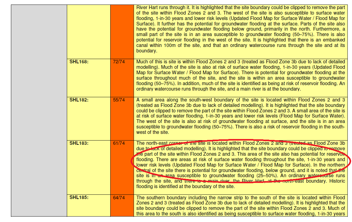
The main document shows that there is a risk of fluvial (river), reservoir, surface water and groundwater flooding across large parts of the site. It recommends further work to better quantify the risks and work out the mitigation.
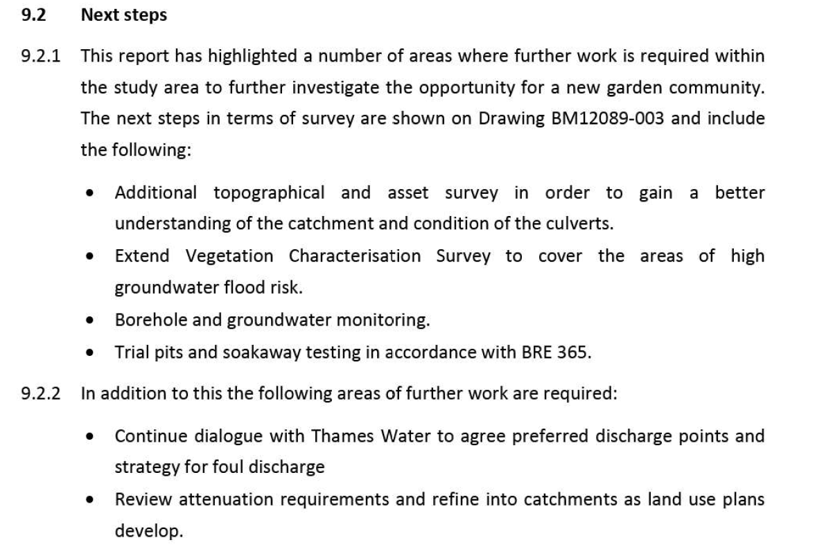
Shapley Heath Flood Risk Study Additional Work Programme
In particular, a 12-month borehole study is recommended.
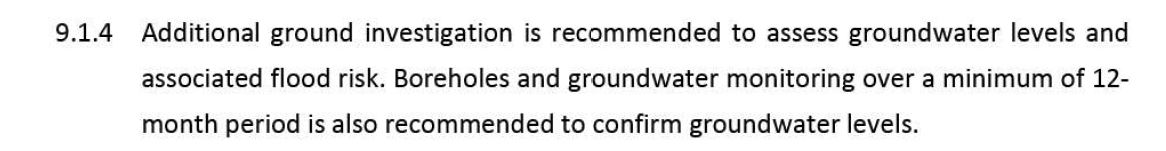
Shapley Heath Flood Risk Study 12 month borehole study required
Given the project has been cancelled and no budget is currently allocated, it isn’t clear when or if this work will take place.
It is worth noting that significant parts of the evidence base are self-contradictory.
Surface Water Contradictions
The first point to note is that they provide a very low quality image of the parts of the Area of Search that are subject to surface water risk.
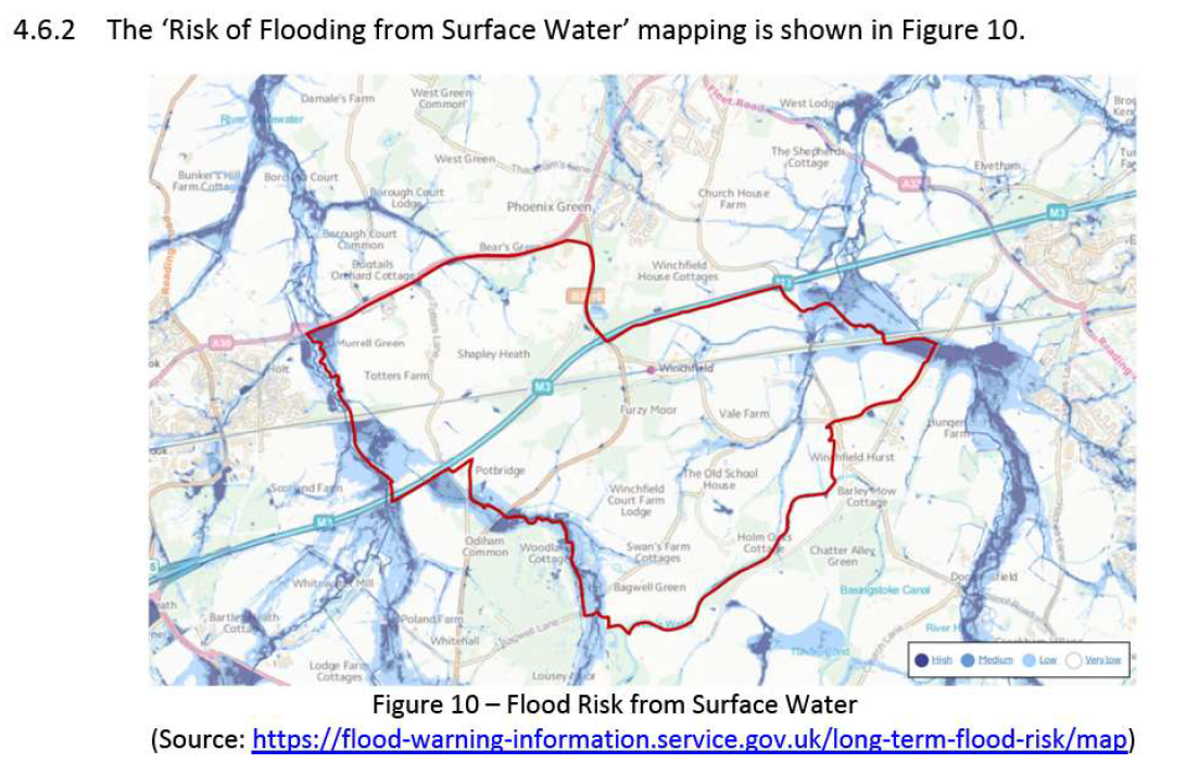
Shapley Heath Flood Risk Study Figure 10 Surface Water
At first glance, it looks like pretty much the whole site is clear of surface water flood risk.
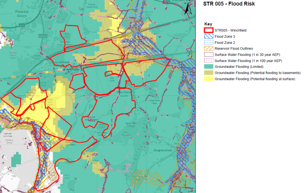
However, if you superimpose the Area of Search on Hart’s own map of surface water flood risk, a very different picture emerges.
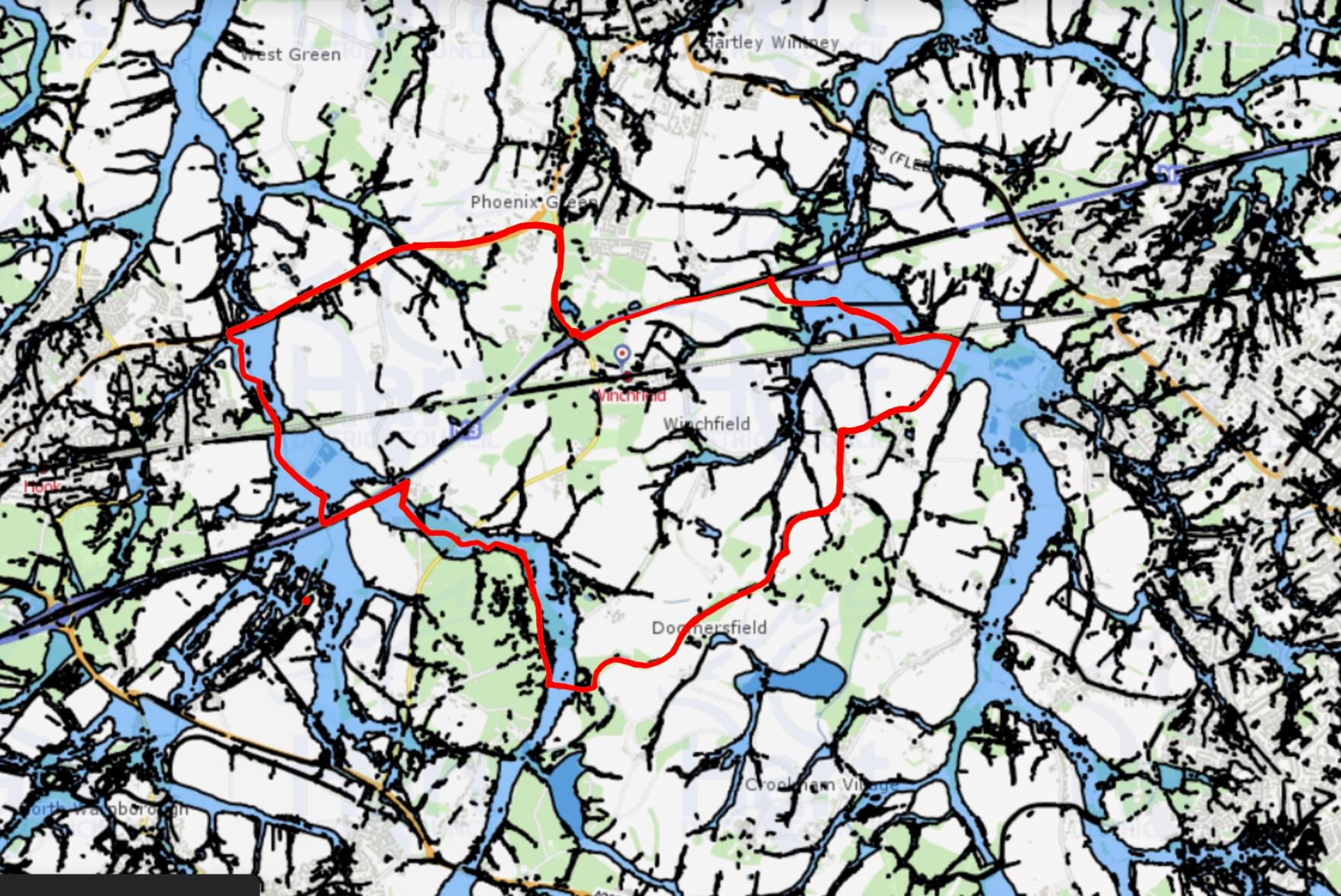
Shapley Heath Surface Water Flood Risk from Hart Council Maps
Large swathes of the Area of Search is subject to surface water flood risk. An addendum to Hart’s own Strategic Flood Risk Assessment states that their various models of surface water flood risk underestimate the extent of flooding.
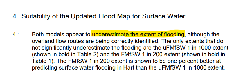
Models Underestimate Surface Water Flood Risk
Clearly, more work is required on this subject.
Groundwater Contradictions
They use two different charts to illustrate the risk of groundwater flooding. The first shows high risk to the North East of the site and negligible risk across the central belt.
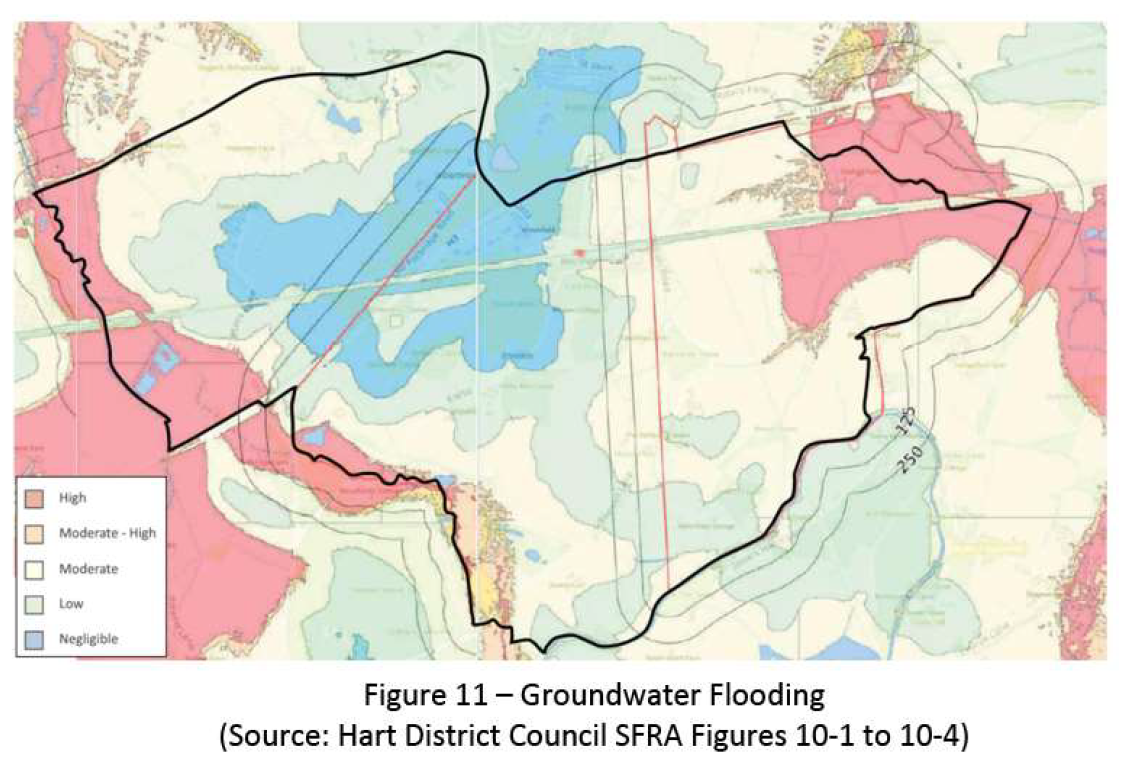
Shapley Heath Flood Risk Study Figure 11 Groundwater Flood Risk
The second map shows high risk to the south, medium risk in the north east and low (note not negligible) across most of the rest of the site.
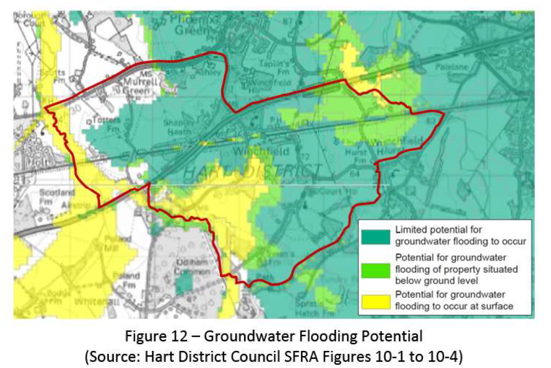
Shapley Heath Flood Risk Study Figure 12 Groundwater Flood Risk
No wonder they called for the 12 month borehole study to work out what the real risks are.
Exit Route contradictions
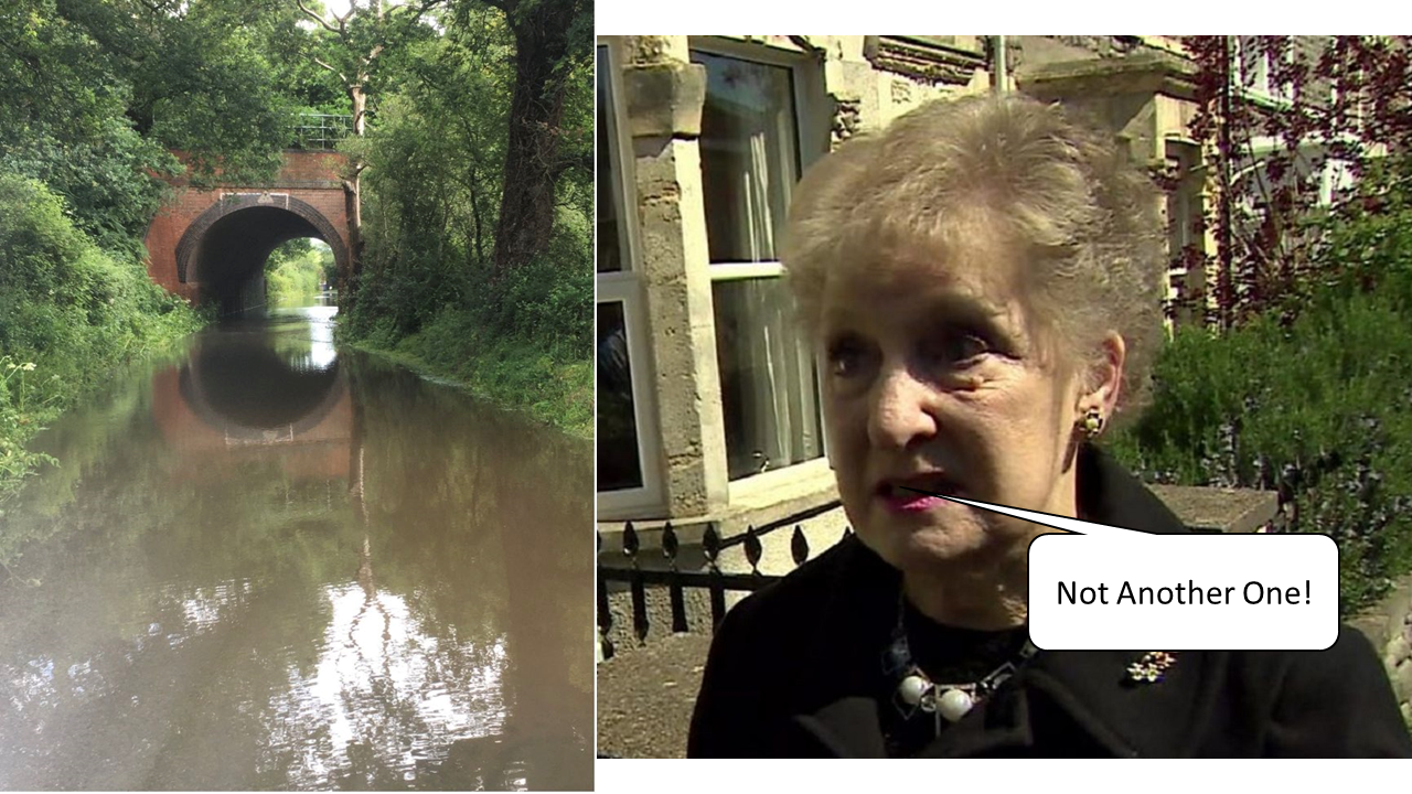
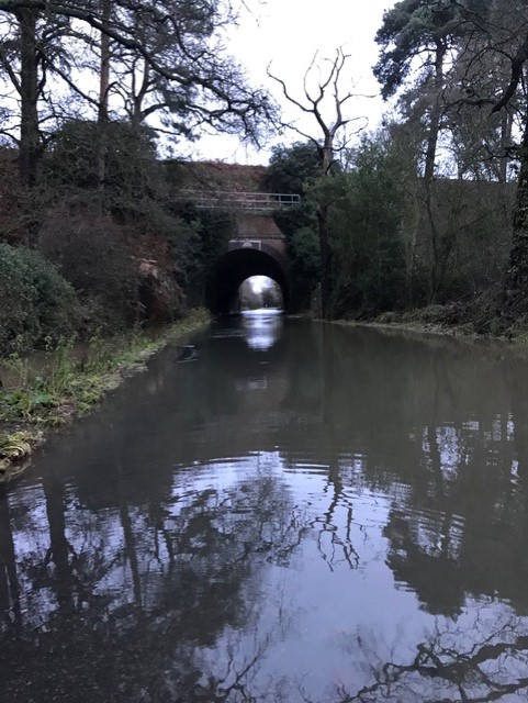
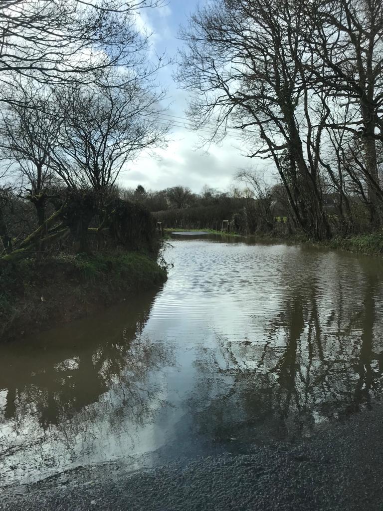
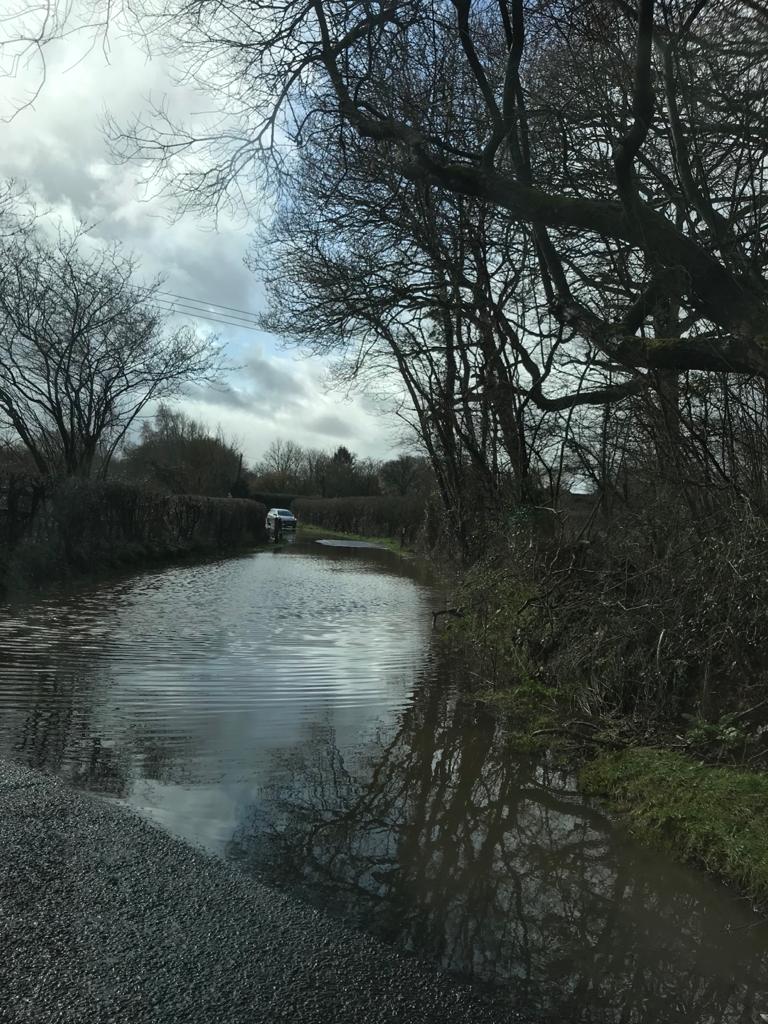
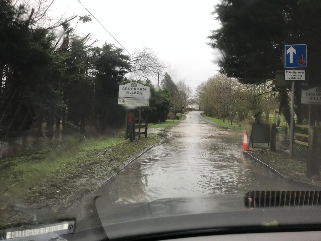
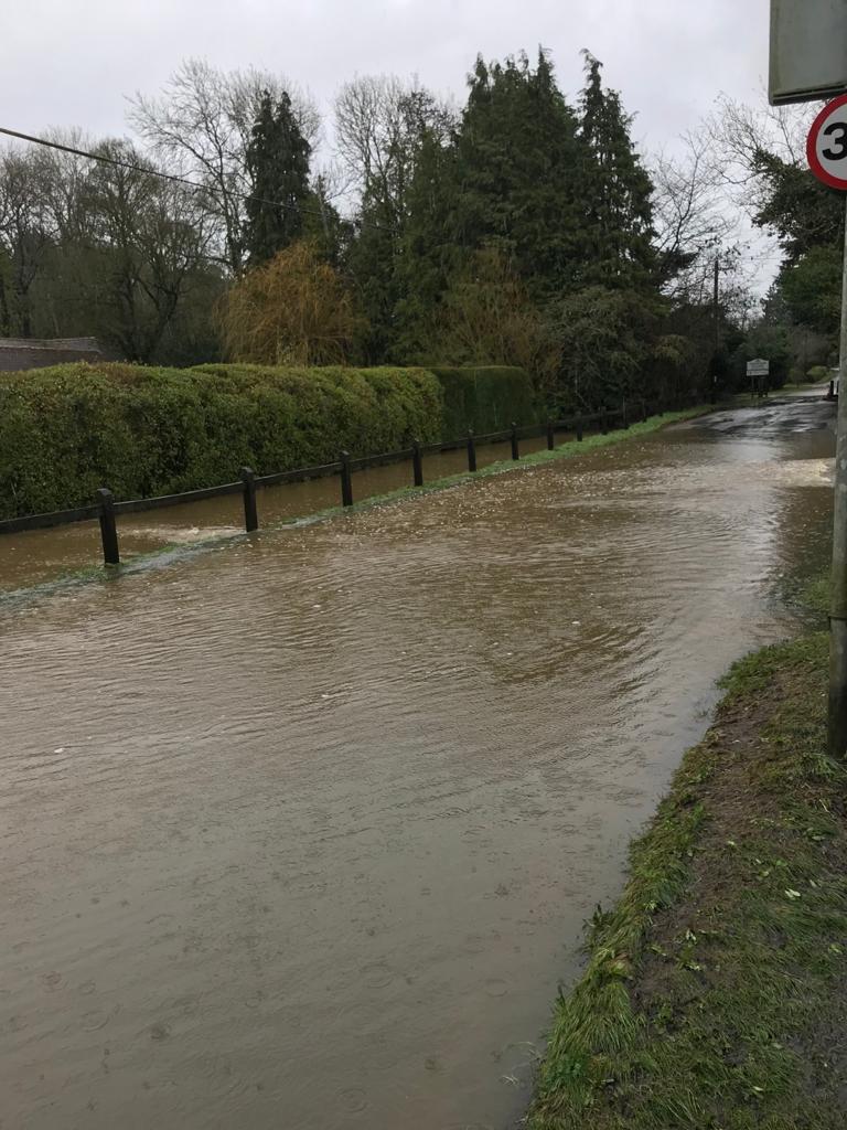
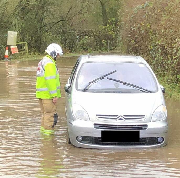
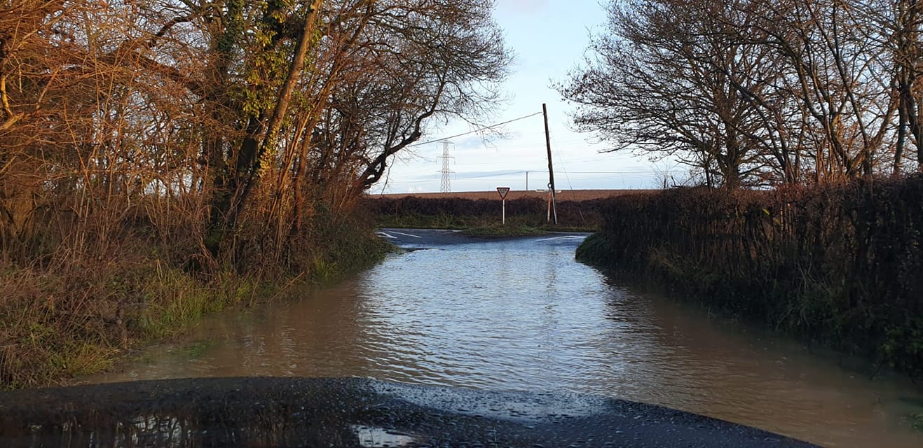
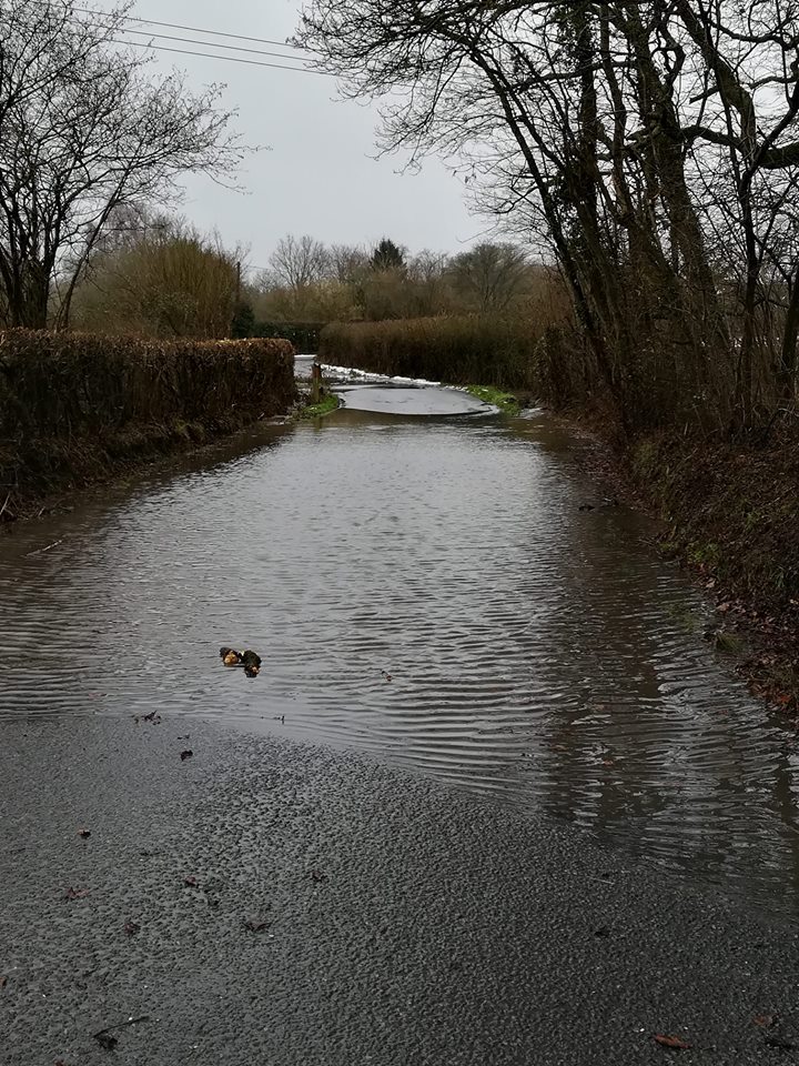
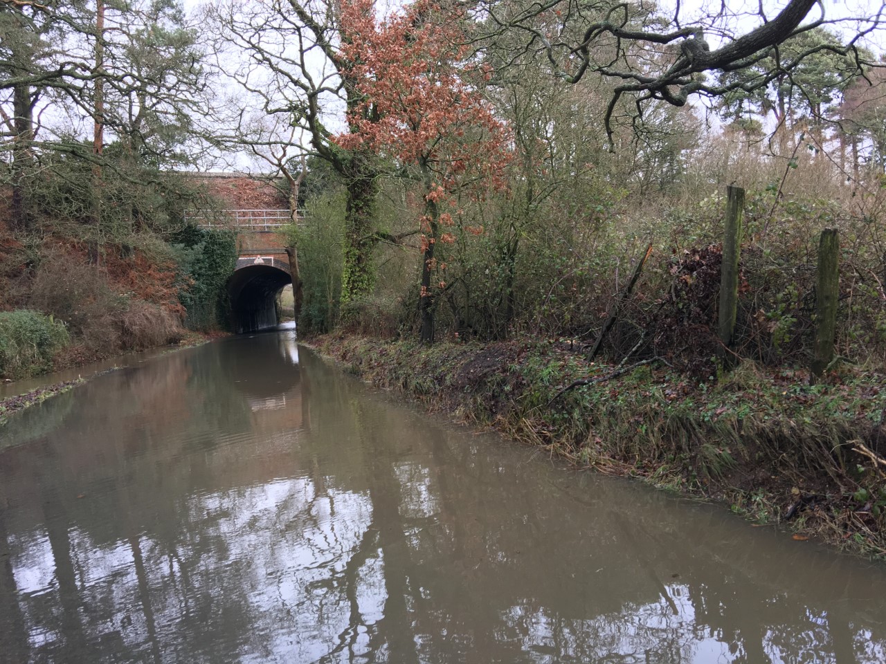
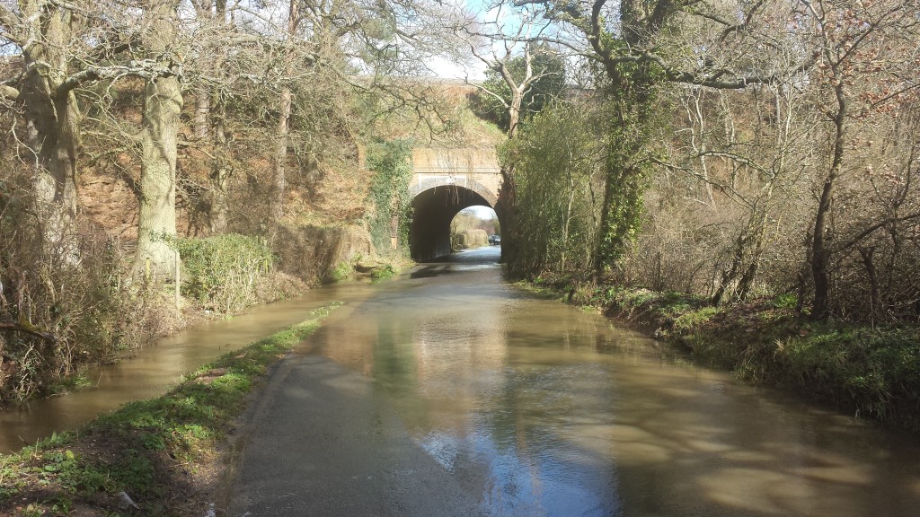
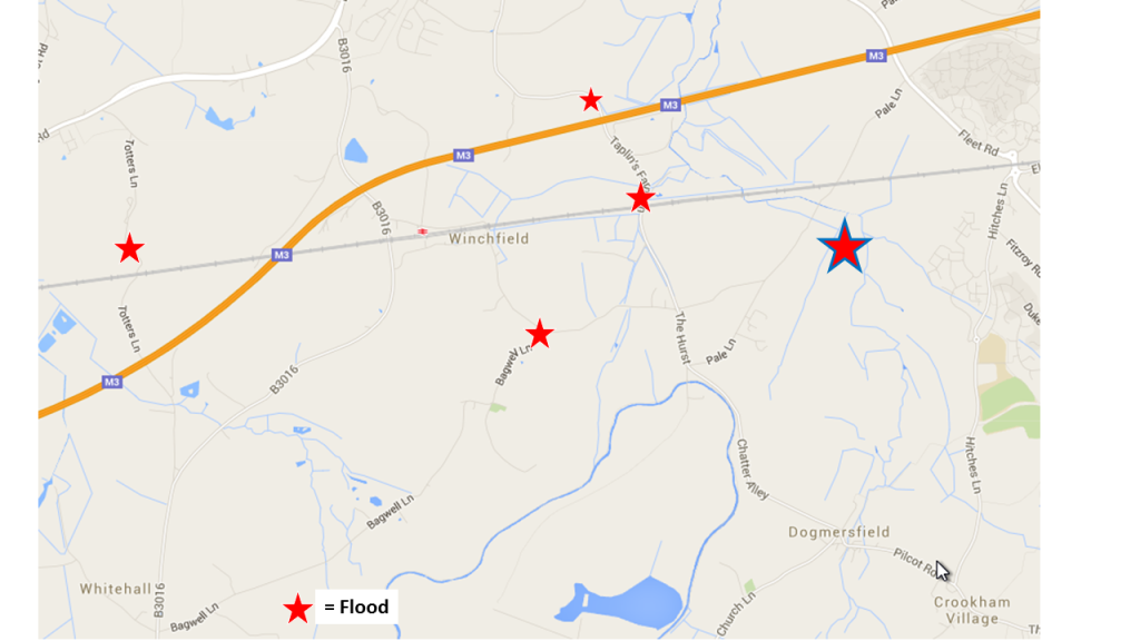
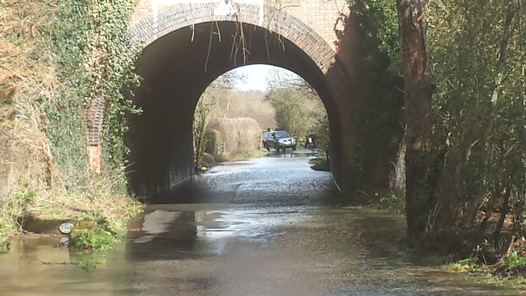
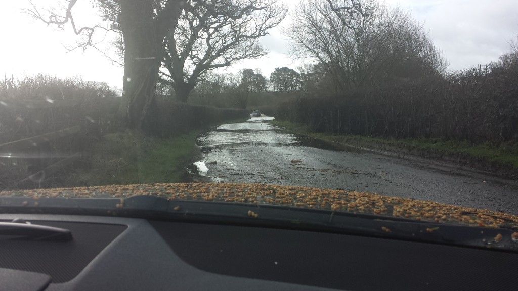
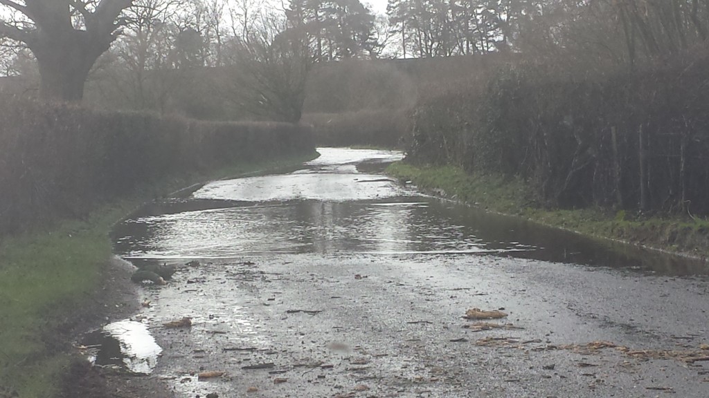
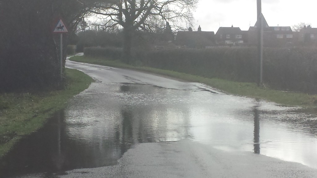
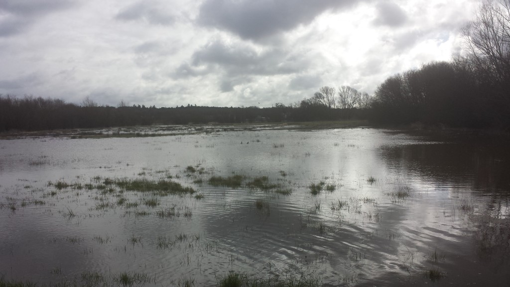
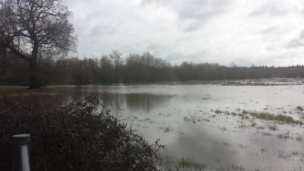
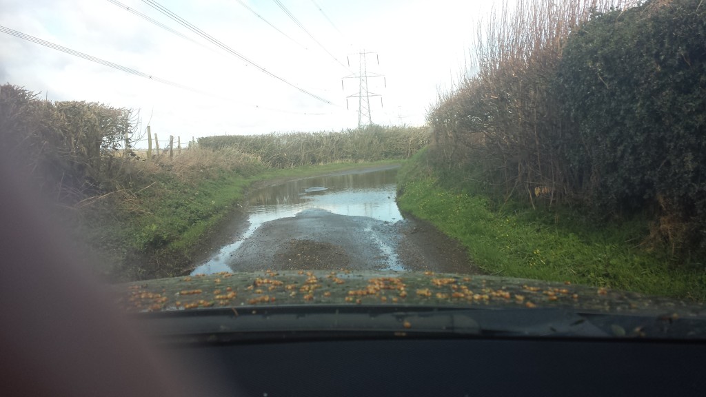
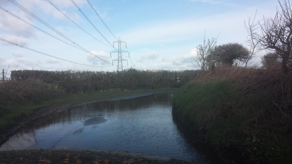
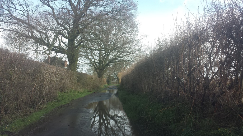
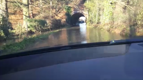
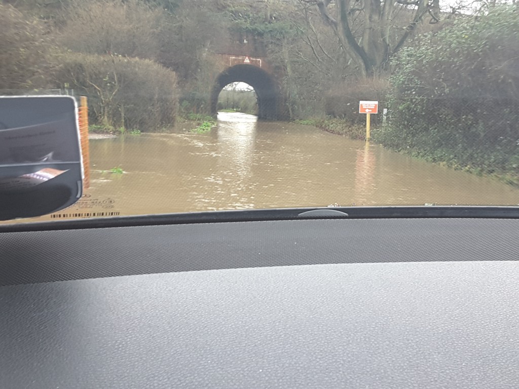
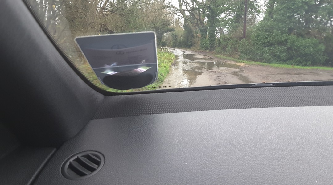
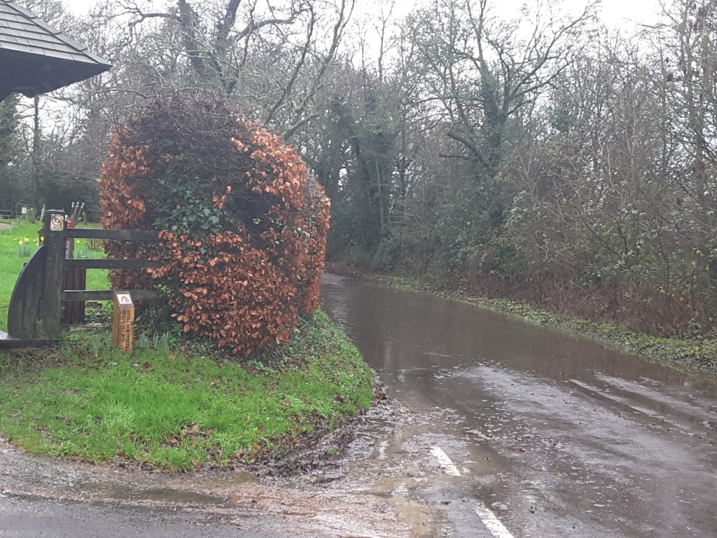
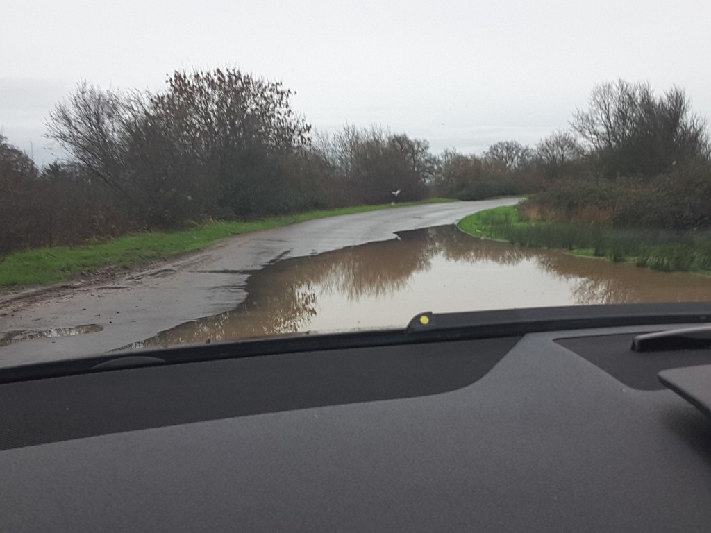
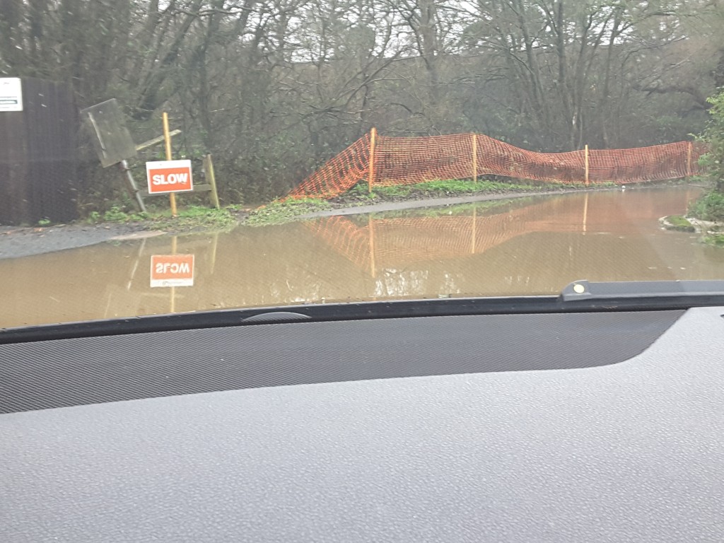
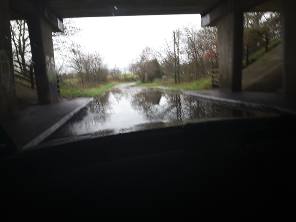
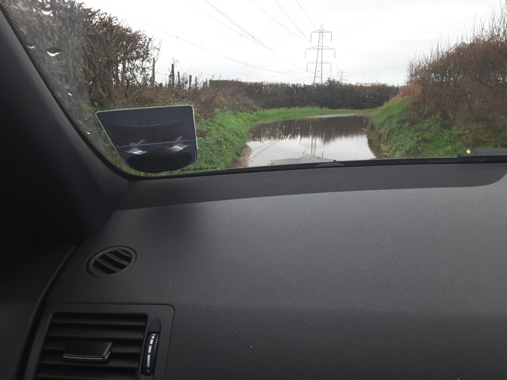
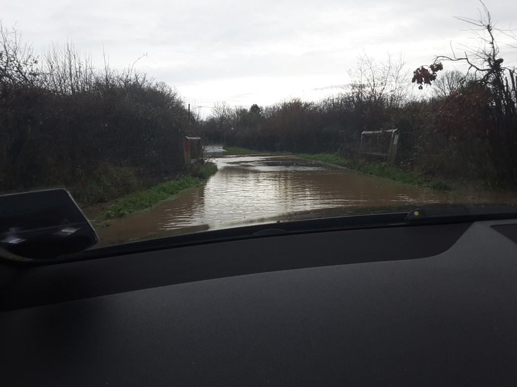
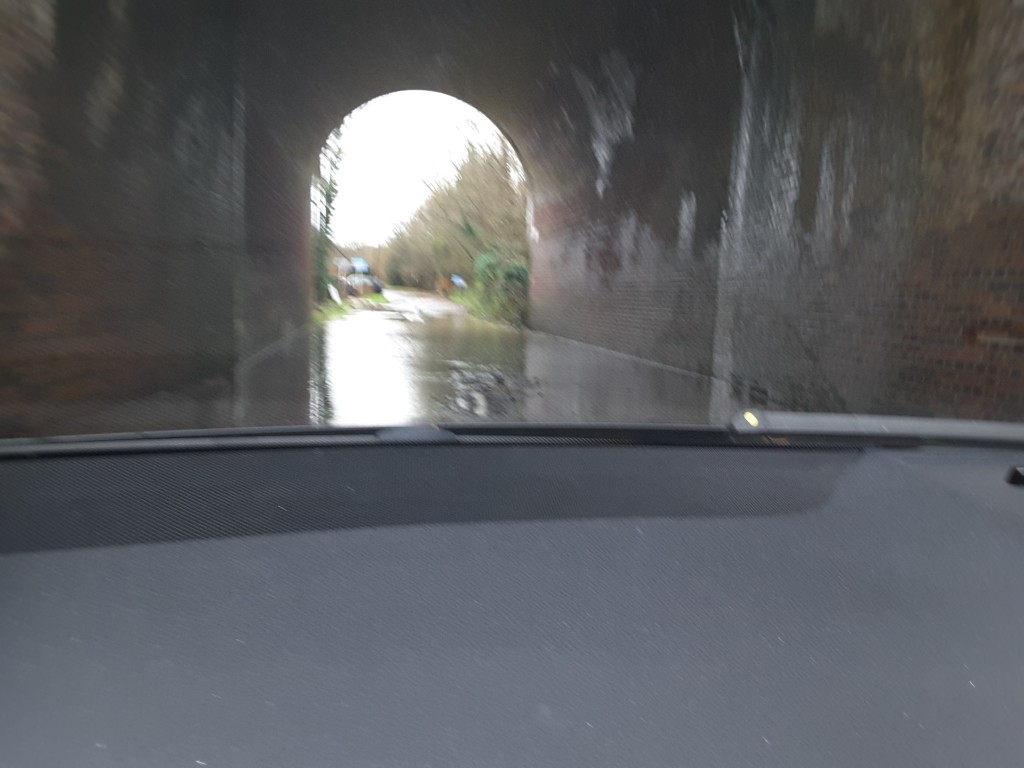
As part of their mitigation strategy, they identify a number of “dry routes” out of the site. These include Taplins Farm Lane, Station Road, Bagwell Lane and Totters Lane. The very roads that we have documented flood frequently and often to such an extent that they are impassable. They even reproduced the graphic below in their own document.
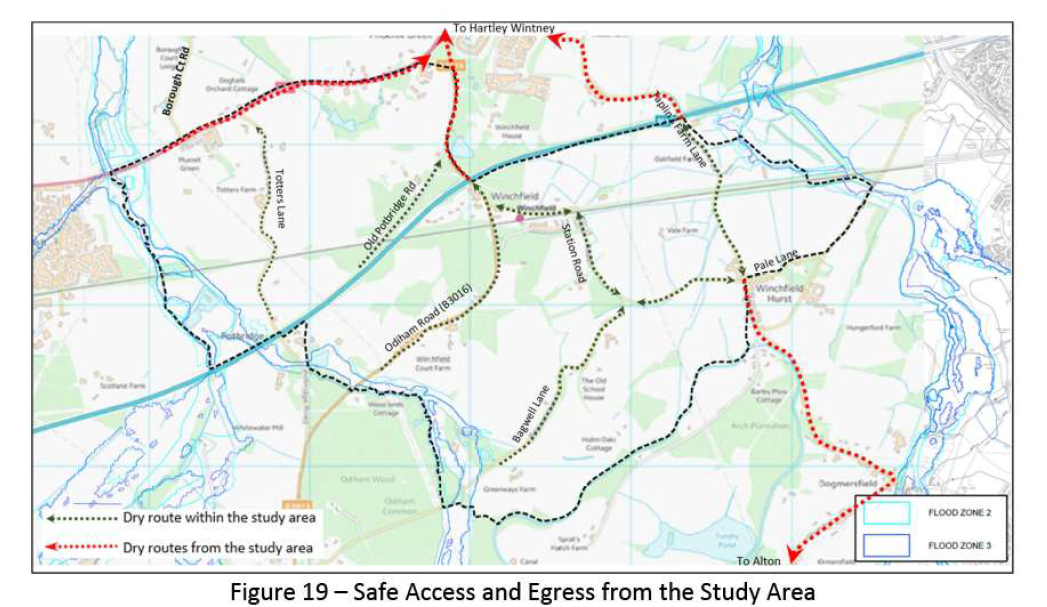
Shapley Heath Flood Risk Study Allegedly Dry Routes
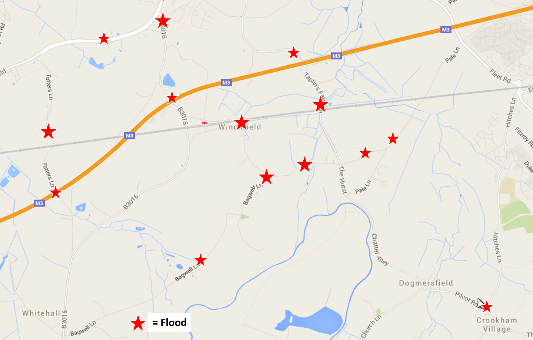
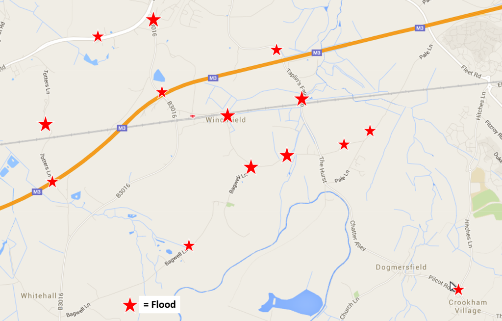
Winchfield, Hook, Crookham Village Floods 3 January 2016
Clearly, they need to think again.
Shapley Heath Baseline Studies – Air Quality
Wardell-Armstrong have produced another 15-page report. However, the report is next to useless because there are no monitoring stations within the boundary of the Area of Search.
They do have a section on potential air quality impacts. They dismiss concerns about any impacts during construction as only “temporary.
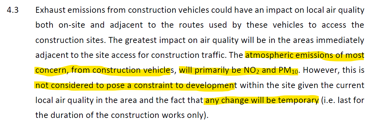
Shapley Heath Air Quality Study Temporary Impacts during 16 year construction phase
However, the bid documentation suggested a building trajectory of 16 years. This hardly fits most people’s definition of temporary.
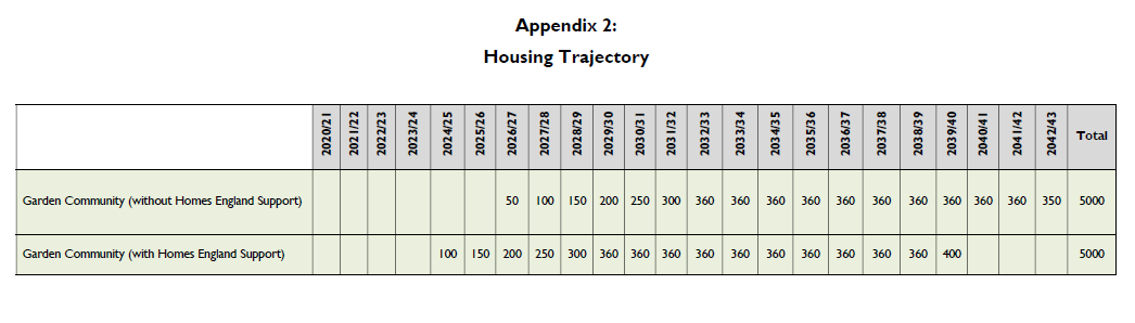
Shapley Heath Housing Trajectory Sept 2020
They then move on to the “operation” phase, by which they mean the impact on air quality having built 5-10,000 extra houses.
They concede that there could be potential damage to nearby SSSI’s, although they do not mention the many SINCs within the Area of Search.

Shapley Heath Air Quality Study Potential Damage to SSSIs during operation
They also admit that the M3 is “the most notable constraint” regarding air quality.
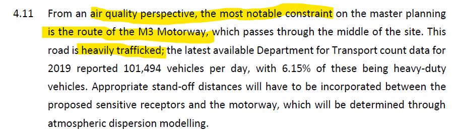
Shapley Heath Air Quality – M3 Is A Significant Constraint
Thankfully, they have given up on the idea of a tree-burning biomass power plant or CHP as they euphemistically call it. In a previous Sustainability Appraisal they used the potential of such a plant to rank Shapley Heath above other options. Heaven knows why, burning wood to produce power generates more CO2 and noxious particulate emissions than burning coal.
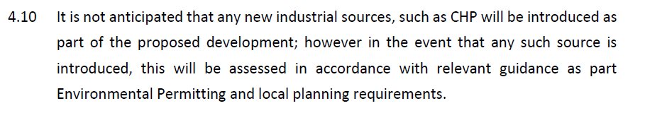
Shapley Heath Air Quality – Given up on idea of a Power Plant
Of course they need to do further more detailed work.
Shapley Heath Baseline Studies – Noise
Our friends at Wardell Armstrong have been busy again, this time on a 39-page Noise Assessment report. However, we believe this assessment to contain a very significant flaws:
- Study Timing.
- No account was taken of the extra traffic generated by the development.
- They assumed the development would be residential only.
Study Timing
First, the study was carried out in mid-June 2021. They assumed traffic levels were back to normal levels. However, some Covid restrictions were still in place up to mid-July 2021.
Shapley Heath Noise Study – Study period 9-14 June 2021
In addition, the study period was 9-14th June 2021. The 12th of June was a Saturday and the 13th was a Sunday. Weekends generally have lower traffic levels, so some of the readings they took will understate the mid-week noise levels.
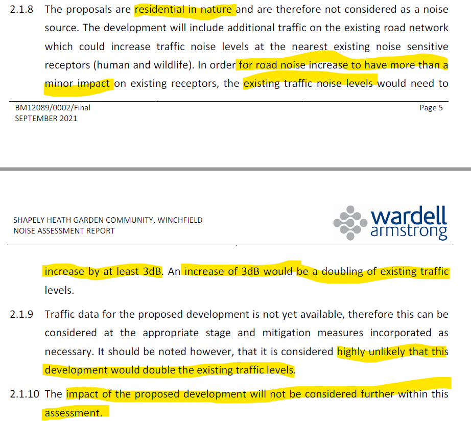
Extra Traffic Ignored
The extra traffic that will be generated by the development was not considered in their work. They justify this by saying traffic volumes would have to double to generate a 3dB increase in noise levels.
Shapley Heath Noise Study – Will Not Consider Impact of Proposed Development
For a road like the M3, that is justifiable. For the A30 London Road, that assumption is at least debatable as it is likely to be one of the major access points should the development go ahead. Therefore, traffic volumes will likely rise significantly. However, for the more minor roads such as the B3016, Station Road, Bagwell Lane and Taplins Farm Lane, this assumption is demonstrably false. There’s currently only a couple of hundred dwellings in Winchfield. Increasing that by 5-10,000 would likely increase traffic on these minor roads by at least an order of magnitude, far more than double. Yet, they have chosen to ignore this obvious fact, despite designing the place to have “convoluted” car journeys adding to congestion and noise.
Assumed Residential Only
Moreover, they also assume that the development would be residential only. However, Hart’s own Project Overview document made it clear that the development would be mixed use, with various employment sites, supermarkets/retail and schools. These types of development will add further to the noise problem.

Shapley Heath Project Overview – Mixed Use Community with Employment and Retail premises
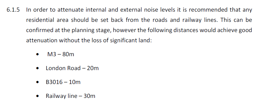
Noise Mitigation Strategy
To mitigate the impact they recommend buffer zones around various roads and the railway. These include 80m from the M3, 20m from the A30 and 30m from the railway. We suspect the 10m buffer recommended around the B3016 will prove to be inadequate because traffic levels will rise very significantly.
Shapley Heath Noise Study – Road and Rail Buffer Zones
However, as highlighted above, they have assumed zero extra traffic impact on Station Road, Bagwell Lane and Taplins Farm Lane. Therefore additional buffer zones maybe required. Such a buffer zone would reduce the land available for building, particularly on the parcel of land bounded by the B3016, the M3, Taplins Farm Lane and the railway.
They also recommend various other mitigation strategies such as 2m high fences, special glass in some windows near the major noise sources and “acoustic ventilation” so there’s no need to open windows.
The report concludes that if appropriate mitigation measures are put in place, “there are no planning or technical
reasons with regard to noise to refuse the promotion of this site as a residential development”. Of course, more detailed acoustic design will be required, to generate even more fees.
Shapley Heath Baseline Studies – Ecology and Biodiversity Net Gain
This is a 15-page report plus a 12-page appendix consisting mostly of maps. It was produced by a Ethos Environmental Planning. Overall it’s a chocolate teapot of a report because it concludes that in order to increase biodiversity, the number of biodiversity points need to increase, but it doesn’t say how.
Methodology
It starts by classifying different parts of the Area of Search into Habitat Groups
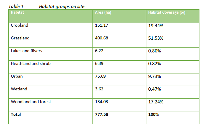
Shapley Heath Ecology and Biodiversity Habitat Groups
It then goes on to award “Biodiversity Units” to each group.
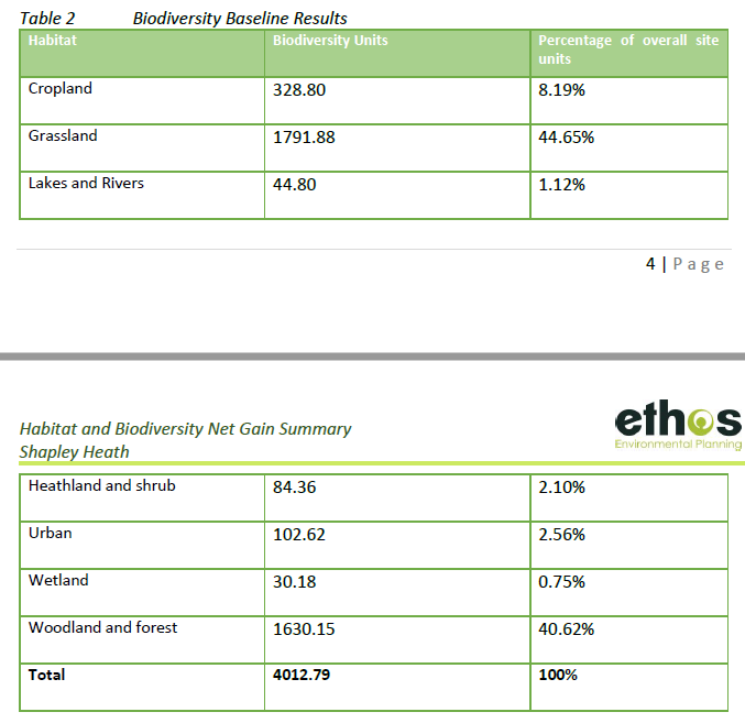
Shapley Heath Ecology and Biodiversity Units
Biodiversity units are calculated using the Biodiversity Metric 2.0. The metric subjects the area of the habitats to a selection of multipliers which determine an areas biodiversity value. The multipliers are the condition of the habitat, its distinctiveness, its connectivity and its strategic significance. However, the report doesn’t explain how they assigned values to the various multipliers. They do caveat their results by making clear that the Biodiversity Metric 2.0 they used is a beta-test trial and the results maybe subject to change.
They go on to say that to enhance or maintain biodiversity, they need to retain high value areas and poorer areas “be targeted for removal”.
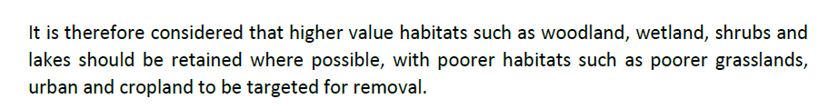
Shapley Heath Ecology and Biodiversity target areas for removal
So, if you already live in the Area of Search, they’re going to target your house for removal.
Conclusions
They conclude with a statement of the obvious. To increase biodiversity points, you have to increase biodiversity points. However, they offer no advice on how to do that. By combining their tables we have been able to demonstrate that replacing any of the grassland or cropland with urban development, biodiversity will be reduced. This is because the average biodiversity units per hectare are lowest for urban areas.
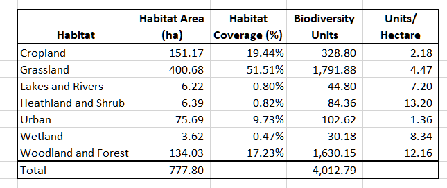
Shapley Heath Ecology and Biodiversity Points per Hectare
This is contrary to the expectations set in the Project Overview:
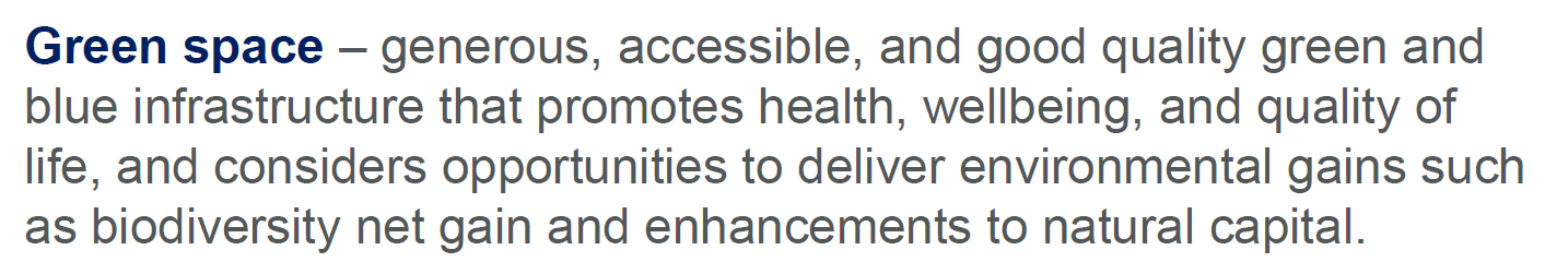
Shapley Heath Project Overview BioDiversity Net Gain
The Shapley Heath survey last year even suggested that “green spaces within garden communities are also opportunities to enhance biodiversity and the natural environment”. It isn’t clear how they came to that conclusion on the basis of their own survey.
Ancient Woodland, Ancient and Veteran Trees
This is a 39-page report with an 8-page appendix again produced by EDP. Overall, this is a useful report detailing all of the areas of ancient woodland and a schedule of 37 veteran trees. The report points out that the NPPF says that development which might damage these areas be refused, unless there are exceptional circumstances. It recommends buffer zones around the veteran trees of around 5m from the edge of the canopy and 15m from the ancient woodland. Note the results of the survey expire two years after it was conducted. This means that the survey will be useless after December 2022.