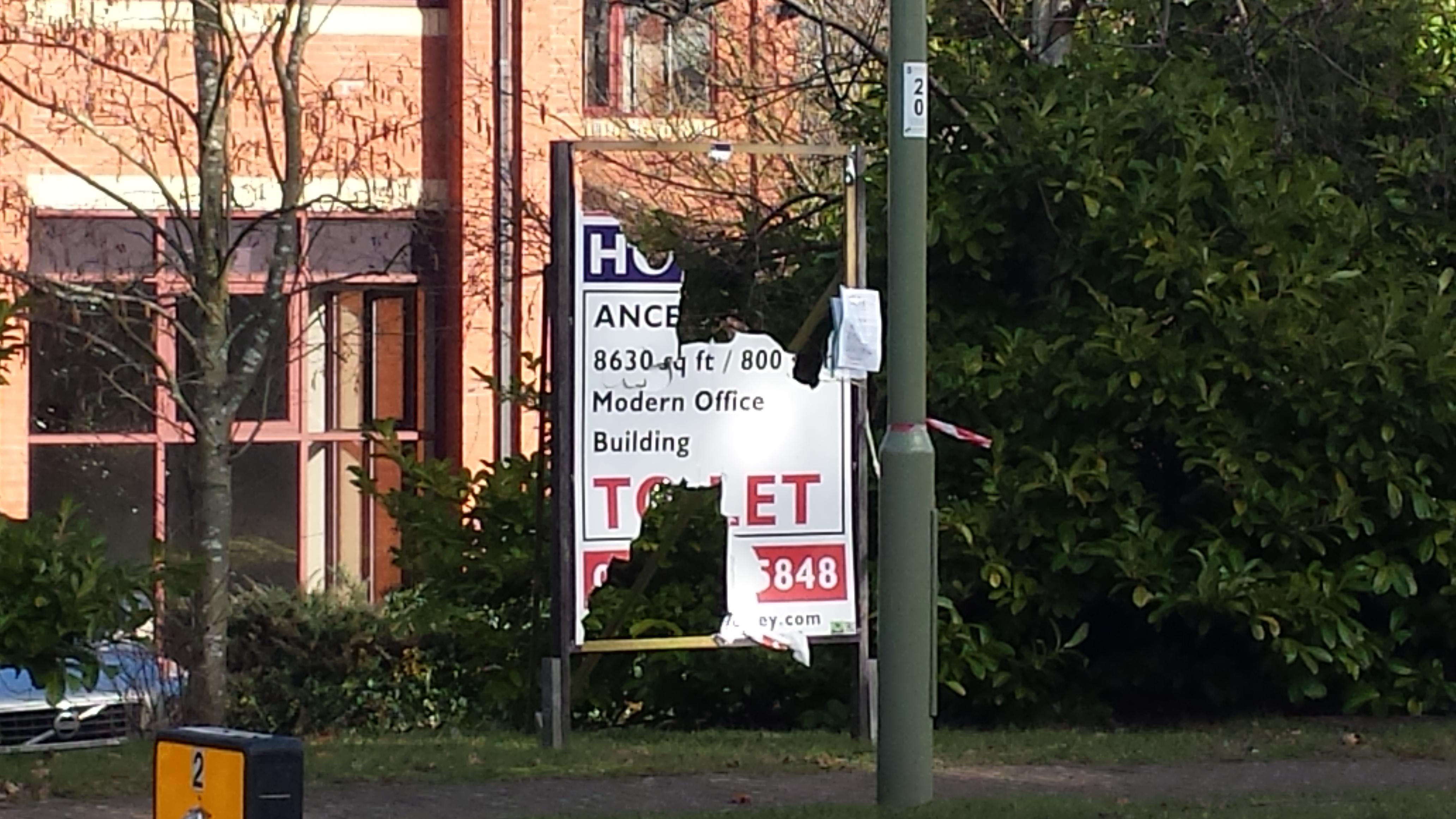
Vacant Office at Ancells Farm, Fleet, Hampshire
As we posted earlier, we have submitted the We ♥ Hart petition to Hart District Council and the council have set out the process by which they will consider the petition.
We have drafted some suggestions as to how the council should respond and sent them to Council leader, Stephen Parker and they are shown below. We have a chance to put these ideas to Cabinet on 1 October at 7pm. Please tell us if you are coming along to give us your support.
Please e-mail your councillors to ask them to support these proposals.
Dear Stephen,
Thank you very much for your email.
As you know the petition is from 2,130 signatories, nearly four times the number that responded to Hart Council’s consultation last year and more than ten times the number of people who expressed a first preference for a new town and is therefore a very significant expression of local opinion.
I welcome your approach to treat the petition seriously. My understanding is that a petition of over 1,000 signatories would trigger an automatic debate at full council. However, I do believe a debate at Cabinet is more likely to be more productive, so I support the approach you suggest.
As you might expect, I have my own suggestions as to what the appropriate responses to the petition should be and I set them out below for your consideration, interwoven with the petition objectives:
- To reduce the overall housing allocation for Hart District
I think there are two broad approaches to this. First, challenge the SHMA to reduce the overall housing allocation for the whole HMA. If this is successful, then it will have a two-fold effect of reducing Hart’s own need and also reducing the risk of overflow from Surrey Heath and Rushmoor. I believe the key arguments are around inward migration assumptions; average household size and in particular jobs growth assumptions which are at a rate nearly double what was achieved over the economic cycle from 1998-2012 and will result in unprecedented levels of participation in the labour market (rising from around 70% to around 86%) for those of employment age. I gave more detail on these arguments at both the Hop Garden Road appeal and in my response to the Rushmoor Local Plan. More detail can be found here. However, I do recognise it is difficult for the council to challenge its own document and I await Rushmoor’s response to my strong challenge, but I do understand that the SHMA may be re-visited and it would be helpful if the council would commit to challenging the assumptions set out above as part of that process.
Second, in conversation with a number of professionals in the planning sector, I have been told a number of times, that it is uncommon for councils to explore fully their “policy on” options with regard to environmental and other constraints. One of the main attractions of Hart as a district is its rural environment with associated SPA, SSSI’s, SINCs, green space and wildlife. May I suggest that a proper environmental study is carried out to set out the value of Hart’s environment and ecology to build an argument for not meeting the full requirement of the SHMA? I know that WAG is working on some proposals in this area with some of the rural parishes and would be keen to discuss the matter with you and offer to share the costs of preparation.
- Demand that the Council develops a vision and strategy for Hart that retains its role as a rural, green hinterland for NE Hampshire that respects the separate character and identity of Hart’s settlements and landscapes and preserves the green spaces as amenity space for the urban settlements.
You may recognise the words above as taken from the withdrawn 2013 Core Strategy. This was, and remains a good vision. I would ask that as a minimum, the forthcoming Regulation 18 consultation sets out at least one potential “vision” for the district, and that one of the “vision” options includes words to this effect.
- To require that the housing need is met by building on brownfield sites and increasing density in our existing urban areas
Last November, the council’s estimate of brownfield capacity over the entire plan period was around 750 units (taken from parts 1 and 3 of the SHLAA as per the FOI request I made) out of the then remaining 4,000 units to build (or grant permission for) up to 2032. Since then considerable progress has been made in identifying and in some cases granting permission on additional brownfield sites:
| Location | Number of Dwellings |
|---|---|
| Guillemont Park Phase 1 (not included as brownfield site in SHLAA) | 150 |
| Guillemont Park Phase 2 | 320 |
| Ancells Farm, Fleet | 370 |
| Bartley Wood, Hook | 200 |
| Fleet Road, Fleet | 220 |
| Bramshill House | 350 |
| Fleet Police Station | 50 |
| Extra dwellings at Landata House | 28 |
| Total | 1,688 |
All of the dwellings above were not included as brownfield sites in the SHLAA. Guillemont Park (Sun Park) was in the SHLAA but for a lower number of units, and in Part 2, which was not considered to include brownfield locations. Since last November revised permission has been granted at Landata House for 28 more dwellings than were included in the 5 year land supply calculation.
If the original 750 units were to be added to the 1,688 units identified above, then that amounts to a total of 2,438 potential units on brownfield. If it were possible to increase the density (from 30dph to a still reasonable 80dph in urban areas) on the original 750 units, the total identified capacity would rise to some 3,688 units.
The remaining requirement of 4,000 has of course been reduced by the unfortunate decisions to allow development at Watery Lane (300 units) and Hawley Park Farm (126 units) leaving the remaining allocation at 3,574.
It is clear that with some creativity and energy, the gap between the remaining allocation of 3,574 and the currently identified brownfield capacity can be closed by working on a combination of reducing the overall allocation by reducing the SHMA or applying environmental “policy on” considerations, increasing density and finding more brownfield sites.
In the light of this, I welcome the paper that is to be put before Cabinet next week, signalling the more positive approach that the council proposes towards building housing on previously developed land.
I would ask though, that you consider some further steps:
- Creating a new, formal “reasonable suitable alternative” option of meeting the remaining housing allocation solely through brownfield development. This option should appear in the consultation paper.
- Creating a complete database of all of the potential brownfield sites in the district, including those not in the October 2014 SHLAA and those not yet formally promoted to the council, including sites such as Bramshill House, Pyestock (aka Hartland Park), Sun Park, Ancells Farm, Bartley Wood, Fleet High St, Fleet Police Station and all of the run down town centres (e.g. Fleet, Yateley, Blackwater and Hook).
- Inviting leading architects to compete to produce some visionary outline schemes of what a “brownfield solution” might look like for the district, taking into account changing demographics, changing shopping habits driven by the internet and achievable housing densities.
- Organising a conference with the architects, land owners, developers and local community representatives with the objective of identifying the art of the possible for brownfield development amongst the competing solutions from the architects.
- This could be done in conjunction with the neighbouring authorities of Surrey Heath and Rushmoor, particularly given the massive amount of current and forecast vacant employment land and Rushmoor seeking to protect 96 Ha.
- To request that future housing stock reflects the needs of the changing demographics of the district.
I set out in a question to council earlier this year that Hart will need to deliver around 2,500 housing units to meet the needs of the ageing population. I contend that a new town will simply build the wrong type of accommodation in the wrong place to meet those needs. It would be far better if these were built on brownfield sites in more urban areas, close to amenities such as doctors, post offices, shops and so on. When the elderly move into these types of development, their well-being improves and of course, they free up conventional housing stock for families. Could I therefore ask that the forthcoming consultation paper contains specific proposals on how the needs of the ageing population will be met?
- To demand the council and government do not plan for any new settlement in Hart that will act as a sink for the unmet housing need in neighbouring areas.
Addressing points 1, 2, 3 & 4 will render a new town unnecessary particularly when you consider the:
- Recent report from the RTPI suggesting new town developments near to railway stations are not sustainable and add to traffic congestion because only a small proportion of the population use the station to get to work
- Government has called on planners to recognise the intrinsic value of the countryside.
- Eye-watering costs of infrastructure for a new town, especially considering the current £78m funding deficit in Hart and £1.9bn funding deficit across Hampshire.
I do hope you find these suggestions helpful. I would be grateful if you could circulate them to planning officers and Cabinet members for their consideration.