Whitewater Valley Preservation Society Oppose Winchfield/Hook new town

River Whitewater Preservation Society 300x222

River Whitewater

The Whitewater Valley Preservation Society (WVPS) have struck a blow for common sense and advised their members to vote against the proposed Hartley Winchook new settlement in Winchfield and Hook parishes.

Their full advice can be found here.  The key quotes from their document are:

“The potential impact of 5,000 houses said to be at Winchfield, but especially those either side of the A30 at Murrell Green, upon the river and its valley will be significant. One other site which will have a significant impact on the river and valley is in Odiham parish at North Warnborough / Greywell”…

…”If, on looking at the table above, you are not convinced of the benefits of a new town, then in question 4 you
should rank Approach 3 last; and in question 5 you should rank Approach 4 first (this being the only one which
excludes the Winchfield new town)”…

…”The Hook sites at Murrell Green listed in the table above are all in the proposed Winchfield new settlement, and the Odiham site “COM004” would see the open fields between Greywell and North Warnborough developed with houses and sports pitches”…

…”And the second pair of questions asks to what extent you agree with the draft vision and whether you have any comments on the Vision. You may wish to point out, in response to either of these two pairs of questions that the level and location of the developments proposed will clearly make it very difficult to realise the vision.”

If you agree with WVPS and would like to make your voice heard and object to the new town idea, we urge you to respond to the Hart District Council consultation about the Local Plan and ask Hart to think again. We have created a dedicated consultation page and two guides to responding to the consultation that are available on the downloads below. The comments are designed to be cut and pasted into the boxes provided. It will be very powerful if you could edit the comments into your own words. Please do find time to respond to the consultation and play your part in saving our countryside and our rivers.

Full version:

Responses to Local Plan Consultation

2 Minute version:

Respond to Local Plan Consultation in 2 minutes


Floods in Winchfield, Hartley Wintney, Hook and Crookham Village cast doubt on new town plan

Flood Taplins Farm Road Winchfield 3 January 2016.

Flood Taplins Farm Road Winchfield 3 January 2016.

Bravehart donned his waders and took to his canoe yesterday to take pictures of the widespread floods across the country roads in Winchfield and the roads in and out of the proposed new town in Hartley Wintney, Hook and Crookham Village.

As you can see from the carousel below the floods were severe and widespread, and that is without all the surrounding green fields being concreted over.  Imagine what it would be like if the capacity of the soil to absorb water was reduced by building 5,000 houses.

Bravehart found floods in the following areas:

Winchfield, Hook, Crookham Village Floods 3 January 2016

Winchfield, Hook, Crookham Village Floods 3 January 2016

  • Church Lane, Hartley Wintney near St Mary’s Church
  • Taplins Farm Lane, near the farm and near the bridge over the M3
  • Taplins Farm Lane, just below the Internet car showroom, along the road through the railway tunnel up to near Hurst Farm
  • The Hurst and Pale Lane in Winchfield
  • Extensive flooding along Station Road from the Hurst to Bagwell Lane and again through the railway tunnel
  • The bottom of Bagwell Lane, Winchfield and at many places along the lane towards Odiham Common
  • Totters Lane under the M3, near the bridge over the railway and near the A30 in Hook parish
  • On the A30 between Murrell Green and Phoenix Green
  • On the B3016 Odiham Road near the junction with the A30 and under the M3
  • On Pilcot Road near the junction with Hitches Lane in Crookham Village

Yesterday’s events demonstrate the evidence in the site assessment that the area is very susceptible to groundwater flooding.

Winchfield Flood Risk

Winchfield Flood Risk

We find it difficult to believe that anyone can conclude that these sites and these roads are a suitable location for a new town of 5,000 houses.

[Update]

This story covered in Get Hampshire January 4 2016: Floods will worsen if green fields are concreted over for new Winchfield town, campaigners warn

And covered in Fleet News and Mail January 6 2016: Flooding proves new town idea will not float says campaigner

[/Update]

If you would like to make your voice heard and object to the new town idea, we urge you to respond to the Hart District Council consultation about the Local Plan and ask them to think again. We have created a dedicated consultation page and two guides to responding to the consultation that are available on the downloads below. The comments are designed to be cut and pasted into the boxes provided. It will be very powerful if you could edit the comments into your own words. Please do find time to respond to the consultation and play your part in saving our countryside.

Full version:

Responses to Local Plan Consultation

2 Minute version:

Respond to Local Plan Consultation in 2 minutes
Flood Church Lane Hartley Wintney 3 January 2016

Flood Church Lane Hartley Wintney 3 January 2016


Flood Taplins Farm Road Winchfield 3 January 2016

Flood Taplins Farm Road Winchfield 3 January 2016


Flood Taplins Farm Road Winchfield 3 January 2016

Flood Taplins Farm Road Winchfield 3 January 2016


Flood Potbridge Road Winchfield 3 January 2016

Flood Potbridge Road Winchfield 3 January 2016


Flood Totters Lane Hook 3 January 2016.

Flood Totters Lane Hook 3 January 2016.


Flood Bagwell Lane Winchfield 3 January 2016.

Flood Bagwell Lane Winchfield 3 January 2016.


Railway bridge at Station Road WInchfield. Floods at Winchfield, Hook and Crookham Village 3 January 2016

Railway bridge at Station Road Winchfield. Village 3 January 2016


Flood Hitches Lane/Pilcot Road Crookham Village 3 January 2016

Flood Hitches Lane/Pilcot Road Crookham Village 3 January 2016


Flood B3016 Odiham Road Winchfield 3 January 2016.

Flood B3016 Odiham Road Winchfield 3 January 2016.

Winchfield new town plan proposes 772 new houses on former landfill site

SHL 167 former landfill site Beggars Corner, Winchfield, Hart District, Hampshire

SHL 167 former landfill site Beggars Corner, Winchfield, Hart District, Hampshire

One of the sites proposed for the Winchfield new town is a former landfill site.  There are 772 new houses proposed for site SHL 167, also known as Beggars Corner.  However, a solar farm was recently turned down at this site and the environmental report shows that much of the site was once landfill, with unknown contents.

SHL167 SHLAA Map - Beggars Corner, Winchfield, Hart District, Hampshire

SHL167 SHLAA Map – Beggars Corner, Winchfield, Hart District, Hampshire

SHL 167 Landfill details Beggars Corner

SHL 167 Landfill details Beggars Corner, Winchfield, Hart District, Hampshire

Interestingly, Hart Council’s decision to refuse the solar farm application (ref: 15/01614/FUL) had nothing to do with the landfill issues, but was because the proposed site was:

“within the zone of theoretical visibility and the Odiham Conservation Area. The proposed development would seriously detract from the amenity and consequent recreational value of the nearby public right of ways”.

We find it difficult to believe that a former landfill site is a suitable location for the 772 new houses proposed in the same location.  And it is also hard to see how a planning application won’t face the same difficulties as the solar farm application, further undermining the questionable viability of the proposed Hartley Winchook new town.

If you would like to make your voice heard, we urge you to respond to the Hart District Council consultation about the Local Plan and ask them to think again. We have created a dedicated consultation page and two guides to responding to the consultation that are available on the downloads below. The comments are designed to be cut and pasted into the boxes provided. It will be very powerful if you could edit the comments into your own words. Please do find time to respond to the consultation and play your part in saving our countryside.

Full version:

Responses to Local Plan Consultation

2 Minute version:

Respond to Local Plan Consultation in 2 minutes

Hart District’s £78m infrastructure funding deficit

Much is being made of the supposed infrastructure benefits of a new town in Hart District.  We believe these benefits are a mirage and have written elsewhere about the astronomical £300m costs and the pitiful expected developer contributions. This post is about the massive infrastructure funding deficit facing our existing communities and how developer contributions won’t make a bit of difference to this and how a new town will make things worse.

Back in October 2014 Hart Council produced an infrastructure delivery schedule that set out the current deficit, split by type and area.  This shows a deficit of £78m not including healthcare facilities.  The breakdown is shown by type and area in the images below:

Hart District Estimated Infrastructure costs by type March 2013.

Hart District Estimated Infrastructure costs by type March 2013.


Estimated Infrastructure costs by area March 2013

Hart District Estimated Infrastructure costs by area March 2013

Key quotes from the document include:

“It is therefore reasonable to conclude that it is unlikely that there will be sufficient future funds, from both capital programmes and developer contributions, within the plan period, to deliver all of the projects listed in the HCC Transport Statement”

“Although developer contributions will continue to play an important role in helping to bridge the funding gap, it is also clear that the funds raised through developer contributions will only contribute a modest proportion of the total identified funding gap”

“Developer contributions are, however, by no means the only source of funding for infrastructure providers. Local Authorities, for example, could fund the costs of meeting future unmet community infrastructure needs, in addition to developer contributions, through a variety of means including Infrastructure Provider Capital Programmes, Council Tax, Prudential Borrowing, New Homes Bonus, Grants (Government and private), Capital Receipts, Council Reserves and Local Economic Partnership (LEP) funding”

“The South West Main Line (SWML) outer trains, which serve Hart, has significant forecasted future peak crowding, with a capacity shortfall of over 6,100 passengers in the high-peak hour, even if every main line train is at maximum length”

As can be seen, Fleet, Church Crookham and Hook have the largest deficits and there is no way that developer contributions are going to make a dent in these, let alone cover the extra infrastructure costs of a new town.  Nobody has yet explained how these deficits will be fixed by building a new town.  On the contrary, a new town is likely to starve these areas of much needed investment.

If you would like to make your voice heard, we urge you to respond to the Hart District Council consultation about the Local Plan and ask them to think again. We have created a dedicated consultation page and two guides to responding to the consultation that are available on the downloads below. The comments are designed to be cut and pasted into the boxes provided. It will be very powerful if you could edit the comments into your own words. Please do find time to respond to the consultation and play your part in saving our countryside.

Full version:

Responses to Local Plan Consultation

2 Minute version:

Respond to Local Plan Consultation in 2 minutes

More brownfield sites come available in Hart District

Brownfield site: vacant offices at Ancells Farm Business Park, Fleet, Hart District, Hampshire.

Brownfield site: vacant offices near Ancells Farm Business Park, Fleet, Hart District, Hampshire.

Bravehart has been on a tour again, taking photos of newly vacant commercial premises in Hart.  It is becoming increasingly obvious that we can meet our housing needs by regenerating these vacant sites.

Brownfield site: vacant offices at Ancells Farm Business Park, Fleet, Hart District, Hampshire. We Heart Hart. We Love Hart

Brownfield site: vacant offices at Ancells Farm Business Park, Fleet, Hart District, Hampshire.


Vacant offices at Murrell Green, Hart District, Hampshire

Vacant offices at Murrell Green, Hart District, Hampshire


Brownfield site: vacant offices at Winkworth Business Park, Hart District, Hampshire.

Brownfield site: vacant offices at Winkworth Business Park, Hart District, Hampshire.

If you would like to make your voice heard, we urge you to respond to the Hart District Council consultation about the Local Plan and ask them to think again. We have created a dedicated consultation page and two guides to responding to the consultation that are available on the downloads below. The comments are designed to be cut and pasted into the boxes provided. It will be very powerful if you could edit the comments into your own words. Please do find time to respond to the consultation and play your part in saving our countryside.

Full version:

Responses to Local Plan Consultation

2 Minute version:

Respond to Local Plan Consultation in 2 minutes

Secret Winchfield New Town plan emerges

Winchfield Consortium Preferred Development Option

Winchfield Consortium Preferred Development Option

A secret Winchfield new town plan has emerged from Hart District Council.  The document was produced in February 2015 by the Winchfield Consortium who appear to be promoting land around Murrell Green (as Pearson Strategic) alongside the land promoted by Barratts in Winchfield to create the Hartley Winchook settlement.  The document, which is available for download below, contains a number of interesting points that appear to undermine the case for a new settlement at those sites:

First, the total capacity of the proposed ‘settlement’ is 4,883 units (which is somewhat below the minimum size of 5,000 units for new eco-towns) spread across four loosely connected development zones.  One would have to be quite generous to term this type of development a new ‘settlement’ as there is no defined centre, or heart.

Second, the infrastructure contribution looks to be very limited, with the document talking of the “majority of the infrastructure will be delivered through S106 agreement”, with the infrastructure being defined as a spine road, a primary school, the secondary school and the local centres. This appears to mean that the Winchfield Consortium/Barratts/Pearson Strategic will contribute only 50.1% of the cost of these specific elements.  It is notable that there is no mention of healthcare or sports facilities, no upgrades to the connecting road network and no upgrades to the railway station. And of course, these contributions will do nothing to address the infrastructure deficit in out existing settlements.

Third, it is clear that the Murrell Green sites, which are largely in Hook parish, are required to make the proposal work, and these sites are in the first phase of development (see pages 26-27), contrary to the expectations of the Hook community groups.

Fourth, this is now the third document (others here and here) we have seen that shows a proposed secondary school adjacent to the Mildmay Oaks hospital.

Compare Flood Risk to development sites

Comparison of development sites to flood risk areas

Finally, comparing Hart’s strategic site assessments to this document shows that much of the proposed development is in an area susceptible to varying degrees of groundwater flooding.  We have seen only this week the dangers of building close to flood zones.

The Winchfield Concept document can be found on the download below:

Winchfield Consortium Concept Paper

If these plans concern you, we have created a dedicated consultation page and two guides to responding to the consultation that are available on the downloads below. The comments are designed to be cut and pasted into the boxes provided. It will be very powerful if you could edit the comments into your own words. Please do find time to respond to the consultation and play your part in saving our countryside.

Full version:

Responses to Local Plan Consultation

2 Minute version:

Respond to Local Plan Consultation in 2 minutes

link

Which parishes have seen most development Hart District?

Elvetham Heath near Fleet, Hampshire

Elvetham Heath near Fleet, Hampshire

There has been much controversy about how much development there has been in Hart District over the past few years, so inspired by a post on the Winchfield Action Group site, we thought we’d take a closer look at the data.

We have compiled a list by parish and ward of the number of dwellings in each area in 2001 and 2011, according to the census and the results are shown in the table below:

ParishWard2001 Census (Dwellings)2011 Census (Dwellings)% Increase
Blackwater & Hawley177218675.4
Bramshill9863-35.7
Church Crookham330933280.6
Crondall6887387.2
Crookham Village156316304.3
Dogmersfield1241283.2
Eversley5996508.5
Ewshot2292352.6
FleetCentral2235256514.8
FleetCourtmoor188819282.1
FleetNorth (inc Elvetham Heath)13602947116.7
FleetPondtail182018984.3
FleetWest185719786.5
Fleet Total91601131623.5
Greywell1041040
Hartley Wintney212622224.5
Heckfield137135-1.5
Hook2718311114.5
Mattingley2322382.6
Odiham & Long Sutton271228806.2
Rotherwick2052123.4
South Warnborough21326223
Winchfield2392587.9
Yateley79427959.2
Total34170373369.3

It should be noted that the data only runs up to 2011 and so misses out most or all of certain developments such as QEB in Church Crookham, Dilly Lane and Rifle Range Farm in Hartley Wintney, Edenbrook and the planned new developments at Hawley Park Farm, new development to the North East of Hook and at Watery Lane.

It does show that the area with the largest increase is what was known as Fleet North, which has now been split after incorporating Elvetham Heath.

It is not really for us to point fingers at different areas of the district.  We will let readers make up their own mind and draw their own conclusions from the data.

If anyone finds an error in any of the data, then please do get in touch and we will make any corrections that are needed.

[Update]

I was asked to provide updated data of the permissions and completions since 2011.  There is no easy way to get this data.  This is a copy of what I received:

The majority of the information (with details of location and parish) on housing completions and permissions for the next few years can be found in the following two published documents :

Appendix 2&3
http://www.hart.gov.uk/sites/default/files/4_The_Council/Policies_and_published_documents/Planning_policy/Hart%205%20yr%20supply%20statement%20at%201st%20October%202015.pdf

And http://www.hart.gov.uk/sites/default/files/4_The_Council/Policies_and_published_documents/Planning_policy/Final%20Dwelling%20Completion%20Figures%202014-15_for%20website.xlsx

It’s regrettable  that you only used figures from the superseded five year land supply (2001-2011) calculation in the Interim Housing Delivery Strategy which was superseded by the Five Year Land Supply Position Statement:
Five Year Housing Land Supply Position Statement, 1st October 2015
2014-15, and the Completions list from Hampshire County Council (1st April 2015) both of which were linked on the  council website “Current planning policy and guidance” referring to the local plan consultation, and also discussed at a council meeting.

I’m glad got said you’d incorporate the latest numbers, and look forward to seeing this. I believe you’ll find disproportionate housing allocation to the North and East of the region whilst minimal development in the centre, West or south.

I can confirm that I used neither of the Housing Land Supply documents to produce the table above.  As the original post says, the source for the above is the census.

The link to the pdf just gives a long list of sites in a form that it is impossible to analyse in any meaningful way, least of all by parish.  The spreadsheet contains a list of starts, completions and losses for 2014-2015, a summary of which by Parish is shown below.

Dwellings started completed and lost in Hart District 2014-15

[/Update]

The case for a brownfield solution to Hart’s housing needs

Which would you rather preserve - derelict eyesore or our wildlife?

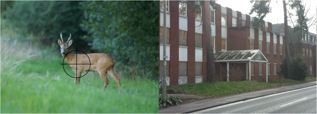
Which would you rather preserve – derelict eyesore or our wildlife?

As you know, Hart Council has begun a new consultation asking us where we would prefer to build the remaining 2,500 houses we are being asked to build as part of the Local Plan. This has generated some lively debate with some councillors and community groups favouring a new town. Whilst We Hart has a lot of sympathy with the residents of Fleet and Church Crookham, who have suffered from some poor planning decisions over the past years, we aim to show why it would be wrong to consider a new town or urban extension now and make a bad situation even worse.

We have to deliver over 370 houses per year up to 2032.  If these were to be built on green field sites it would mean we would be concreting over the equivalent of 25 football pitches each and every year for 20 years.  This is simply not sustainable, and it is clear something needs to change.

Eminent architects such as Richard Rogers, academics such as Professor Dieter Helm and journalists such as Simon Jenkins have called for our green spaces to be protected and for more building on brownfield land.  The Government is also actively encouraging brownfield development.

The benefits are clear, in that less infrastructure investment is required to support this type of development, urban living makes better use of scarce resources, so is kinder to the environment and town and city dwellers use their cars less and so don’t cause as much congestion.

So, having established the general case for brownfield over green field development, what about the specifics of the proposals before us in Hart?

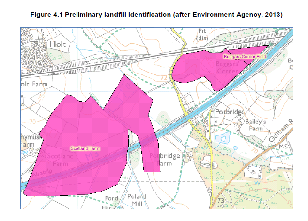
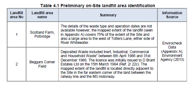
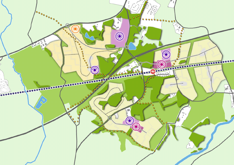
First, it can be done. We have gone through Hart Council’s data and shown that there are sufficient sites to meet our remaining needs on brownfield site alone, and if we can bring Pyestock into play and Hart are successful in their quest to find even more sites, we will have a surplus of brownfield sites.

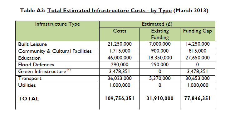
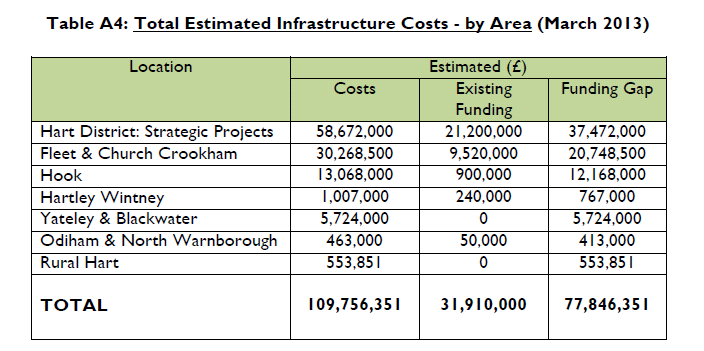
Supporters of a new town point to the supposed infrastructure benefits, but we believe this argument is flawed.  There is no doubt that there is a need for more infrastructure investment in our existing towns and villages, as is shown by the current £78m funding deficit.  Even Hart Council acknowledge that new schools would cost £80-100m, but then when you add up the costs of new and improved roads, roundabouts, bridges, sewage works, and railway station, it is clear that a new town will require over £300m of infrastructure spending before you even get to providing new sports and community facilities. But a reasonable expectation of developer contributions is only around £50m.  So, it is clear that a new town, or indeed an urban extension, could not get the infrastructure it needs and more importantly, would not do anything to address the problems in our existing communities .

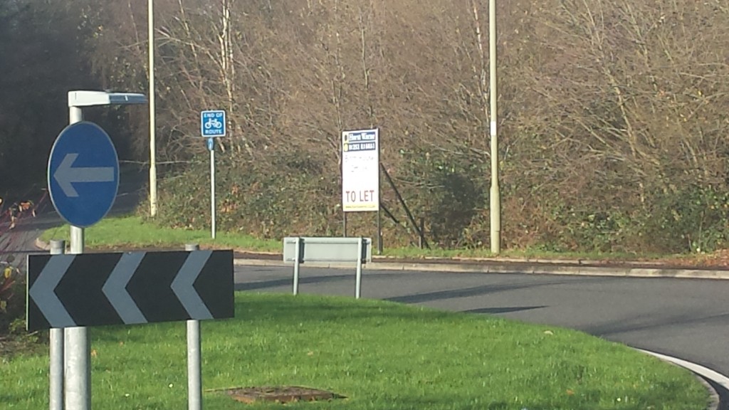
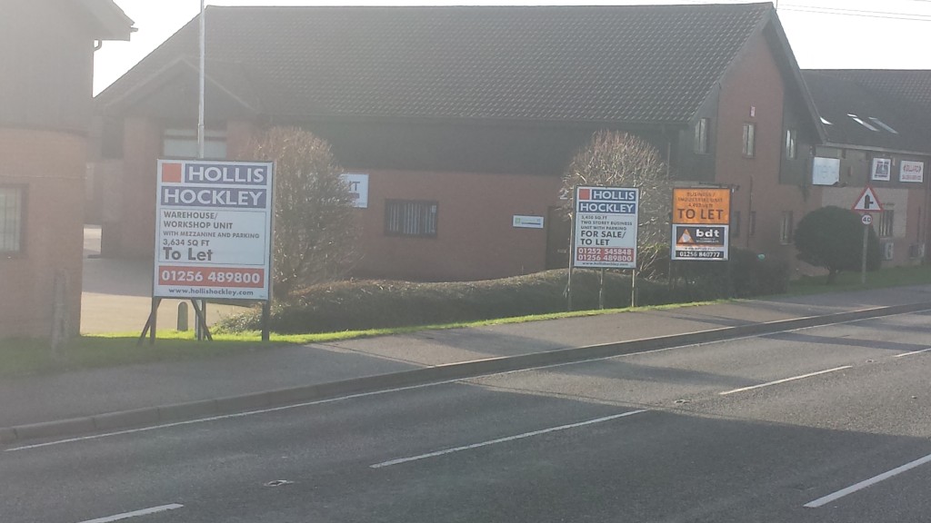
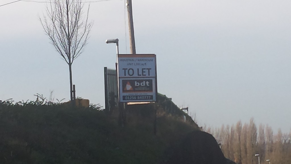
By contrast, properly designed brownfield redevelopments (not office conversions) would generate developer contributions for local communities and if Hart Council followed Ranil Jayawardena’s advice, they could use compulsory purchase powers to buy up some of these sites and use the profits from development to fund even more local infrastructure.

When you look at travel to work patterns of Hart residents, it is clear that many people work in Fleet, Surrey Heath, Rushmoor and Waverley.  So, residents of a new town will need to travel through Fleet, Church Crookham and Hartley Wintney adding to congestion.  Other workers will travel through Hook to get to work in places like Basingstoke.  Dispersal throughout the district will ease the congestion problem, and brownfield development to the east of Fleet will place workers closer to their jobs and offer greener transport alternatives.

Our housing needs assessment calls for 60-70% of new build properties to be 1 or 2-bedroomed and also calls for over 2,000 units of specialist accommodation for the elderly to be built up to 2031.  A new town or urban extension is likely to continue to build predominantly larger properties at prices of over £500,000 which will no doubt be attractive to those who want to move from London, but will be out of reach of middle income households in Hart and so do nothing for local people.  Well planned development of smaller properties on brownfield sites will do more to help our young people to get on the housing ladder and help older people when they want to down-size to free up their larger properties for growing families.

Of course planning for a new town or urban extension would also open us up to building 3,000 houses for Rushmoor and Surrey Heath.  Whereas a vision and strategy to protect our green lungs in the heart of Hart would offer us some protection.

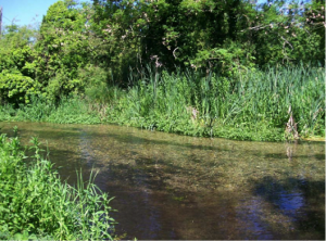
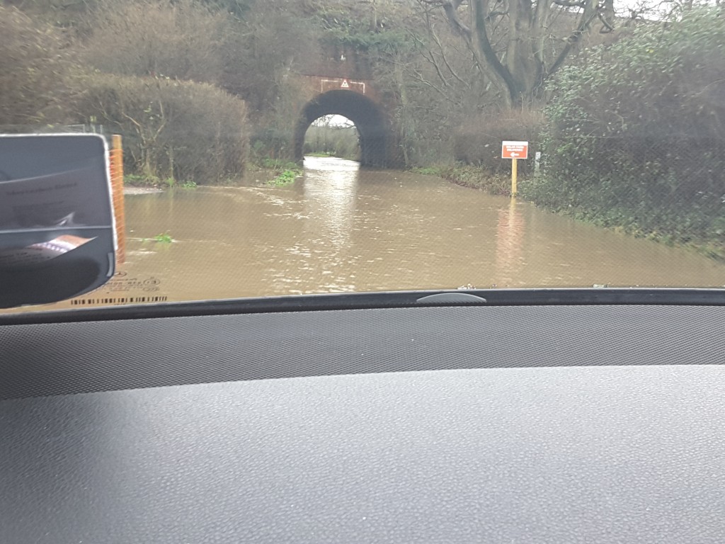
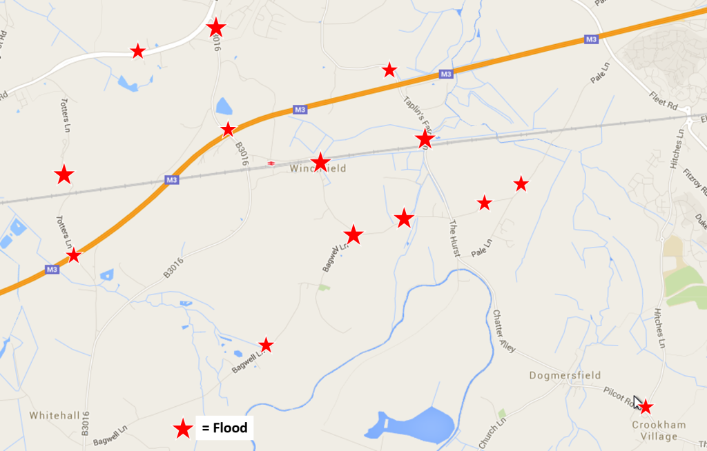
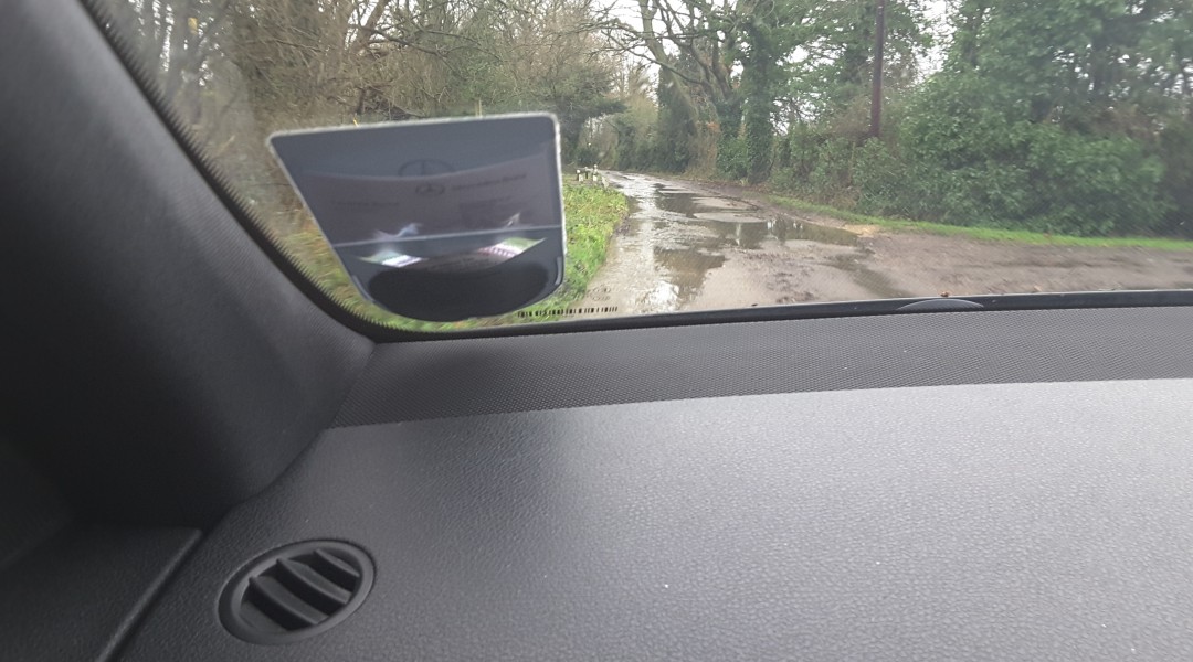
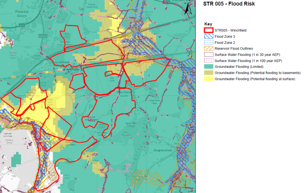
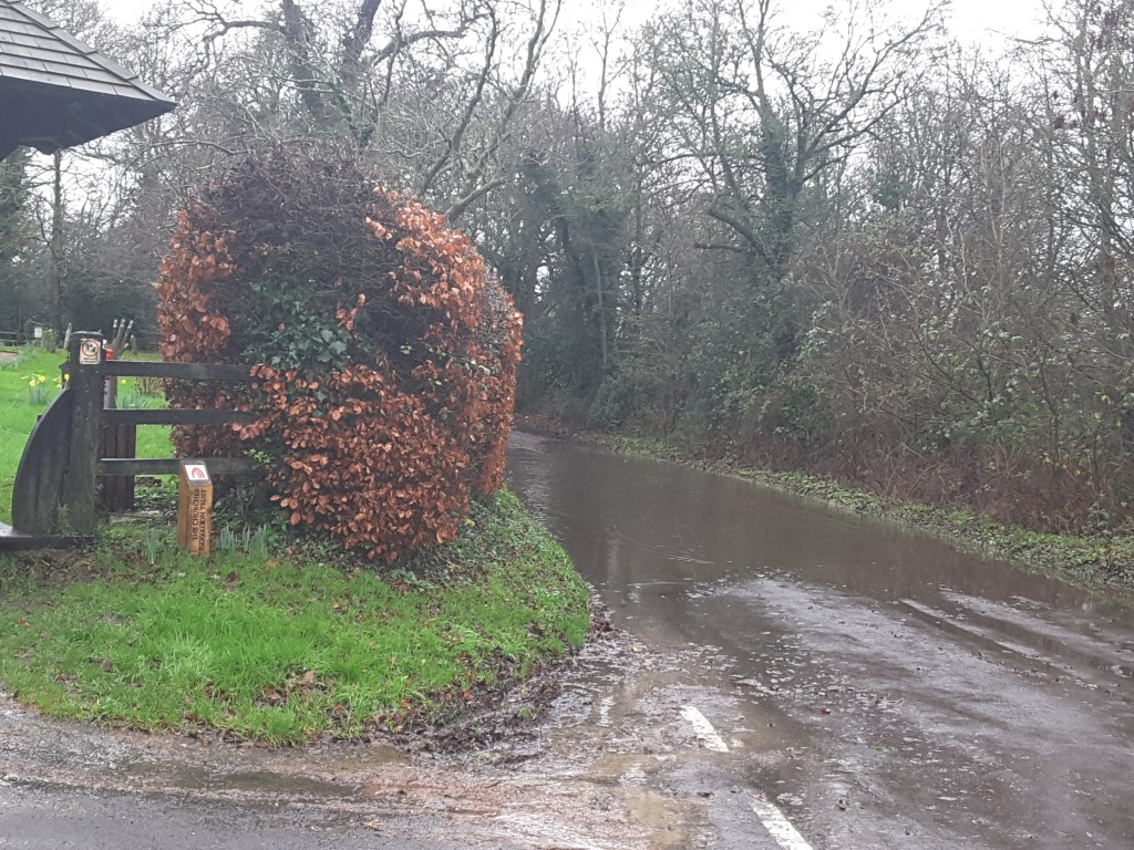
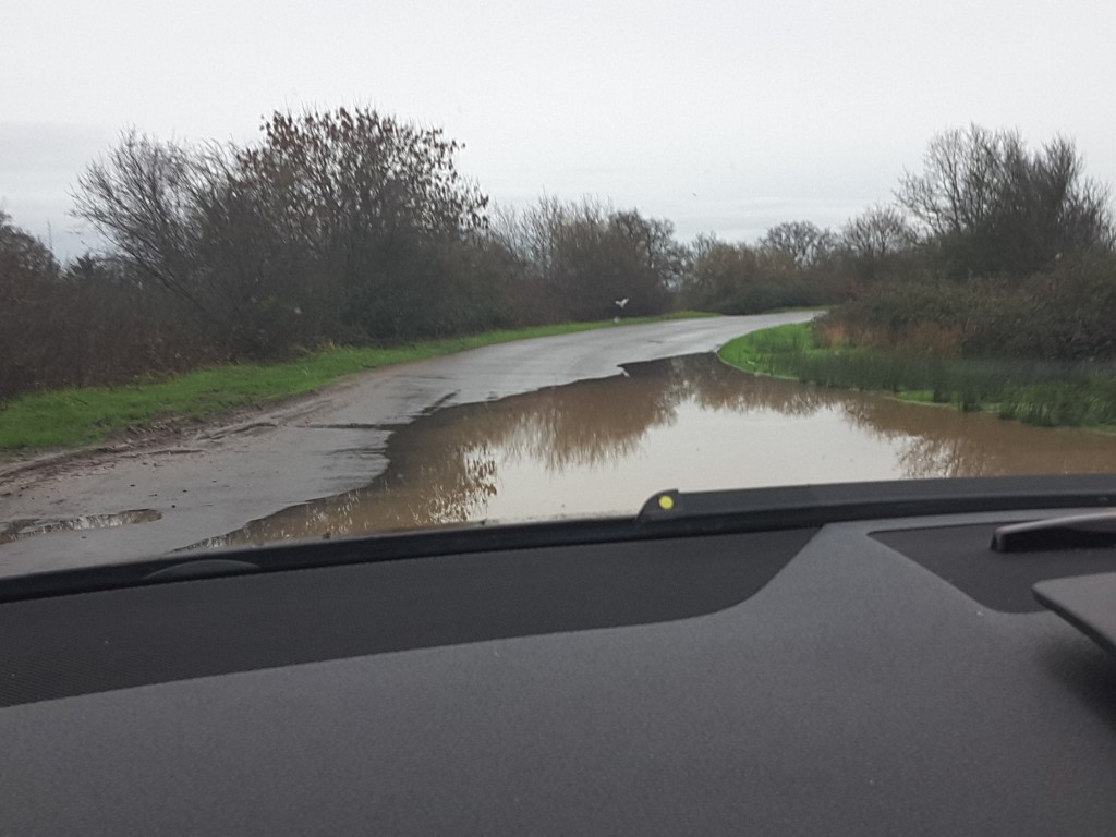
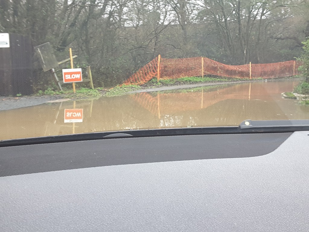
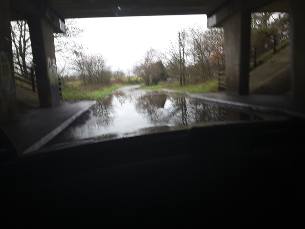
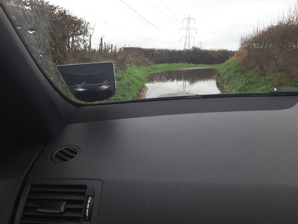
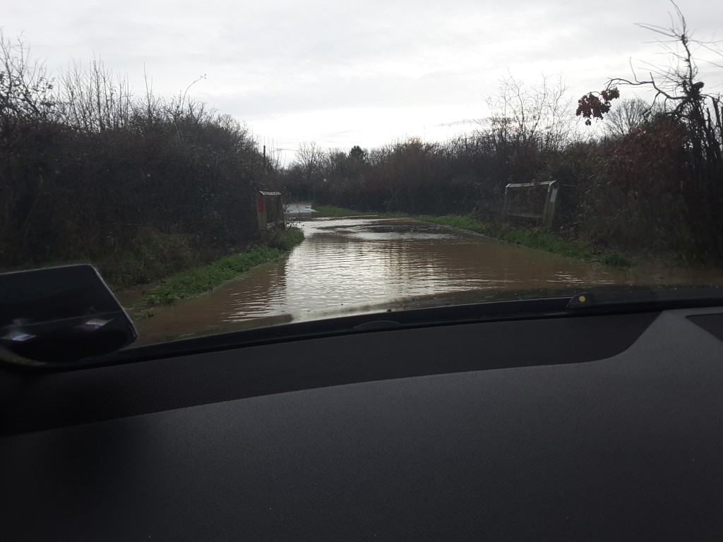
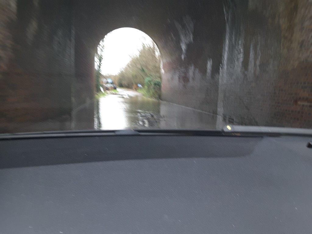
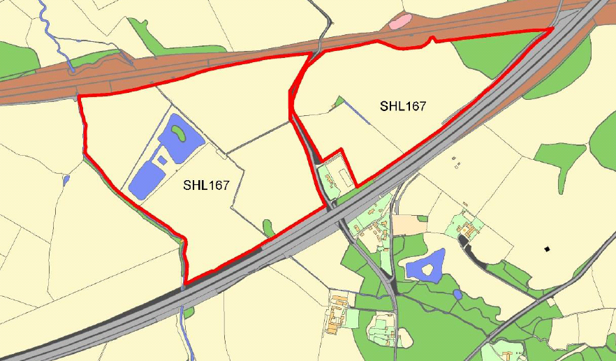
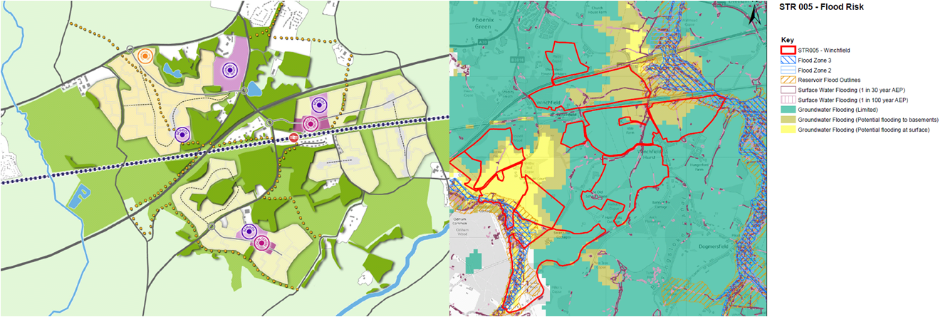
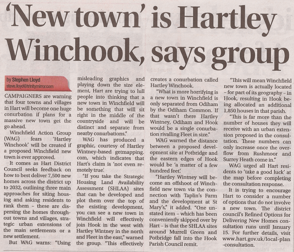
We also have to challenge the viability of the new town and urban extension plans.  The new town would coalesce our villages into a massive urban sprawl that would effectively become Hartley Winchook.  The proposed urban extensions would add further unwelcome development outside existing settlement boundaries. The professionals who have looked at the new town proposal have said “it would be challenging to plan a compact nuclear settlement on this site”, and of course there are other significant constraints such as lack of mains gas or sewage, flood risk and environmental damage.  All of the new town and urban extension sites have been classed as “not currently developable” by Hart Council.

It is time to make a break from the past mistakes and change to a more sustainable strategy, with a planning horizon of 50 years ahead and realise that more and more housing estates in the countryside are simply not sustainable.  We need to go for dispersal of our housing needs on brownfield sites across the district to build more affordable homes for our young people, create better specialist accommodation for the elderly and generate much needed infrastructure funding for local communities.

We have created a dedicated consultation page and two guides to responding to the consultation that are available on the downloads below. The comments are designed to be cut and pasted into the boxes provided.  It will be very powerful if you could edit the comments into your own words. Please do find time to respond to the consultation and play your part in saving our countryside.

Full version:

Responses to Local Plan Consultation

2 Minute version:

Respond to Local Plan Consultation in 2 minutes


Winchfield Action Group covered in Fleet News and Mail

New town is Hartley Winchook say Winchfield Action Group

New town is Hartley Winchook say Winchfield Action Group

We are pleased to note that Winchfield Action Group were covered in Fleet News and Mail yesterday.  A large image of the article can be found here.

The article notes the big risk of effectively coalescing Hartley Wintney, Winchfield and Hook into a giant conurbation that we have termed Hartley Winchook, leading to a massive increase in congestion and strain on public services as well destruction of habitat and our environment.

It is worth noting again that the proposed new town will be roughly three times the size of Elvetham Heath, more than twice the size of Hartley Wintney and about twice the size of Hook.  We don’t need a new town when there is a brownfield solution.

Show me the money – how will new town infrastructure be funded?

Hart District Council have made much of the supposed infrastructure benefits of  a new town in Hartley Wintney, Winchfield and Hook parishes to create a new Hartley Winchook conurbation.  But they have so far failed to spell out the infrastructure costs and not disclosed where the money would come from.  It is our belief that these alleged infrastructure benefits are a mirage and would not solve the acknowledged infrastructure issues in Fleet and Church Crookham. Any infrastructure money we get would be better spent regenerating our town centres and this can only be achieved with properly planned redevelopment of the numerous brownfield sites in our town centres.

Our estimate of infrastructure costs is over £300m, with the potential developer contributions of around £50m for a 5,000 house new town.  On its own, this delivers a funding gap of at least £250m, on top of the existing £78m infrastructure funding deficit.  The detail of our workings is shown below.  It is clear that despite two years of work since the last Local Plan failed, the proposals for a new town simply have not been thought through, so it would be madness to vote for a new town in the consultation.

We have created a dedicated consultation page and two guides to responding to the consultation that are available on the downloads below. The comments are designed to be cut and pasted into the boxes provided.  It will be very powerful if you could edit the comments into your own words. Please do find time to respond to the consultation and play your part in saving our countryside.

Full version:

Responses to Local Plan Consultation

2 Minute version:

Respond to Local Plan Consultation in 2 minutes

Cost estimate:

Infrastructure itemNumber requiredCost per unit (£m)Cost (£m)
Roundabouts
Roundabout (A30/B3016)144
Roundabout (A287/B3016)144
Roundabout (B3016/New Town)22.55
Roundabout (Pale Lane/A323)12.52.5
Roundabout (A287/Crondall Road)12.52.5
Roundabout (Pilcot Road/Hitches Lane)12.52.5
New Motorway Junction1100100
New roundabout on to A30 for SHL sites 126,136 & 169144
Sub-Total Roundabouts124.5
Bridges
Bridge widening/strenghening River Hart at Queens Head11.51.5
Bridge widening/strenghening River Hart Pale Lane11.51.5
Railway bridges widening and strengthening3515
Sub-Total Bridges18
Roads
New roads into new town (1.5km)1.52.13.15
Widening Bagwell Lane from new road to Station Road (1.5km)1.52.13.15
Widening Taplins Farm Lane/Church Lane to Barley Mow (2 km)22.14.2
Widening Station Road to the Hurst (2km)22.14.2
Widen Pale lane from Barley Mow to A323 (2km)22.14.2
Widen Chatter Alley/Pilcot Rd from Barley Mow to Hitches Lane (2km)22.14.2
Access road improvements to new station around Totters Lane22.14.2
Sub-Total Roads27.3
Schools
Secondary School16060
Primary schools31030
Sub-Total Schools90
Sewage Works
New Sewage works off Pale Lane to west of Edenbrook12525
Sub-Total Sewage Works25
Electricity Pylons
Bury cables underground2.52050
Sub-total Electricity pylons50
Railway Station
New Railway Station at Murrell Green12525
Sub-Total Railway Station25
Total359.8

The sources for these numbers are as follows, with some references to HDC’s Infrastructure Delivery Update:

  • Roundabouts.  Cost of A30 improvements at Blackbushe is around £4m.  Roundabouts at either end of the B3016 will cross a dual carriageway and will likely require some element of approach road improvement, so reasonable to assume the cost of each change will be about the same.  There will also no doubt need to be a new roundabout on to the A30 at Murrell Green. I have scaled down this number for the additional roundabouts needed as they are simpler.
  • Bridge improvements estimated.  Both bridges over the river Hart (at the Queens Head pub and on Pale Lane) will need to be completely replaced and widened to cope with two way traffic and probably some road adjustments too.  The work on the railway bridges will be considerable to widen them to cater for two way traffic underneath, and potentially to strengthen them for double decker trains.  Plus the Barratts new town plan for Winchfield shows a new footbridge over the motorway that hasn’t been individually costed. The bridge on Totters Lane over the railway will also need improvement, but we understand it is listed, so that will be difficult.
  • Road costs estimated from this  2006 report from Imperial College London give a cost of £2.13m/km  of new single carriageway road.  Road lengths above taken from Google Maps.  The infrastructure delivery update indicated that a new M3 junction may be required, although it is unclear where that would be located, nor is it clear where they would build the access roads.   It is difficult to see how a brand new junction will give much change from £100m (despite Hart’s estimate of only £30m in the consultation papers), given a new junction at Birmingham airport will cost £250m.
  • Schools.  Hart Council have quoted £80-100m for new schools.  I have chosen the mid-point of that estimate in the figures above. Note that the secondary school (according to both the Barratts vision document and the Hart strategic assessment of the Winchfield site) is within a couple of hundred metres of the M3 and next door to Mildmay Oaks hospital where a convicted sex offender escaped earlier this year and one of the primary schools is located between the M3 and the railway, hardly a suitable environment for children to grow up in.
  • Electricity Pylons.  No-one is going to want to live underneath high voltage electricity pylons, and two lots of high voltage pylons cross the planned area for the new town.  Presumably they were put there originally because they weren’t near where people live.  It costs £1.6m/km to lay new pylon runs and £20m/km to bury cables.  The infrastructure delivery update indicated that burying the cables may be required “if these sites are to be developed optimally”, so I have used that figure in the calculations.
  • Railway Station.  It cost  over £8m to upgrade the facilities and car-park at Fleet, and even more expensive works would be required at Winchfield: it also cost £4m to extend the platforms at Bedford station.  But the infrastructure delivery update indicated that Winchfield station may be relocated and expanded, most likely to the west (north of the M3). The potential advantages of this approach would be that the existing station could continue to operate until the replacement station opened.  We have therefore estimated a cost of £25m for a new station and believe that this may well be an understatement, because the land will also need to be purchased and big road improvements would be needed on say Totters Lane to allow access to the new station.

Contribution estimate

We might expect around £50m from developing 5,000 new houses that have not yet received planning permission in the local plan.  This is based on only 3,000 houses being eligible for a CIL charge as 40% of what is built has to be “affordable” and does not attract a CIL charge.  If each house is 95 sq m, and the charge per sq m is £175, then this results in CIL funding of ~£50m.  If they use S106 instead of CIL, the yield can be expected to be broadly similar.

If anyone wishes to put forward an alternative or better estimate, with sources, we will gladly update our estimates accordingly.