The new town, which might be termed Hartley Winchook is Hart District Council’s preferred option to meet our housing needs, but it is not clear whether the proposals are at all viable.
First, if you look at the sites put forward to make up the new town (see below), it is clear they are a mish-mash of disconnected sites bisected by the M3 and the railway, with no clear heart from which to build a successful community. This is recognised by HDC’s planning consultants who have said “It would be challenging to plan a compact nuclear settlement on this site”. In short, this is a ‘tin-man’ proposal for a new town, that Hart Council themselves ruled out back in 2012 and we urge you to oppose it in the consultation.
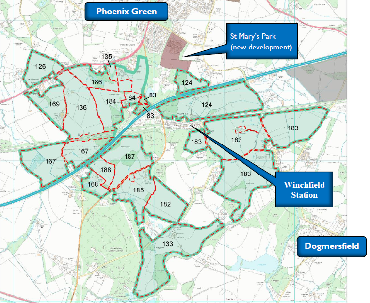
Winchfield and Hook New Town proposal
Second, there are a large number of significant constraints, many of which will be very difficult to overcome. We have set these out below, pulling the quotes from the official HDC evidence base.
Finally, both Hart and the Government have said that new towns need to be at least 5,000 dwellings. We have taken a look at the housing capacity below, and conclude that it is going to be a struggle to achieve this goal because HDC has not yet taken proper account of the need for SANG, schools, sports facilities, roads, car parks and shops.
We do wonder quite what has been going on inside Hart Planning Department, when last year the new town proposal was the preferred option ‘subject to testing’. Where are the results of the testing?
We have created a dedicated consultation page and two guides to responding to the consultation that are available on the downloads below. The comments are designed to be cut and pasted into the boxes provided. It will be very powerful if you could edit the comments into your own words. Please do find time to respond to the consultation and play your part in saving our countryside.
Full version:
Responses to Local Plan Consultation
2 Minute version:
Respond to Local Plan Consultation in 2 minutes
Constraints to housing
The first point to note is that each and every site put forward to be part of the new town is listed as “not currently developable” in all of the SHLAA documentation. There are many constraints noted for the sites, including:
- The road infrastructure has limited capacity for additional traffic.
- There are a number of significant nature conservation features and designations either adjacent or in close proximity to the site.”
- Some part of the site are subject to area based TPOs, particularly to the north of the site, near to Winchfield House.
- The Hampshire Minerals and Waste Plan Policies Map indicates that parts of the site contain areas subject to minerals safeguarding
- Characterised as attractive rolling countryside… The potential for new development within this area to negatively impact on landscape character is considered to be significant.”
- Potential to cause considerable harm to landscape character.
- It is possible that the site contains some ʻbest and most versatileʼ (BMV) agricultural land
- There are a variety of Listed Buildings within and adjacent to the site
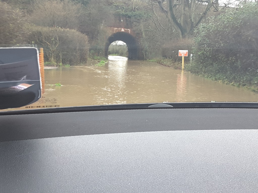
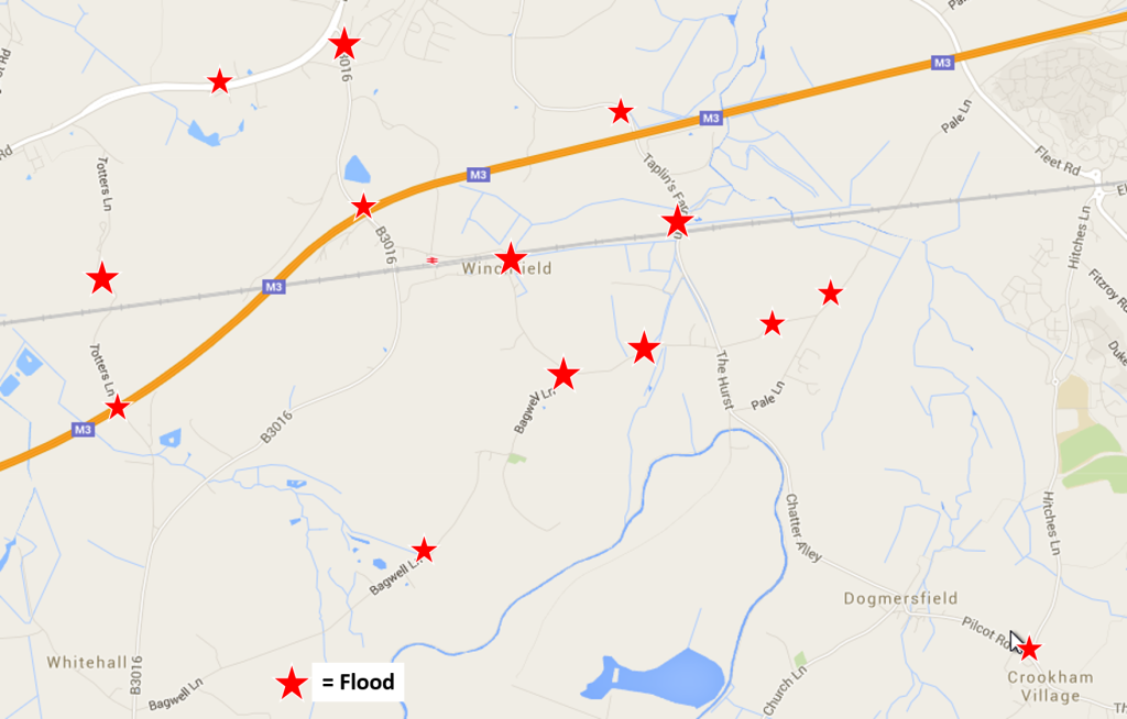
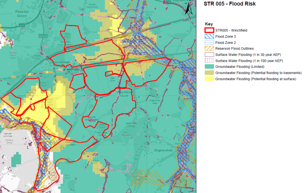
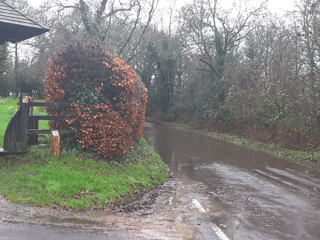
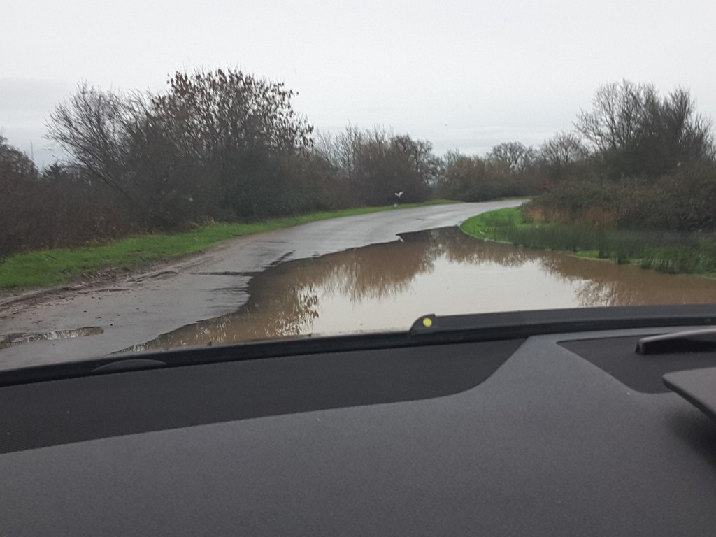
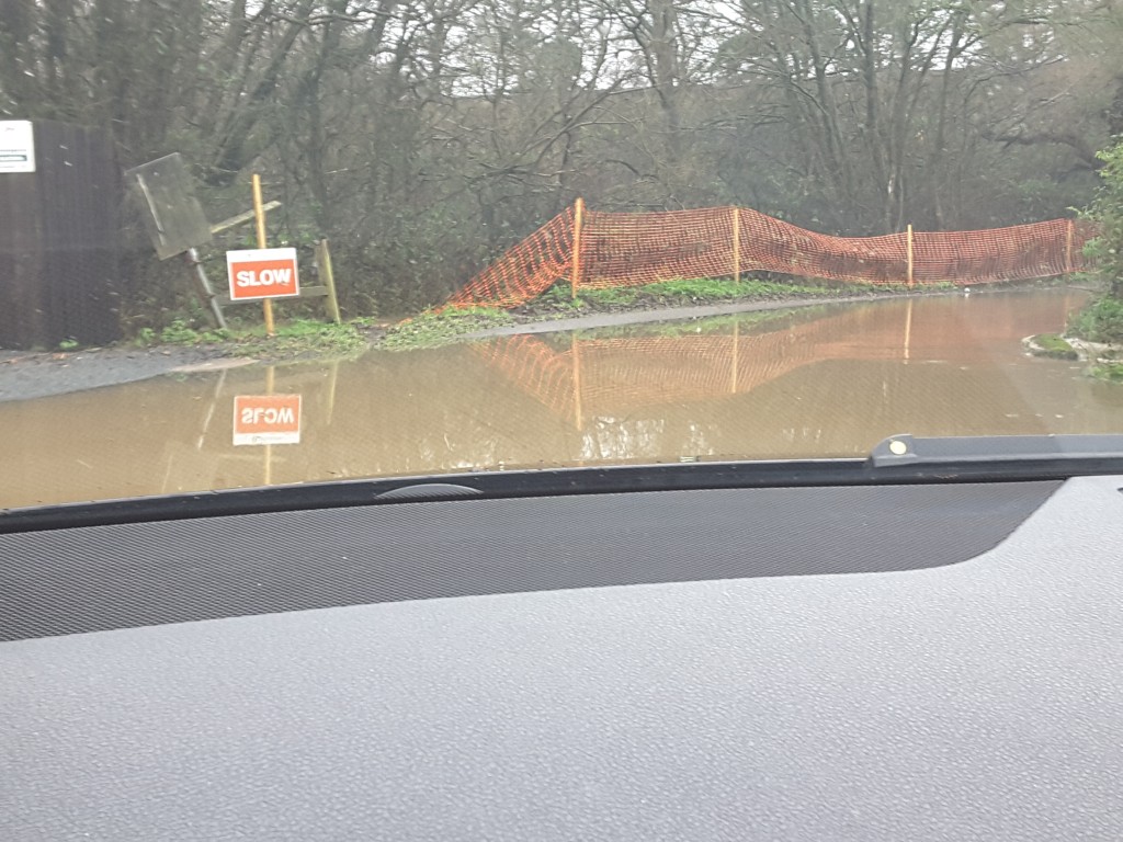
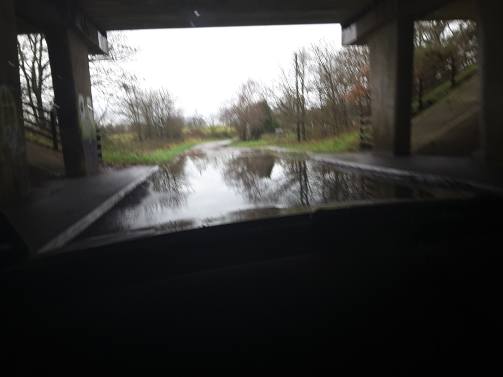
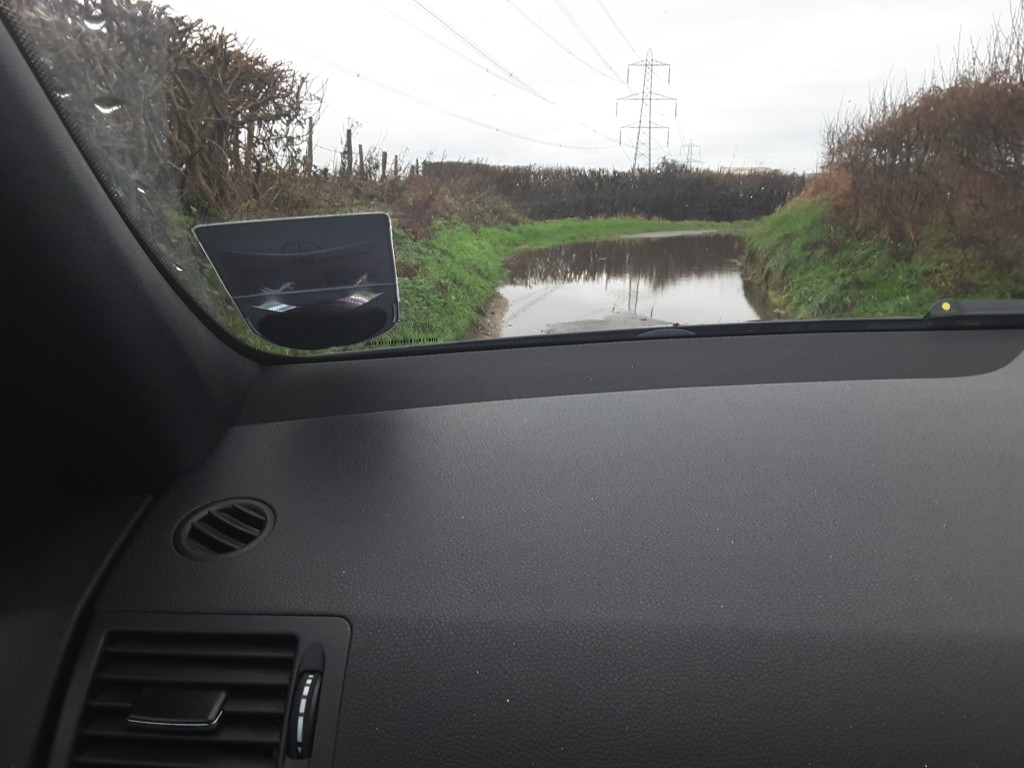
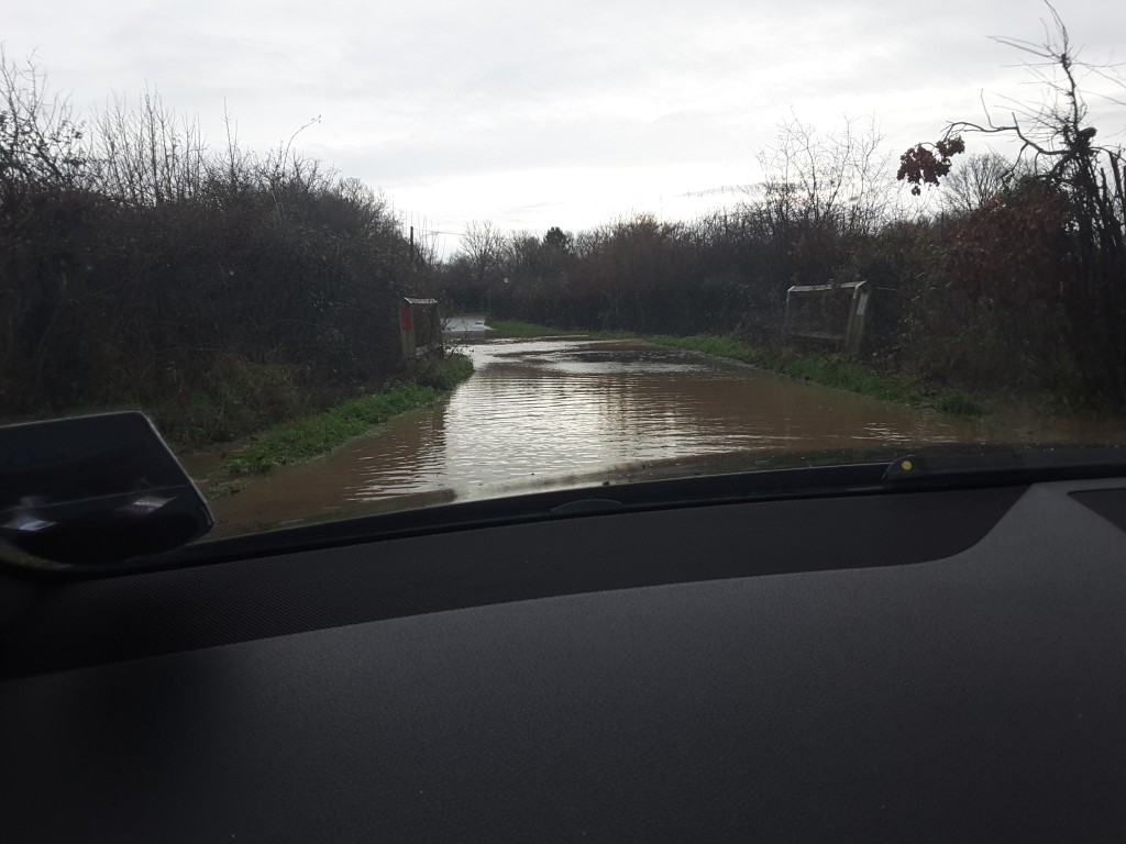
- Significant parts of the site are subject to the risk of groundwater flooding at the surface”.
- The nature of the site, split, with substantial areas of farmland, as well as Winchfield Station between the two halves is considered to significantly influence how a new settlement could be planned.
- Development at the north of the site risks leading to settlement coalescence with Hartley Wintney”.
- Overhead power lines traverse the site and may represent a constraint”.
- The extent to which environmental noise from the motorway and railway impacts on the site should be ascertained.
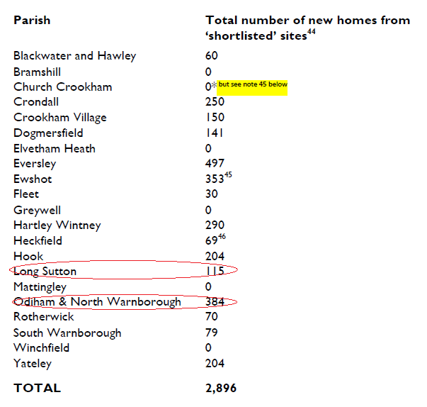
Housing Capacity
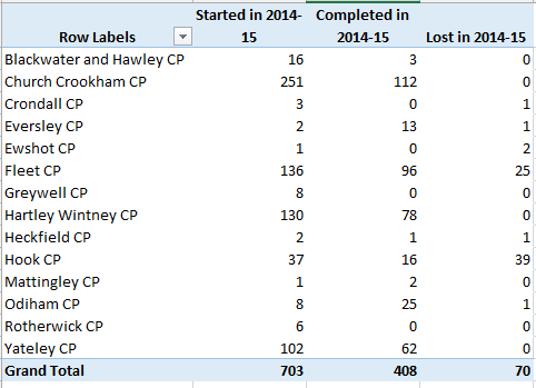
The capacity put forward for each site by Hart Council for the sites in Winchfield, Hook and Hartley Wintney Parishes is shown below.
| Parish/Ref |
Site Assessment Capacity (Low) |
Site Assessment Capacity (High) |
| Hook |
1,458 |
1,458 |
| SHL126 |
450 |
450 |
| SHL136 |
663 |
663 |
| SHL169 |
345 |
345 |
| Winchfield |
5,039 |
6,039 |
| SHL124 |
500 |
1,500 |
| SHL133 |
396 |
396 |
| SHL135 |
55 |
55 |
| SHL167 |
772 |
772 |
| SHL168 |
46 |
46 |
| SHL182 |
600 |
600 |
| SHL183 |
150 |
150 |
| SHL184 |
850 |
850 |
| SHL185 |
450 |
450 |
| SHL186 |
350 |
350 |
| SHL187 |
600 |
600 |
| SHL188 |
200 |
200 |
| SHL83 |
10 |
10 |
| SHL84 |
60 |
60 |
| Grand Total |
6,497 |
7,497 |
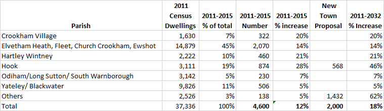
HDC and the Government have said that the minimum size for a new eco-town is 5,000 dwellings. However, many of these sites have not yet been fully assessed by officers to verify the housing capacity claimed by developers. Of particular note is that only ~50Ha of land has been assigned to SANG (part of SHL183). A development of 5,000 houses would require 100Ha of land (minimum of 8Ha per 1,000 people), so a further 50Ha at least is required. At Hart’s usual planning rule of thumb of 30 dwellings per hectare, this would reduce the available capacity by 1,500 units.
A new settlement would also require space for sports facilities. Hartley Wintney has three football pitches and a cricket pitch, and it is less than half the size of the proposed new town. So, let’s assume a new town would need 6 football pitches and 2 cricket pitches. Hartley Wintney FC (with three pitches covers some 3Ha and the cricket pitch some 1.5 Ha) – together say 9 Ha.
HDC say the new town would also need 4 new schools, one secondary and three primary. Robert Mays’ site is around 5 Ha (measured on Google Maps) and the site of Greenfields School at Hartley Wintney is around 2.5Ha, so the four schools would need around 12Ha between them.
Then of course, there would need to be a new supermarket and other shops, medical facilities and other employment space. Tesco in Hook takes up about 1 Ha, but the new town is to be around twice the size of Hook, so a bigger store would be needed. So let’s say a conservative 10Ha in total for supermarkets, shops, surgeries and car parks.
Then of course, we need space for new roads, a sewage works and the new railway station. Fleet station is around 2 Ha, and the old sewage works at Branshott Farm was around 2 Ha. New roads and a motorway junction will further reduce capacity.
That brings the total up to around 35 Ha. That takes off space for a further 1,050 dwellings.
As can be seen, when you take into account the need for SANG, schools, shops, sports facilities, new station and sewage works, the available capacity drops by around 2,550 units, taking the low end estimate of housing capacity to ~4,000, well below the minimum 5,000 and the high end just below the boundary of viability.
A number of the sites are unlikely to ever be suitable for housing, and other sites have very real issues with the potential for groundwater flooding which would further reduce capacity. For example, site SHL167 has just been refused permission for even a solar farm, and SHL133 is borders two SSSI’s and a significant part of it is subject to flooding. And sites such as SHL182, 184, 186, 187 and 188 do not yet appear to have had their capacities factored down by officers to take account of the constraints.
And of course, Dr Anne Crampton has called for a 500m exclusion zone around the motorway, which would render the whole scheme unviable.