New houses near Winchfield station will increase congestion

New houses lead to traffic congestion in Hart District

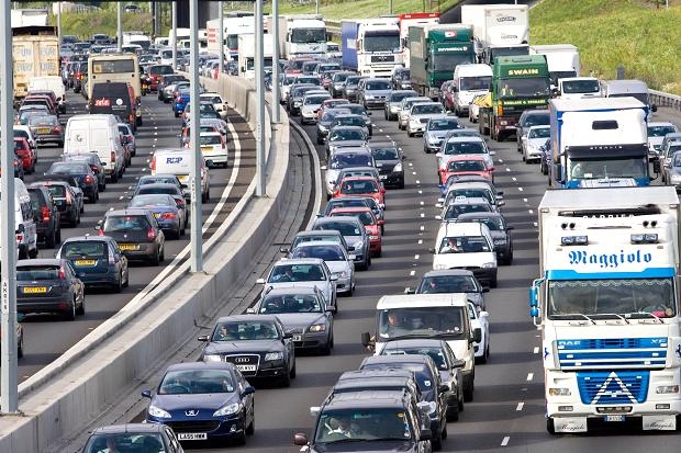
Example of traffic congestion that could happen in Winchfield

A new study by the Royal Town Planning Institute (RTPI), has shown that adding houses near railway stations in country areas could see a massive increase in car journeys each week to create additional congestion and delays on roads that are already overloaded.  Of course there is a direct read across from the RTPI analysis to Hart Council’s proposals for a new town at Winchfield, that would inevitably impact Hartley Wintney, Hook, Odiham, Dogmersfield, Crookham Village, Church Crookham and Fleet.

We can estimate how many extra traffic movements there might be from a 5,000 house new town at Winchfield by looking at the Hampshire County Council transport contributions policy.  They estimate 7 trips per average dwelling per day, which would lead to an extra 7 x 5,000 = 35,000 trips per day or 12.8m extra trips per annum on both minor country roads and our already congested wider road network.

Janet Askew, President of the Royal Town Planning Institute (RTPI), said:

“Quite apart from other good reasons why building in the green belt on such a scale might be opposed, these figures demonstrate a fundamental flaw in the reasoning that there is a quick fix and a sustainable solution to the housing crisis by putting large numbers of new homes close to railway stations.”

The RTPI press release went on to say:

“The view of the RTPI is that brownfield sites should be looked at as a priority for housing but not all brownfield sites will be suitable. The housing crisis is complex and will require a number of different policy solutions, such as increasing access to mortgage finance, improving transport and infrastructure, encouraging the house builders to build more homes, and a strong, delivery focussed planning system. Major proposals for new homes, whether they are in the green belt or on brownfield sites, must be preceded by adequate investment in schools, health, transport and other infrastructure, and planned in a strategic and holistic way, with up to date local plans being critical.”

Of course this is consistent with what We Heart Hart has been saying for many months, but Hart Council will not consider adding a brownfield development option into the Local Plan process; won’t look at our alternative 5-point plan and won’t even establish a register of brownfield sites.

The full text of the RTPI press release is shown below:

Using commuting data from  the 2011 Census the Royal Town Planning Institute (RTPI), has today published analysis which finds that adding 1 million homes near railway stations in the Metropolitan London green belt area could see 3.9-7.5 million car journeys each week added to roads which are already struggling with congestion and delays. These findings – Building in the green belt? A report into commuting in the Metropolitan green belt challenge the assumption that building in the green belt around railway stations would see the majority of new residents using the train to get to jobs in London and could therefore be easily accommodated.

Over the past year various think tanks, academics and policy commentators have considered whether green belt boundaries around London should be relaxed in order to ease the housing crisis. These proposals often suggest the release of green belt land within easy walking or cycling distance of key railway stations, land which could provide space for figures upwards of 1 million homes. The assumption behind these proposals is that the majority of new residents will commute by rail to jobs in central London, enabling sustainable housing growth in the wider Metropolitan region without placing excessive strain on existing roads. However the implications of growth on commuting patterns is difficult to predict without looking at those already living in the green belt. Where are these residents travelling for work, and what methods of transport are they using to get there?

The RTPI examined commuting data for five medium-sized towns within the existing Metropolitan green belt, towns which are centred around railway stations and have direct connections to central London. We found that in these five towns, only 7.4% of commuters actually travel to inner London by train on a regular basis, despite living within easy walking or cycling distance of a station. The majority of commuters (72%) instead travel by private vehicle, mostly driving to jobs within their hometown and to other places not in London.

Janet Askew, President of the Royal Town Planning Institute (RTPI), said:
“If 1 million new homes were built in the green belt in this way, this is likely to result in a huge increase in the number of car journeys being made across the green belt to work, and between schools health facilities and stations”.
“Quite apart from other good reasons why building in the green belt on such a scale might be opposed, these figures demonstrate a fundamental flaw in the reasoning that there is a quick fix and a sustainable solution to the housing crisis by putting large numbers of new homes close to railway stations. While it is difficult to predict exactly future commuting patterns, the overwhelming evidence is that people will use their cars and this will result in vastly increased numbers of car journeys in and through the green belt.”

Trudi Elliott, Chief executive of the Royal Town Planning Institute (RTPI), said:
“The outcome of the analysis was surprising given the range of voices calling for housing around railway stations in the green belt. Our data shows, using one region of the green belt, just how complex the issue of commuting patterns is and how unpredictable they are likely to be in the future. The green belt is an important planning tool. Our findings demonstrate that it is vital to have an evidence base before you make major policy.”

The view of the RTPI is that brownfield sites should be looked at as a priority for housing but not all brownfield sites will be suitable. The housing crisis is complex and will require a number of different policy solutions, such as increasing access to mortgage finance, improving transport and infrastructure, encouraging the house builders to build more homes, and a strong, delivery focussed planning system. Major proposals for new homes, whether they are in the green belt or on brownfield sites, must be preceded by adequate investment in schools, health, transport and other infrastructure, and planned in a strategic and holistic way, with up to date local plans being critical. Any development in the green belt continues to need rigorous justification under the planning system and there are many checks and balances in place.

The five towns in the RTPI analysis were: Hemel Hempstead, High Wycombe, Watford, Maidenhead and Bracknell.

The RTPI is also publishing today a short YouTube film and a new public information note explaining the history, background and purpose of the green belt. A recent Ipsos Mori poll found 71% of all age groups knew just a little/ heard of but know nothing/never heard of green belt land. Among the under 34s this was 85% and among the under 24s the figure was 92%.

Please help Hart fend off an extra 1,600 houses from Rushmoor

Is this what we want Hart to turn into?

Is this what we want Hart to turn into?

Rushmoor Borough Council has published a draft Local Plan where it proposes to build only 8,200 of its assessed need of 9,822 houses over the plan period.  It is clear that Rushmoor is seeking to offload the remaining 1,622 houses on to Hart District.

We need to oppose this move and We Heart Heart have produced some materials to help you do this easily.  Our voice will have greater weight if we can get more Hart residents to comment on Rushmoor’s plan than Rushmoor residents. Please follow the simple process below:

  1. Download the Local Plan response form from the link below.
  2. On page 3, fill in your name and contact details and type your name and date in the boxes at the bottom of the page.
  3. Review the comments made and feel free to add, amend or delete as you see fit.
  4. Save the document, attach it to an email and send to [email protected]
  5. Share a link to this page to all your friends and family as well as any sports clubs or community groups you belong to via word of mouth, email, Facebook and Twitter and ask them to put in a response and share this page again.
  6. If you have not already done so, please sign and share our petition too.
Rushmoor Local Plan Response Form

A summary of the arguments we are putting forwards is outlined below.

Slippery slope to taking more housing than the other districts

The proposal to take an additional 1,622 houses from Rushmoor puts us on the slippery slope to accepting a further 1,400 houses from Surrey Heath such that Hart District ends up having to build the most houses in the Housing Market Area.


Hart DistrictSurrey Heath BoroughRushmoor BoroughTotal Housing Market Area
Original SHMA7,5347,0579,82224,413
Proposed Transfers3,022(1,400)(1,622)0
New Total10,5565,6578,20024,413


This will impact all of our districts including Blackwater and Hawley; Bramshill;  Church Crookham; Crondall; Crookham Village; Dogmersfield; Elvetham Heath; Eversley; Ewshot; Fleet; Greywell; Hartley Wintney; Heckfield; Hook; Mattingley; North Warnborough; Odiham; Rotherwick; South Warnborough; Winchfield; and Yateley adding additional pressure to an already difficult situation and make it more likely we have to accept both a new town and urban extensions on our beautiful green fields and countryside.

Hart and the rest of Housing Market Area are being asked to build too many houses

The whole Housing Market Area (HMA) should reduce the assessed need by 7,800 units which would reduce the pressure on Hart directly and remove the need for Surrey Heath and Rushmoor to ask us to build >3,000 houses for them. This is discussed in more detail here.

Rushmoor isn’t making best use of its brownfield sites

This is discussed in more detail here and here. As can be seen, if Rushmoor gets more creative with Wellesley and plans to build on the sites it has already identified, there is potential capacity for over 30,000 dwellings, more than three times its (overblown) assessed need.   It surely cannot be too much to expect them to find the 1,600 houses they say they can’t build out of this wealth of opportunity.  Rushmoor Borough Council should re-visit its planned densities and seek to meet all of its assessed need within in its own boundaries.  It could then make some sites available for neighbouring rural districts in line with a recent survey of Hampshire residents seeking to protect rural areas.  Neighbouring districts could be approached to provide SANG capacity if required.  Rushmoor should also take a closer look at all the vacant sites in the district and seek to convert them to residential use.

Rushmoor’s Employment Land Review is overblown and seeks to protect more employment land than is necessary.

This is discussed here.  It is also clear that past forecasts got it wrong as evidenced by the large number of vacant office blocks and empty shops across Hart District.  If the ELR was reduced to more sensible levels they could free up more land for housing.

Indeed, even if you accept the overblown employment forecasts, there will be a surplus of nearly 600K sq m of employment space at the end of the plan period, covering around 195 Ha.  Yet Rushmoor seeking to protect 96 Ha of land whilst asking Hart to build 1,600 houses on green fields.

Rushmoor’s infrastructure plans are not credible

We posted here that Hampshire as a whole has a £1.9bn infrastructure funding deficit, with Rushmoor’s share of that being £80m.  Rushmoor makes no mention of this deficit in its draft Local Plan.  Hart’s own numbers show an infrastructure deficit of £78m.  All of these numbers are probably an under-statement given they were all produced before the scale of development now proposed was known.  This is in contravention of NPPF para 177 that says there must be a “reasonable prospect” of delivering the required infrastructure alongside housing:

“It is equally important to ensure that there is a reasonable prospect that planned infrastructure is deliverable in a timely fashion. To facilitate this, it is important that local planning authorities understand district-wide development costs at the time Local Plans are drawn up. For this reason, infrastructure and development policies should be planned at the same time, in the Local Plan”

Finally, they don’t even attempt to quantify the extra infrastructure Hart would need to build the extra 1,600 houses nor do they make any offer to fund any of that extra cost.

Rushmoor not planning to meet the needs of the ageing population

Figure 10.15 of the SHMA sets out the need for specialist housing and registered care places for the HMA and Rushmoor.  This states Rushmoor must build 710 sheltered and extra care units as well as provide an extra 600 registered care places. Their draft Local Plan makes no mention of the extra registered care places and sets no target for the sheltered and extra care units.  This is in contravention of NPPF para 50 which states:

“local planning authorities should…plan for a mix of housing based on current and future demographic trends, market trends and the needs of different groups in the community (such as, but not limited to, families with children, older people, people with disabilities, service families and people wishing to build their own homes)”

Therefore the Rushmoor draft Local Plan runs the risk of being found unsound and should be revised.


In conclusion, the Rushmoor draft Local Plan contains many serious flaws and needs to be revised.

Link


Launch of We ♥ Hart Petition

The We Heart Hart Campaign (aka We Love Hart and We ♥ Hart) have now started a campaign on 38 degrees to petition Hart Council to change its approach to the Hart Local Plan. This petition can be found here: https://you.38degrees.org.uk/petitions/we-hart.

Please support this petition by signing it and sharing it with all your friends via e-mail, Facebook and Twitter.

We need to protect all of our parishes including: Blackwater and Hawley; Bramshill;  Church Crookham; Crondall; Crookham Village; Dogmersfield; Elvetham Heath; Eversley; Ewshot; Fleet; Greywell; Hartley Wintney; Heckfield; Hook; Mattingley; North Warnborough; Odiham; Rotherwick; South Warnborough; Winchfield; and Yateley from this invidious plan.

We Heart Hart Campaign Logo

We Heart Hart Campaign Logo

Hart District

Hart is a beautiful district made up of a mixture of large urban settlements such as Fleet and smaller village type settlements such as Odiham. The space around these settlements is largely made up of green fields and woodland which give Hart its essential rural feel.

In December 2014, for the fourth year running, Hart was named the best place to live in the country in a survey by the Halifax. Each settlement has a distinctive community feel; the quality of the schools is excellent and the 84 square miles of green fields and wooded landscape are a perfect example of England’s green and pleasant land that is excellent for wildlife, cycling and walking.

This essential nature of Hart is now being put under pressure by the National Planning Policy Framework and Hart Council’s response to it. In the years up to 2031, Hart has to build another 7,500 homes. Hart Council is proposing to meet the bulk of this need by building a new settlement in the heart of Hart at Winchfield destroying over 700 acres of green fields and woodland in the process.

We are mounting a campaign against these proposals because we believe the Strategic Housing Market Assessment that gave rise to the need for 7,534 extra houses (not to mention the extra 3,100 houses from Surrey Heath and Rushmoor) is flawed and Hart’s response to this is inappropriate.

This is putting all of the parishes of Hart District at risk including:

Blackwater and Hawley; Bramshill;  Church Crookham; Crondall; Crookham Village; Dogmersfield; Elvetham Heath; Eversley; Ewshot; Fleet; Greywell; Hartley Wintney; Heckfield; Hook; Mattingley; North Warnborough; Odiham; Rotherwick; South Warnborough; Winchfield; and Yateley.