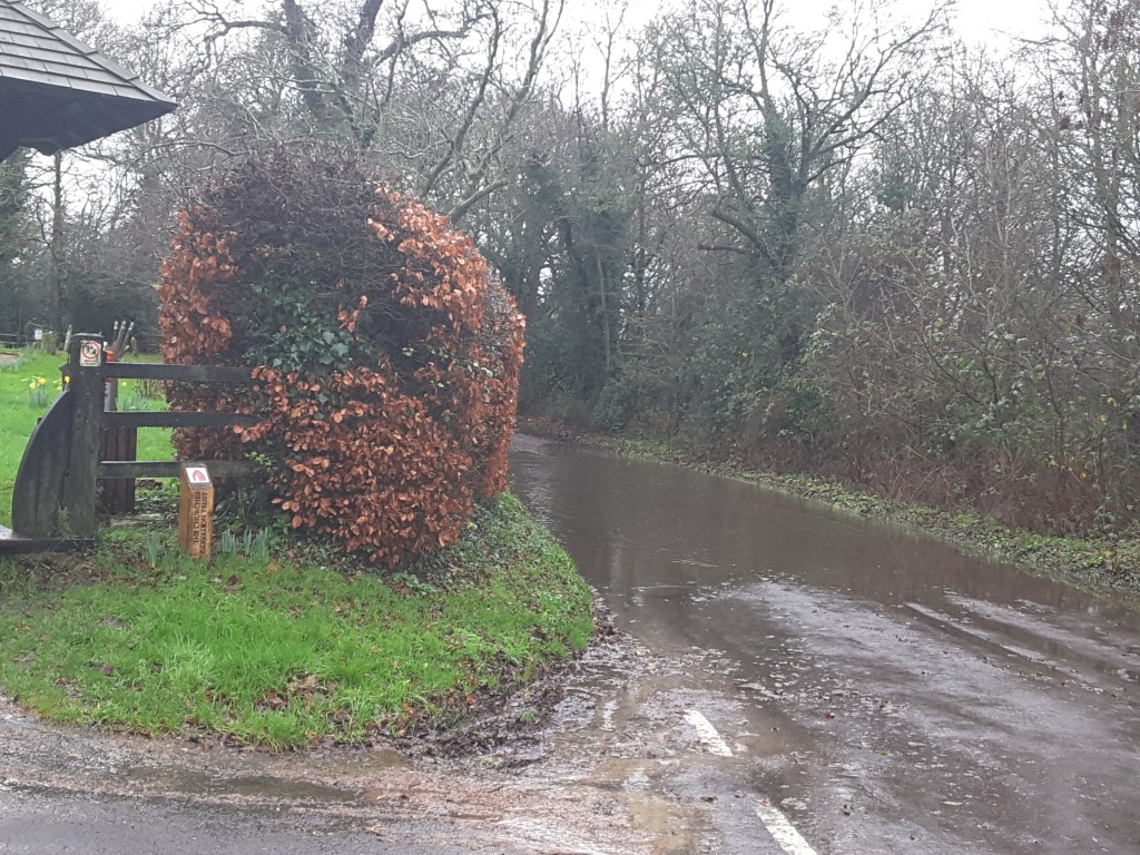
Flood Taplins Farm Road Winchfield 3 January 2016.
Bravehart donned his waders and took to his canoe yesterday to take pictures of the widespread floods across the country roads in Winchfield and the roads in and out of the proposed new town in Hartley Wintney, Hook and Crookham Village.
As you can see from the carousel below the floods were severe and widespread, and that is without all the surrounding green fields being concreted over. Imagine what it would be like if the capacity of the soil to absorb water was reduced by building 5,000 houses.
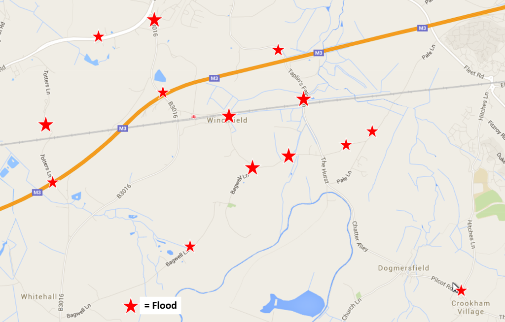
Bravehart found floods in the following areas:
Winchfield, Hook, Crookham Village Floods 3 January 2016
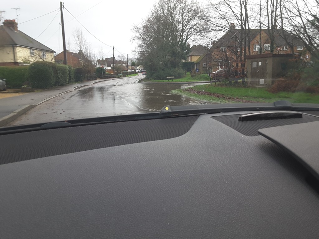
- Church Lane, Hartley Wintney near St Mary’s Church
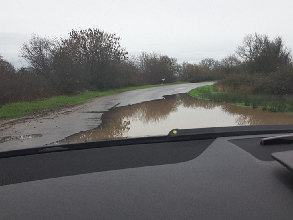
- Taplins Farm Lane, near the farm and near the bridge over the M3
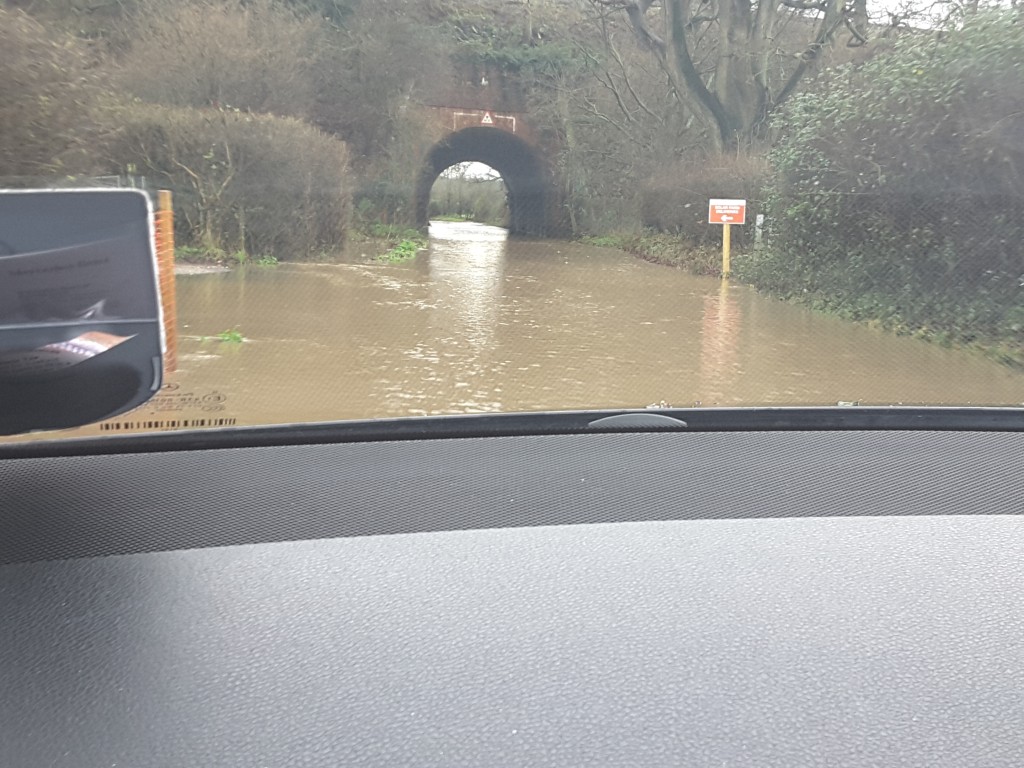
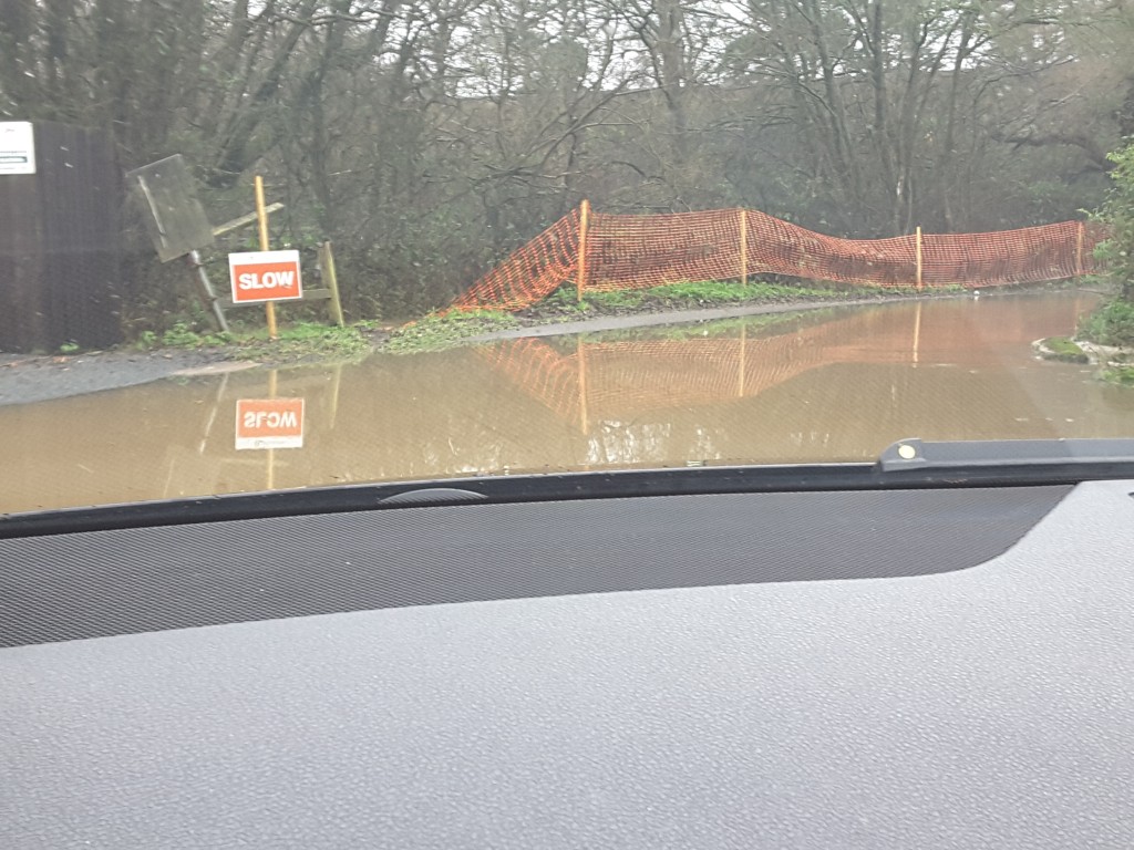
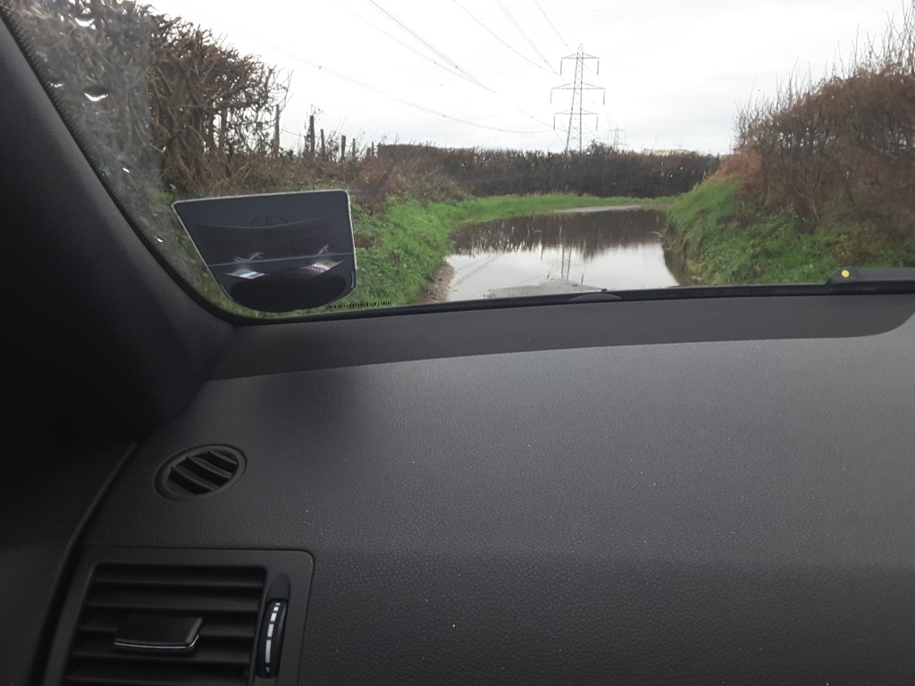
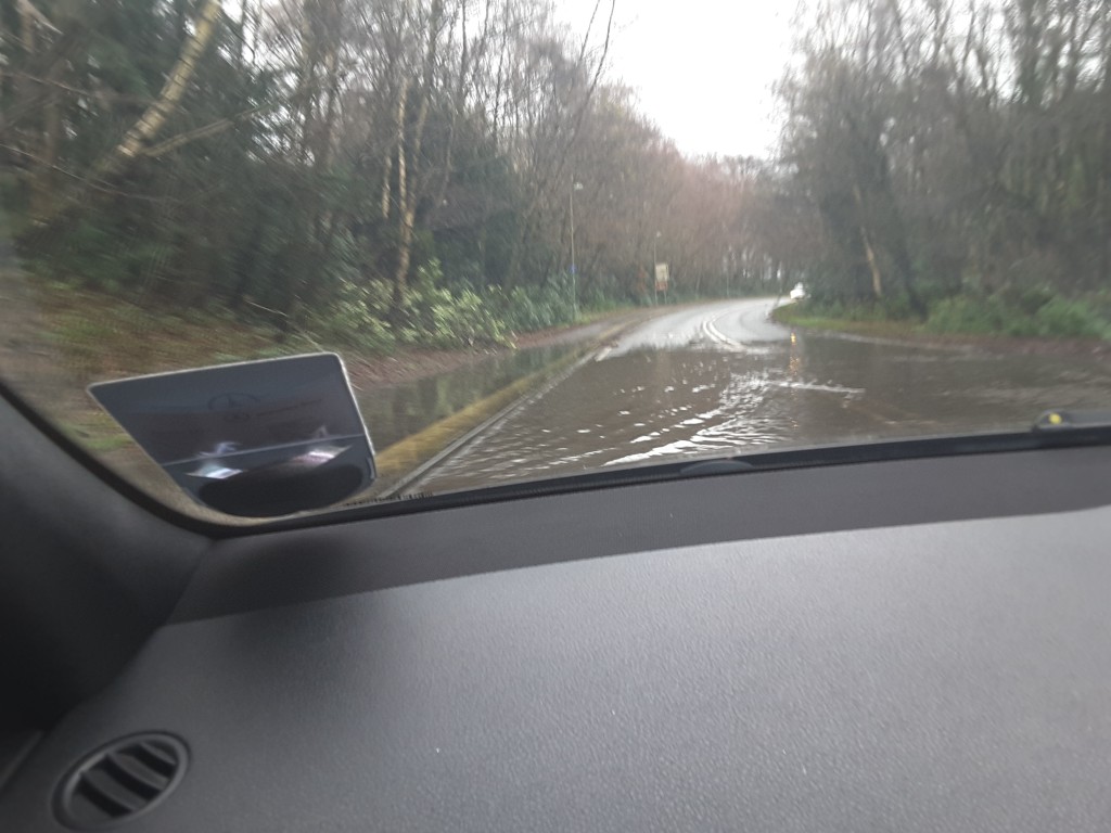
- Taplins Farm Lane, just below the Internet car showroom, along the road through the railway tunnel up to near Hurst Farm
- The Hurst and Pale Lane in Winchfield
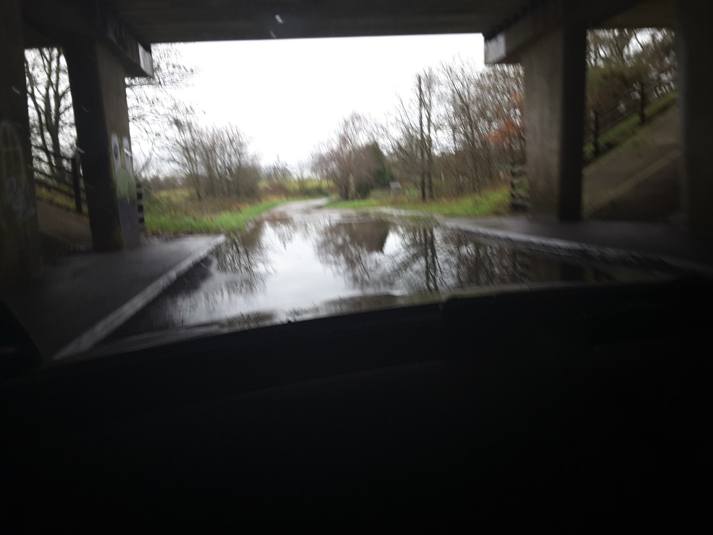
- Extensive flooding along Station Road from the Hurst to Bagwell Lane and again through the railway tunnel
- The bottom of Bagwell Lane, Winchfield and at many places along the lane towards Odiham Common
- Totters Lane under the M3, near the bridge over the railway and near the A30 in Hook parish
- On the A30 between Murrell Green and Phoenix Green
- On the B3016 Odiham Road near the junction with the A30 and under the M3
- On Pilcot Road near the junction with Hitches Lane in Crookham Village


Yesterday’s events demonstrate the evidence in the site assessment that the area is very susceptible to groundwater flooding.
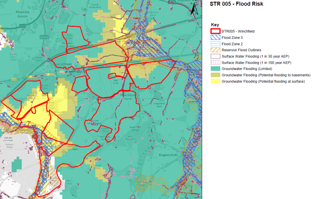
Winchfield Flood Risk
We find it difficult to believe that anyone can conclude that these sites and these roads are a suitable location for a new town of 5,000 houses.
[Update]
This story covered in Get Hampshire January 4 2016: Floods will worsen if green fields are concreted over for new Winchfield town, campaigners warn
And covered in Fleet News and Mail January 6 2016: Flooding proves new town idea will not float says campaigner
[/Update]
If you would like to make your voice heard and object to the new town idea, we urge you to respond to the Hart District Council consultation about the Local Plan and ask them to think again. We have created a dedicated consultation page and two guides to responding to the consultation that are available on the downloads below. The comments are designed to be cut and pasted into the boxes provided. It will be very powerful if you could edit the comments into your own words. Please do find time to respond to the consultation and play your part in saving our countryside.
Full version:
2 Minute version:
Flood Church Lane Hartley Wintney 3 January 2016
Flood Taplins Farm Road Winchfield 3 January 2016
Flood Taplins Farm Road Winchfield 3 January 2016
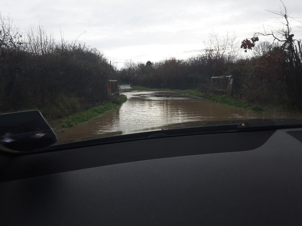
Flood Potbridge Road Winchfield 3 January 2016
Flood Totters Lane Hook 3 January 2016.
Flood Bagwell Lane Winchfield 3 January 2016.
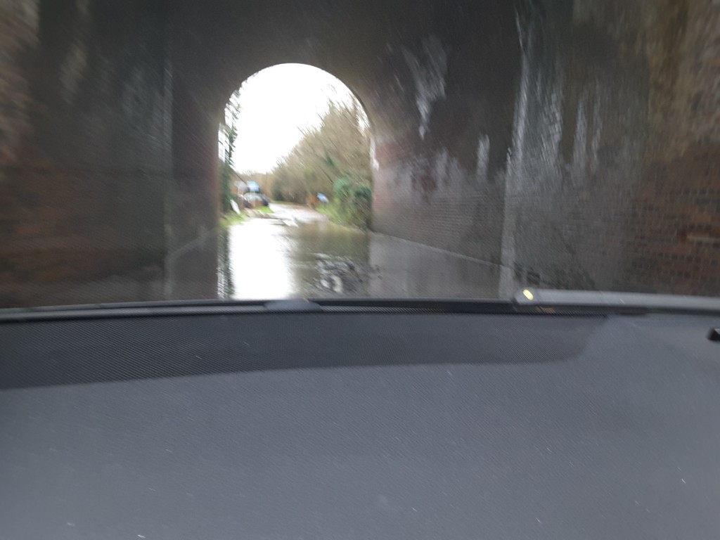
Railway bridge at Station Road Winchfield. Village 3 January 2016
Flood Hitches Lane/Pilcot Road Crookham Village 3 January 2016
Flood B3016 Odiham Road Winchfield 3 January 2016.
Over 4,000 visits to the website yesterday looking at this story. Over 70 shares on Facebook. Let’s hope more people see sense and oppose the new town.
Are these local puddles caused by a permanent rise in the water table or lack of road grid maintenance by Hampshire County Council? It’s another twist on the pothole syndrome. Please take photos and depth measurements and keep notes and dates. I have my reasons. Quantification has more weight than hearsay.
Rob if you need the original pics I can send them to you. Sorry but we didn’t take any measurements.
Flooding? Nooo I can’t see any flooding, my eyes are blinkered with special edition Barratts tenners. /HDC
John Honeywell I would like to correct your thoughts on imagining residents from the area you mentioned ‘ being amused by these localised puddles!’ I am sure their experiences will give them a clear understanding of the power of water and a sympathetic view which I believe you don’t have . I am a Hart resident affected by flooding in the areas mentioned above . These ‘puddles’ you mention amuse me as I’m sure it would the residents from the places you mention by your lack of understanding of the power of water , be it a ‘puddle’ or a lake ! ‘PUDDLES FLOOD HOMES!’
You clearly have no experience of a flooded home . The devastation and damage and very lengthy and stressful process that entails once the ‘puddle’ has subsided . Oh and the puddle water isn’t clean like a puddle either ! Use your imagination. Nor the ‘puddle’ watching that becomes a large part of your life .
Knee deep in Hart or on a much larger scale as in the areas you mention . It is life changing . When your home is not fit for purpose for a very long time and photographs etc are destroyed. Maybe a little thought and understanding before you make a mockery of us Hart residents affected by the puddles you mention .
John Honeywell no one is amused to see or experience flooding. What is essential is that building should not be allowed on flood plains or river catchment areas. Common sense tells you that they are nature’s flood-control system. Pouring concrete onto fields isn’t going to help anyone, even if developers ‘promise’ to put in flood defences – similar to the ones on the Fleet Road/Rifle Range Farm building site? That comprises a ditch and a lifebelt! Water is still pouring onto the Fleet Road this morning.
Just think, this is flooding when there is hardly anything to stop the water from penetrating into the ground, imagine what it could be like when all these fields are built on and there is no where for the water to go.
I don’t quite know why or how, but this post seems to have gone viral today. 77 visitors on the site right now and over 890 visits so far today – comfortably a daily record, and it’s only 13:20
…but hang on…Steve Forster isn’t a developer and HDC don’t have enough cash to fix what is already needing attention…there will always be conflict between fixing the drains and paying developer shareholder dividends…and the developers are in it for the money so profit comes first and infrastructure second…so how can anyone claim the world will be better if the town is built?
I imagine the residents of north-east Scotland, not to mention those in places such as Kendal, York, and Hebden Bridge, would be amused to see these localised puddles in Winchfield and its environs described as flooding http://www.bbc.co.uk/news/uk-scotland-35216974
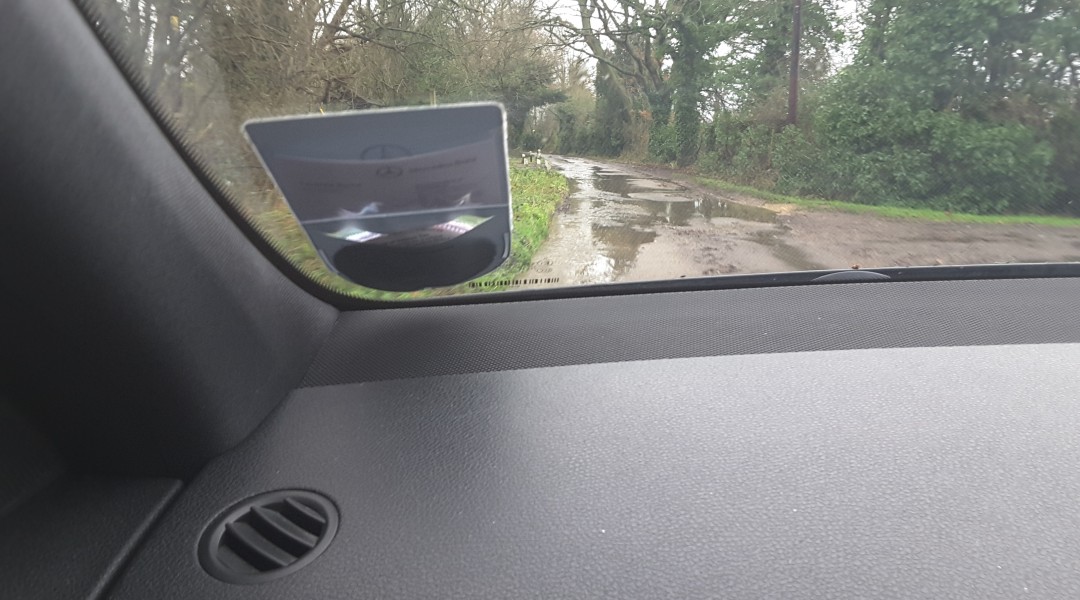
Taplins Farm Lane isn’t a puddle, the road has been impassable for a few days, I drove half way through it on Saturday, got round the corner and turned back when I saw how far it went! It is still closed today and I am having to drive the long way round for the school run.
It is genuinely a serious issue in that spot despite the flood ditches built recently. As the plan is to build exactly on that area and the road is intended to be a route in to the development, the planners should explain how they will address it.
As with earthquakes, the scale of the flooding doesn’t minimise the fact that you live in a zone which is susceptible to such phenomenon. In both cases building without paying attention to the possibility of what will happen is, at best, foolhardy and at worst, negligent.
I am sure the people who got their cars damaged trying to drive through the floods, and those too afraid to try would not be too amused at you trying to ridicule them John Honeywell
That’s each and every road into, out of and through the proposed new town flooded to some extent.
Steve Forster says the developers will pay for and fix the infrastructure.
What could possibly go wrong with that?
We drove through Crookham village yesterday and could literally see the water running down from the fields onto the road